Join Us On Our Adventure!
This is an old article, not all links work!
As is too often the case, the weekend before our trip found us as busy as ever. I wound up having to work, at least part of the day, while getting things ready for our trip. While I was busy working on a LUBA brief, Ann was doing her magic to figure out not ONE, but TWO ways for you to follow us during our journey - without me even having to blog about it during the trip! Read on to see how to join Beast, Jack, Ann and me on our 2018 Grand Fall Adventure!
I’m going to explain two different ways to follow us over the next month or so. One lets you follow our twitter feed right here on the Terrell Photography website. The other involves clicking on a link that takes you to Garmin site where you can check out our travels on their map. You have your choice of using either, or both, or ignoring us for a month.
If you look at the top menu bar, you see a link to @BeastTravels (click here as well). That link will take you to @BeastTravels, which is currently showing our 2018 Fall Trip to Utah.
In the image below, the red arrow points to where you’ll find the @BeastTravels link and a screen shot of the top part of the page.

The map is your typical Google Map, which means you can zoom in and explore the map. We’ve added all of the GPS points that we pre-set for the route and loaded into all of our maps. As you zoom in, the cluster of icons in southern Utah will begin to separate and you’ll get a better idea of where things are located.
Many of the icons have symbols that indicate the purpose for the link - sometimes it’s a campsite, other times a photo site, other times it’s just that I need to make a left turn at an intersection. If you click on an icon, it highlights and the name of the icon will appear on the left in the section under the red bar. Sometimes there is also additional information in that panel.

As background, I used a numbering system for the GPS points. I think of the trip as a series of “stages” for each general location, and the example above is during the 12th stage of the trip (thus the number 12) which is as we’re heading out to Alstrom Point. I think the trip has 18 stages - with the last being “go home.”
Another cool thing about the map Ann selected is that if you zoom in, you really get a feel for the topography we’re going to be traveling through.
Also on the @BeastTravels web page is a twitter feed. Ann has rigged it up so that if we post to our (new) twitter feed, it will automatically update on the @BeastTravel page. The page will hold the most recent 20 tweets we send out. We’ll try to mention the location it’s sent from so you’ll be able to track us down on the map. Here’s what that part of the page looks like:

If you look, some of the tweets have linked URLs (the https:// . . . .). Click on those and it will take you to the photograph we took and attached to the Tweet. I don’t think you have to join Twitter to see the tweets. However, if you are on Twitter (until the weekend I was not) you can join us by clicking on the blue tab that’s at the bottom of the tweets.
So that’s the first of the two ways to follow us. The one drawback, and the problem Ann was not able to resolve this weekend, is that the map doesn’t follow our track as we drive along. If you want to do that, you’ll need to use . . .
#2 The Garmin Mapshare Portal.
As I discussed in our gear blog, we use a Garmin (formerly Delorme) InReach, which is our emergency satellite communication device. One of its other features is that it is a GPS and can use the GPS satellite feature to send our location to a website where it shows on a map that we can share. We’ve set our InReach to ping our location every 30 minutes while it’s on. And every time it pings it will log a track.
Here’s an image of a test track Ann and I did this weekend when we went to visit Mummy and run an errand. The track shows as a blue line.
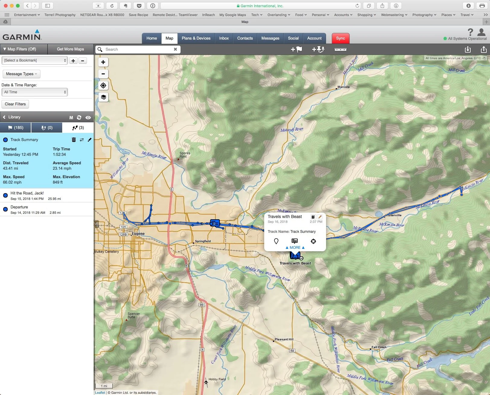
The interval above was much shorter than 30 minutes, but you can see what the track will look like.
Here is a link (click here) to the Garmin Mapshare site. When you open it, you should see this:
or this:

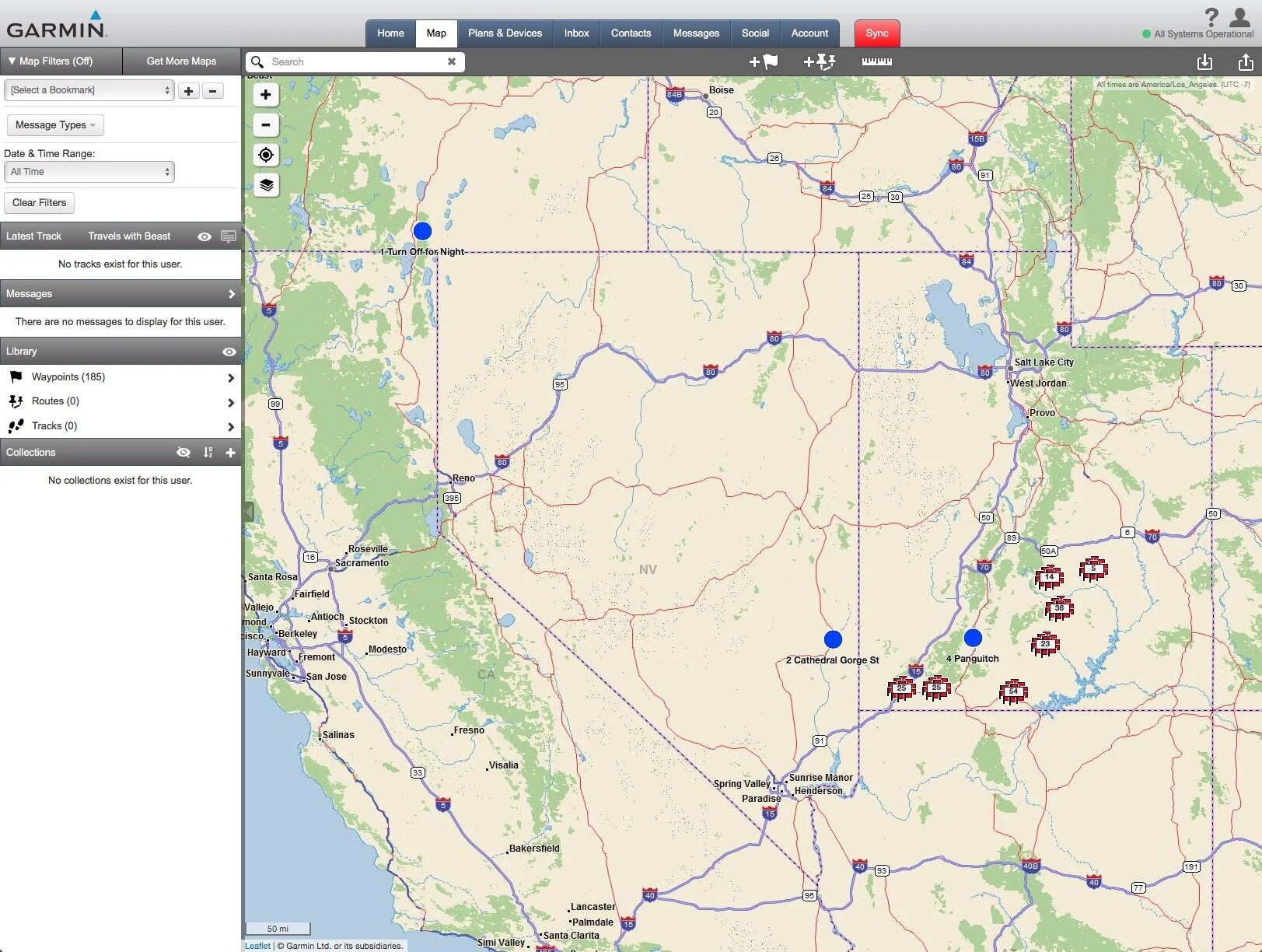
We can’t get it to open at the same scale each time, so be forewarned that you might have to zoom into the map quite a bit. Our general location is obvious though, because this map too will show our pre-recorded GPS points and they show up as the big red Blob in the Western United States.
Two things about the menu bar on the left are worth pointing out. First, if you look at the Messages Menu bar (red arrow below) you currently see “There are no messages to display for this user.” If we send a twitter message from the InReach device, it will post here. It will also post on the @BeastTravels page as well. Unfortunately, tweets from our cellphones will not show up on the Garmin site. And, the InReach does not have a camera, so there will be no images with the InReach Tweets. You will, however, be able to click on the message and it will take you to the location the tweet was sent from on the map.
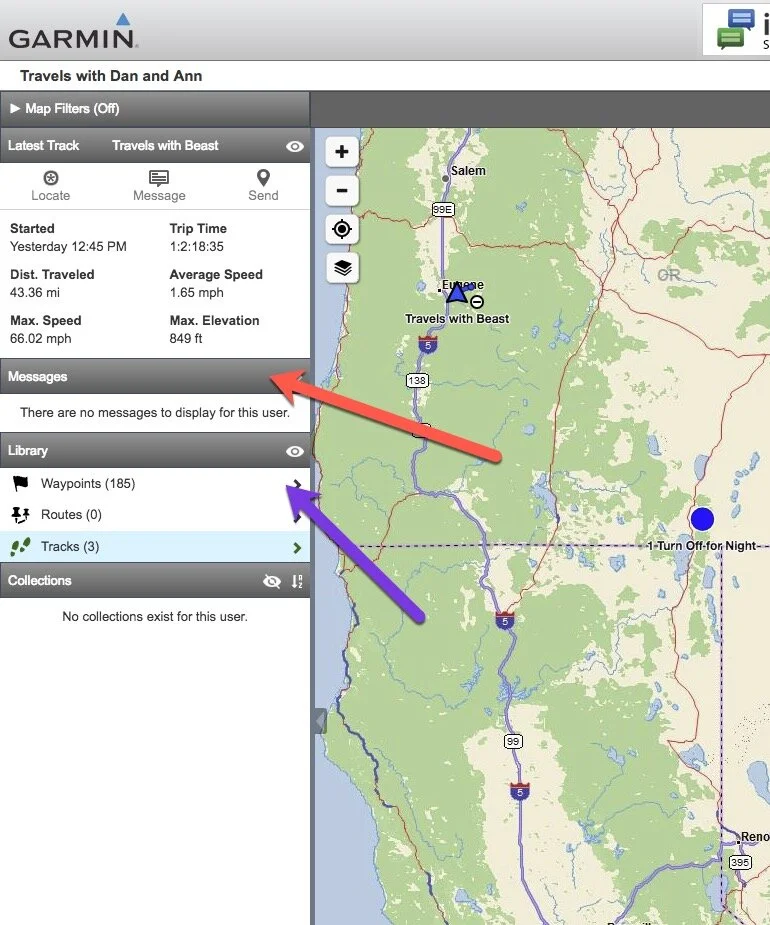
Second, if you look at the purple arrow, you’ll see a “Waypoints” tab under the “Library” heading. If you click on the Waypoints arrow, the tab will expand and show all the recorded GPS waypoints. If you click on one of the waypoints, it will take you to that waypoint on the map.
Some final notes about the icons used. Our current location will indicated by a blue triangle. As you zoom in, the GPS points will show as a blue circle. Click on a blue circle and you get a pop-up information window that explains the point (like the red bar on the @Beast Travels map). If map points are too close together, you see a cluster of red flags with a number inside them indicating the number of points that are hidden. On the map below, the red flags indicate that two points are located there. You have to zoom in before you’ll see the specific points.

As you can see from the image above, just like the Google Map on the @BeastTravels web page, you can zoom into the Garmin Mapshare website. I mean, you can really zoom in. Eventually you get topography and then topo lines. Keep zooming and you eventually get to a high quality aerial photographic image of the location. It’s pretty cool.
So that’s it! Two ways of following us on our adventure over the next month. My suggestion is to kick back and play a bit with the two maps to see what they can do. Over time, we’ll start populating the map with tracks and tweets. And if you find a bug - just don’t expect Ann to fix it any time soon!
Just to give you one last set of links: 1) click here to go to the @BeastTravels site, and 2) click here to go to the Garmin Mapshare site.
Hope you join us!