Fresno - The Long Way Back
After three days of 100+ degree temperatures and with Beast all fixed up, Ann and I were more than ready to start making our way home.
While in Fresno, we’d had several conversations with people about places to go and routes to take home, so we had a few options. Several people had suggested locations involving one-way trips into the Sierras at locations on HWY 168, but those would have to wait for another trip, we wanted to take our time making our way home, not hang out and then make a mad dash back to Oregon.
Fortunately for us, HWY 120 had opened and crossing the Tioga Pass was an option. We might finally get to make that trek across north Yosemite. Unfortunately for us, Mariposa, the town just outside the main road into Yosemite, became the location of a fire that very quickly caused the evacuation of the entire town and a blockade of all roads into or through the town. So we made alternative plans and figured on a route that would loop well around Mariposa and hit HWY 120 from the north. That would give us other options in case we needed a fallback position. And Lassen was still out of the question as they had a dozen or so miles of snow covered road left to clear.
Well we needed the alternative plan. Driving north to Modesto, we learned that the Mariposa fire had doubled in size the night before, which was evident by the giant cloud of haze off to our right as we drove north. Driving east from Oakdale we looked right and saw nothing but a brownish haze where mountains should be. One could barely even see the near-by foothills. Off to the left, hills, mountains and bluish skies. We decided to head left and follow HWY 108 across the Sierras. The Tioga pass wouldn’t be any good if you couldn’t see the mountains, would it? “See that slight darkening in the yellow cloud? That’s Yosemite valley!”
The drive along 108 was beautiful as you would expect. The miles passed faster than expected and after checking out a few campgrounds on the west side of the Sonora Pass, we decided that none of them seemed particularly appealing (or more accurately, the surrounding landscape wasn’t), so we decided to continue. Once we started climbing, we started stopping more frequently.
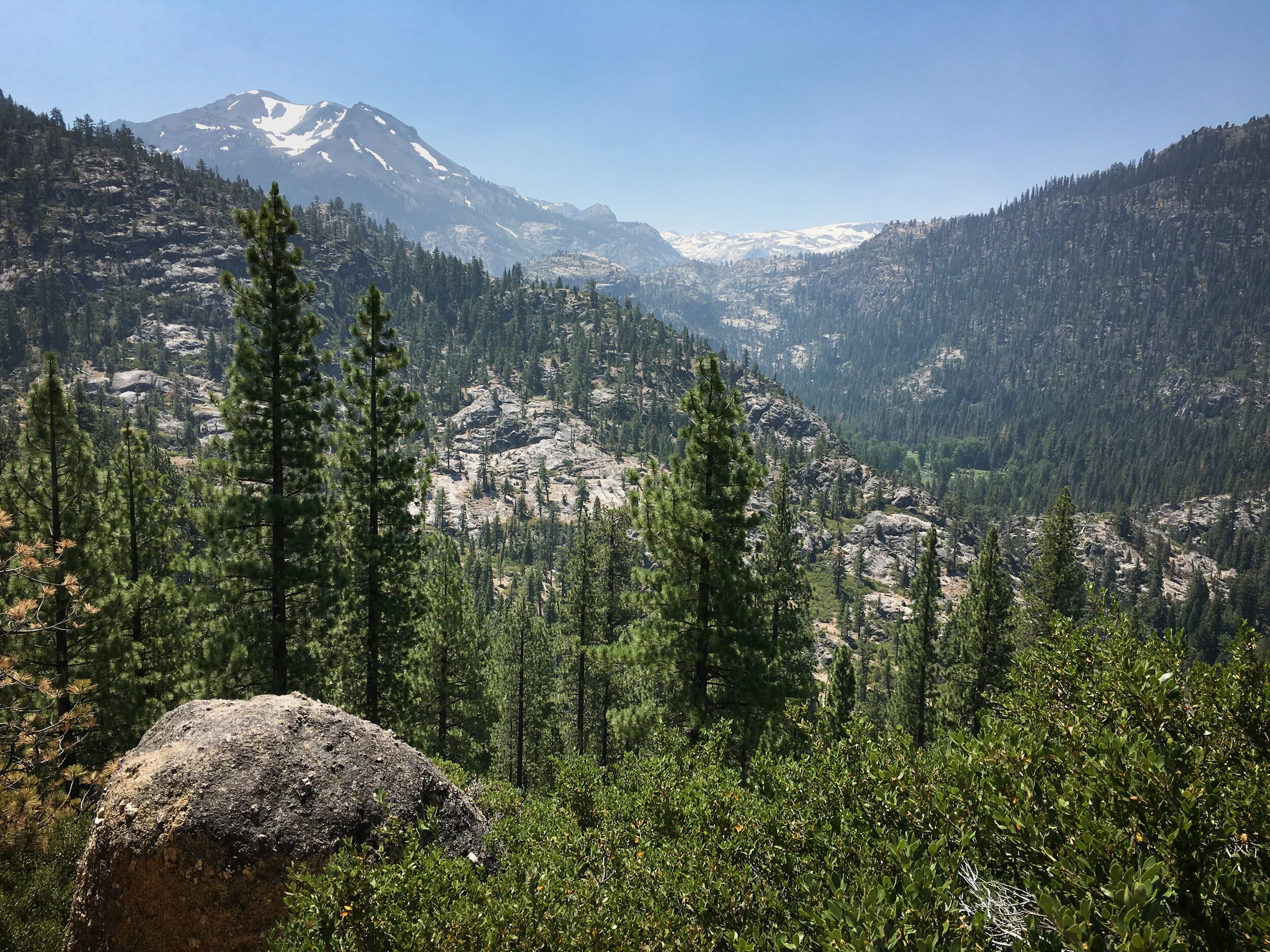
You could tell that the major mountains were to the south, but you could also see the haze from the smoke as well. I’m sure the Tioga Pass road is marvelous, as probably is Lassen NP, but both would have to await a different trip.
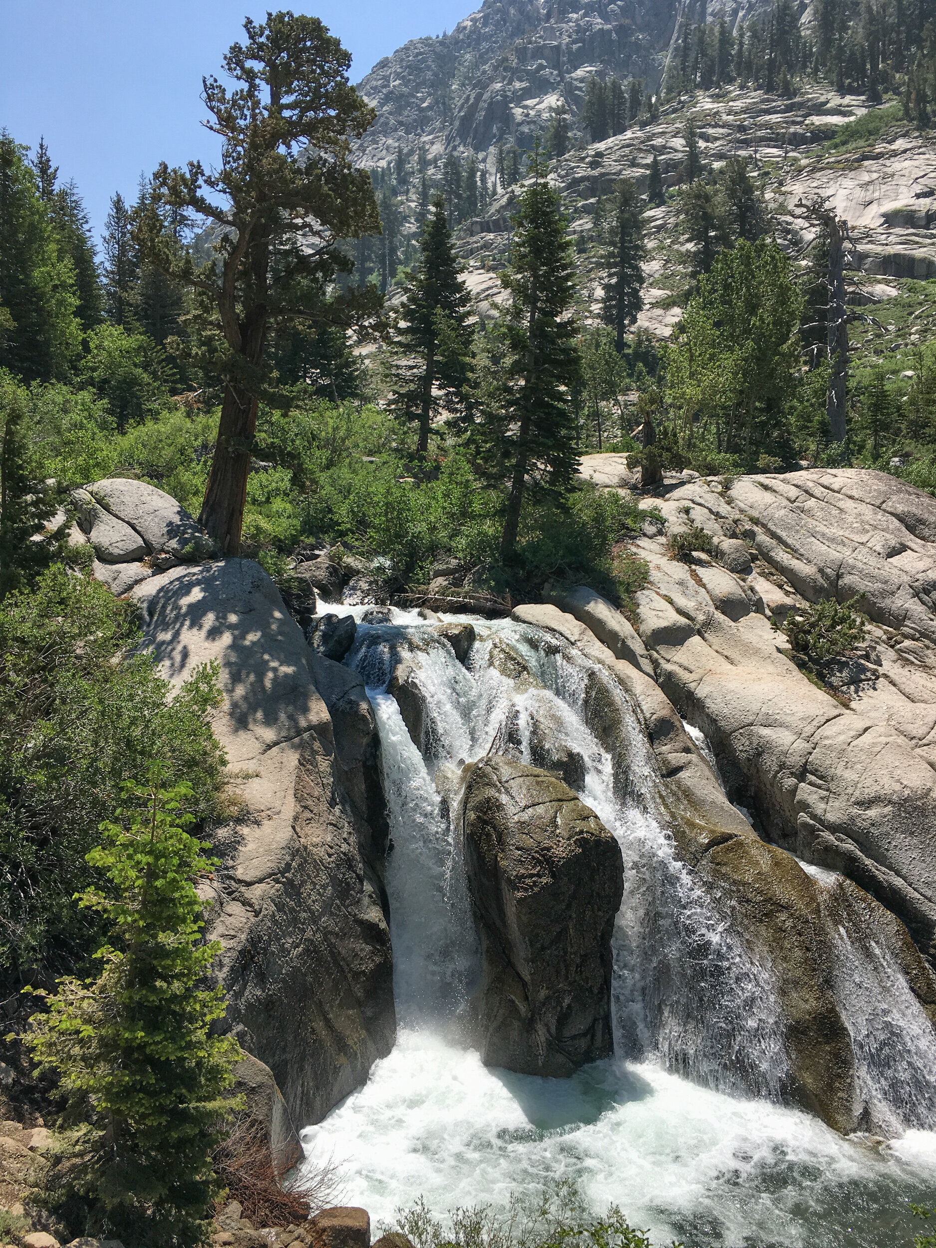
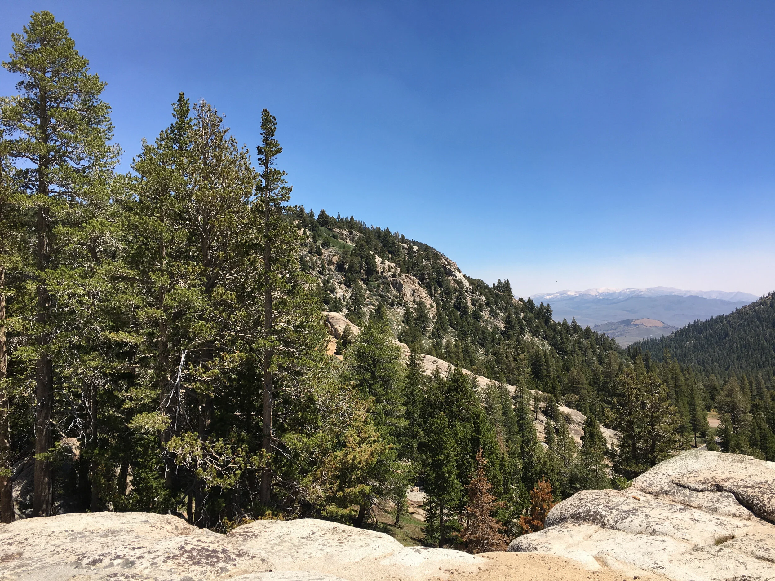
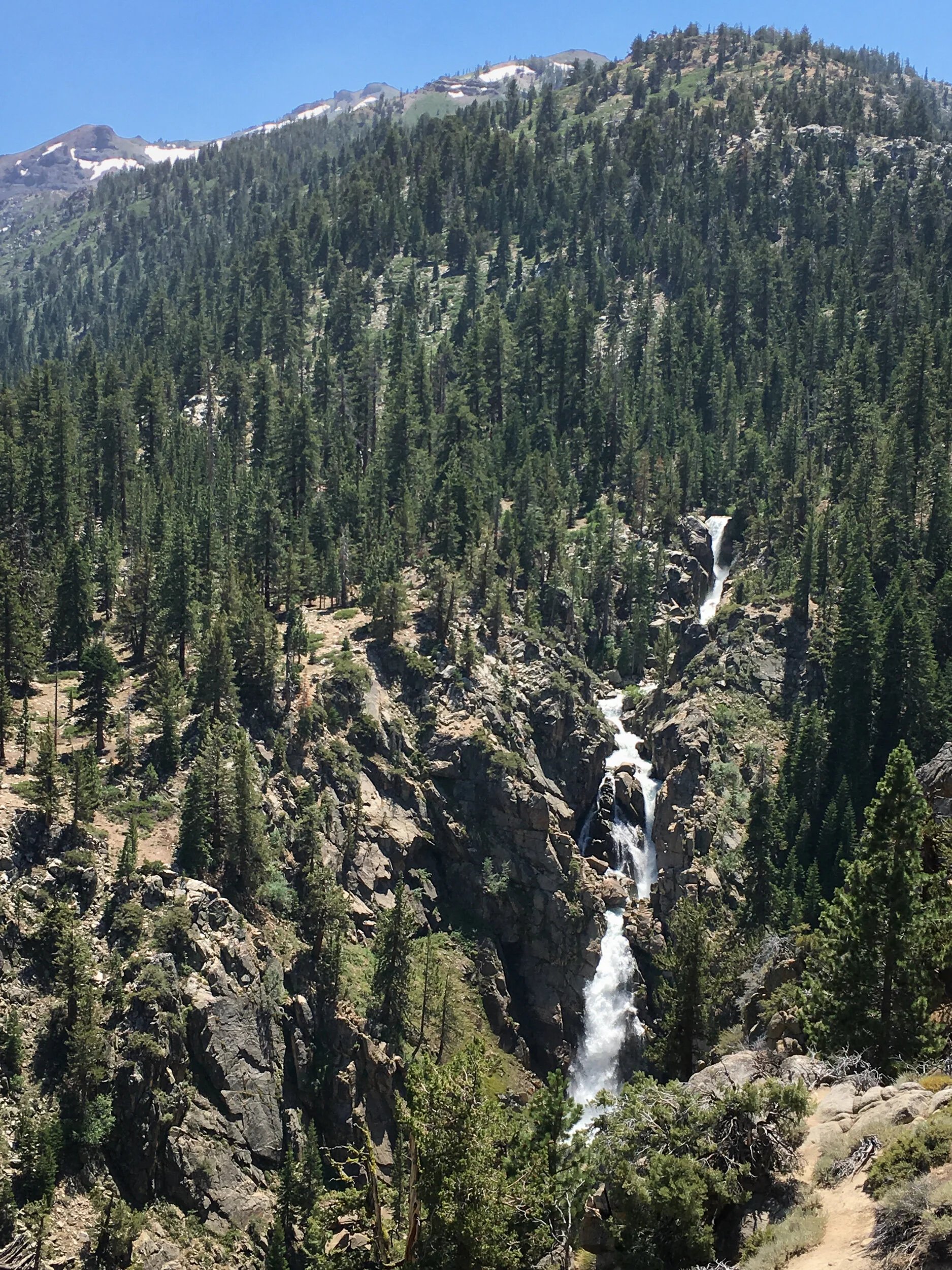
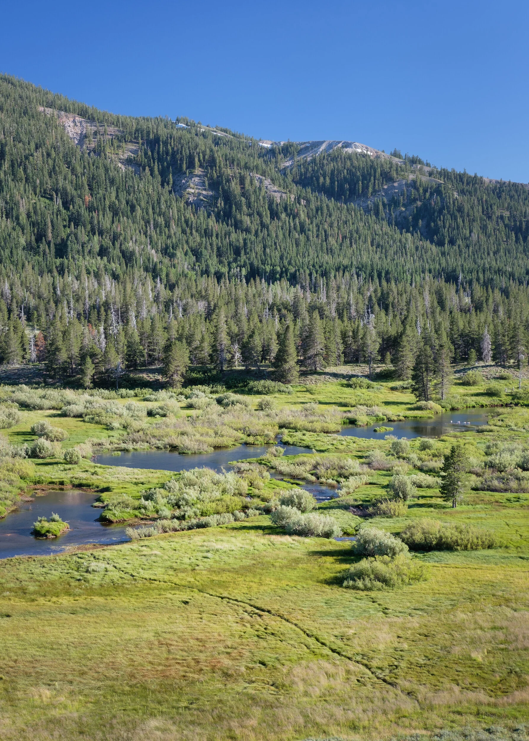
We’d occasionally pass by a spot that really made you wonder what it would be like hiking through the Sierras, especially when the water is flowing.
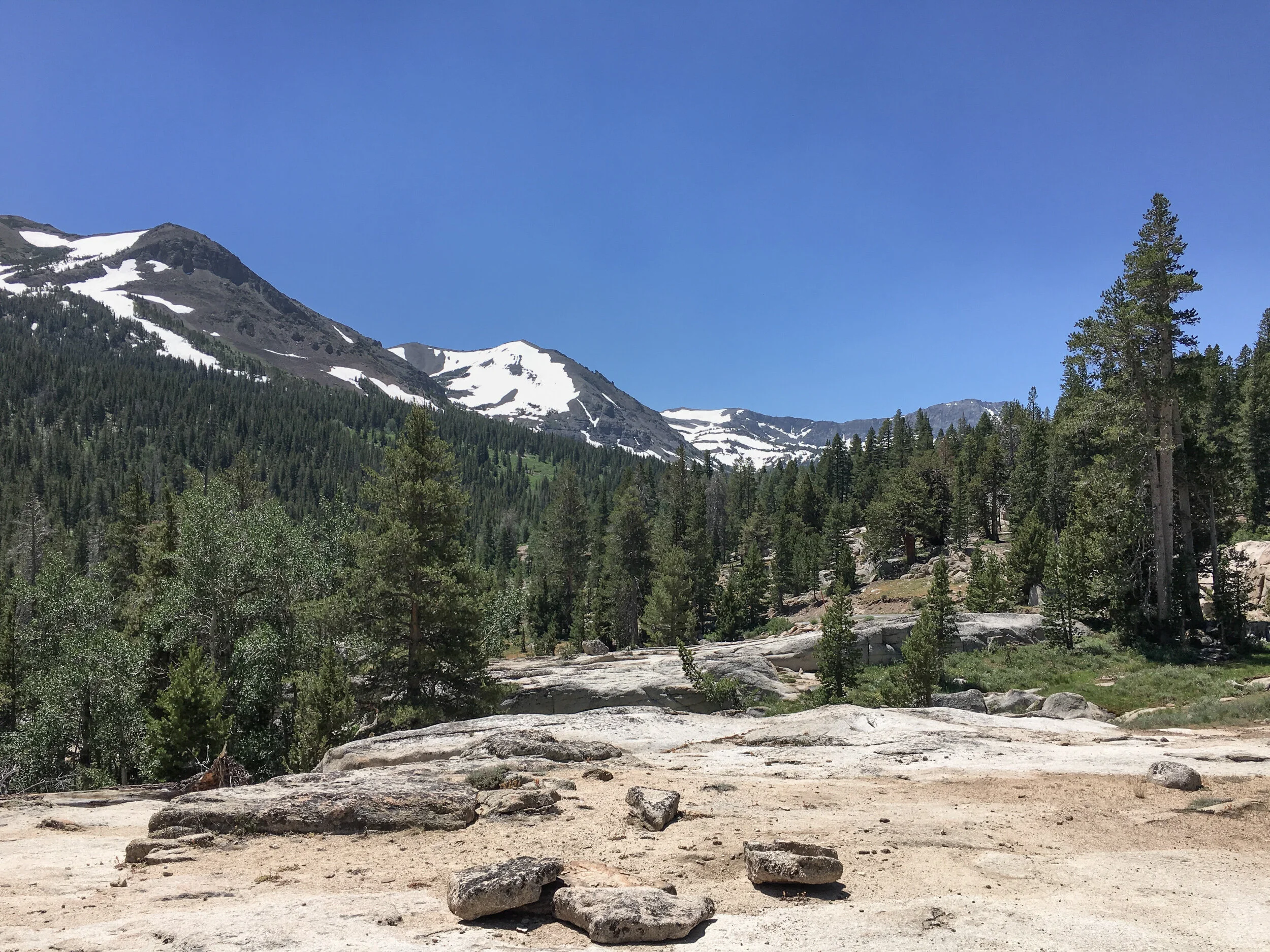
As we started the descent down from the pass, we found a nice pull-out that allowed us to get out and walk around a bit. The area gave one a real feeling of the granite nature of the mountains.
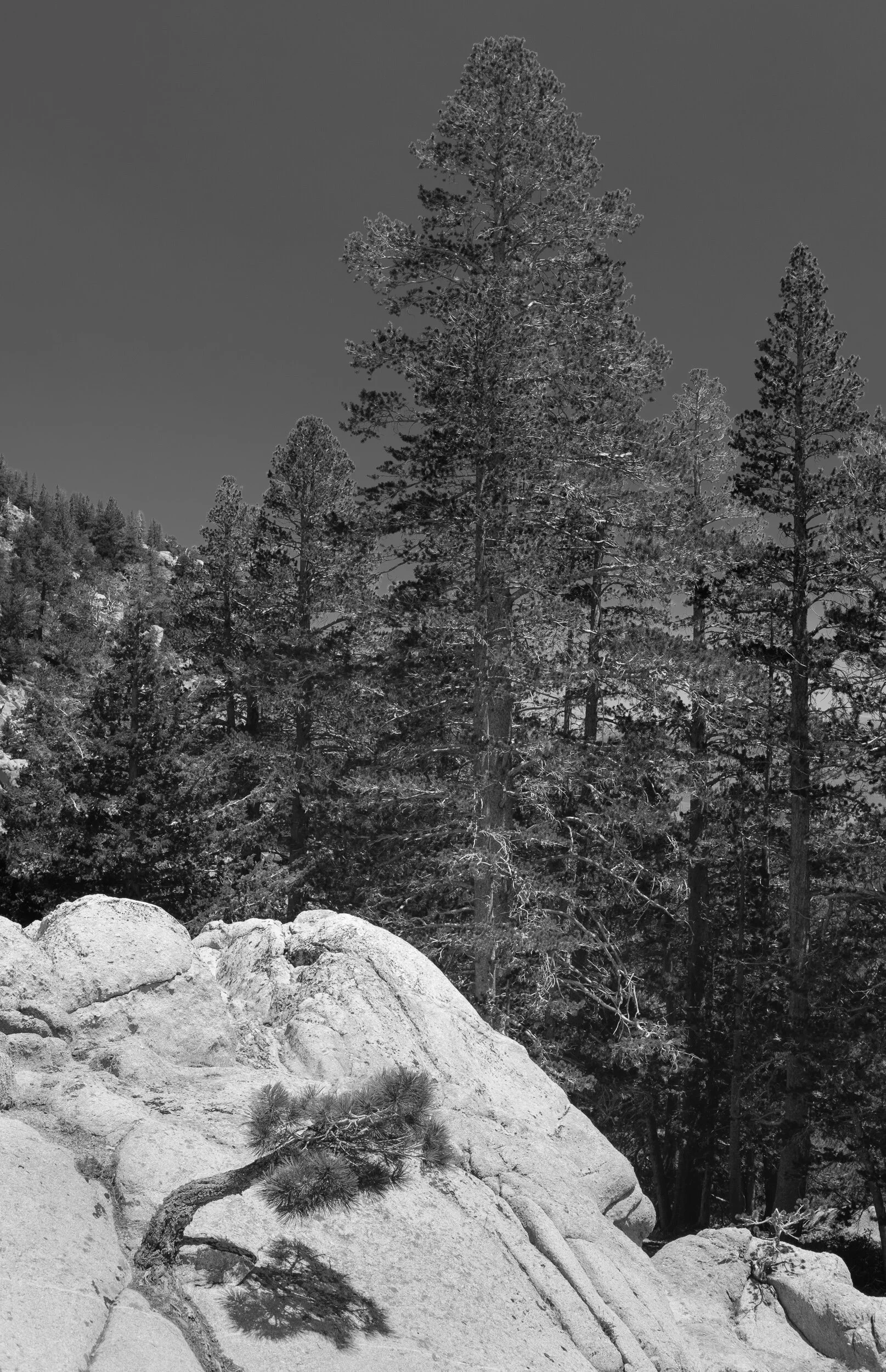
It also led us to pull out the camera gear and to photograph for a bit.
One can see why Ansel loved photographing these rocks in the middle of the day with a red filter to darken the skies.
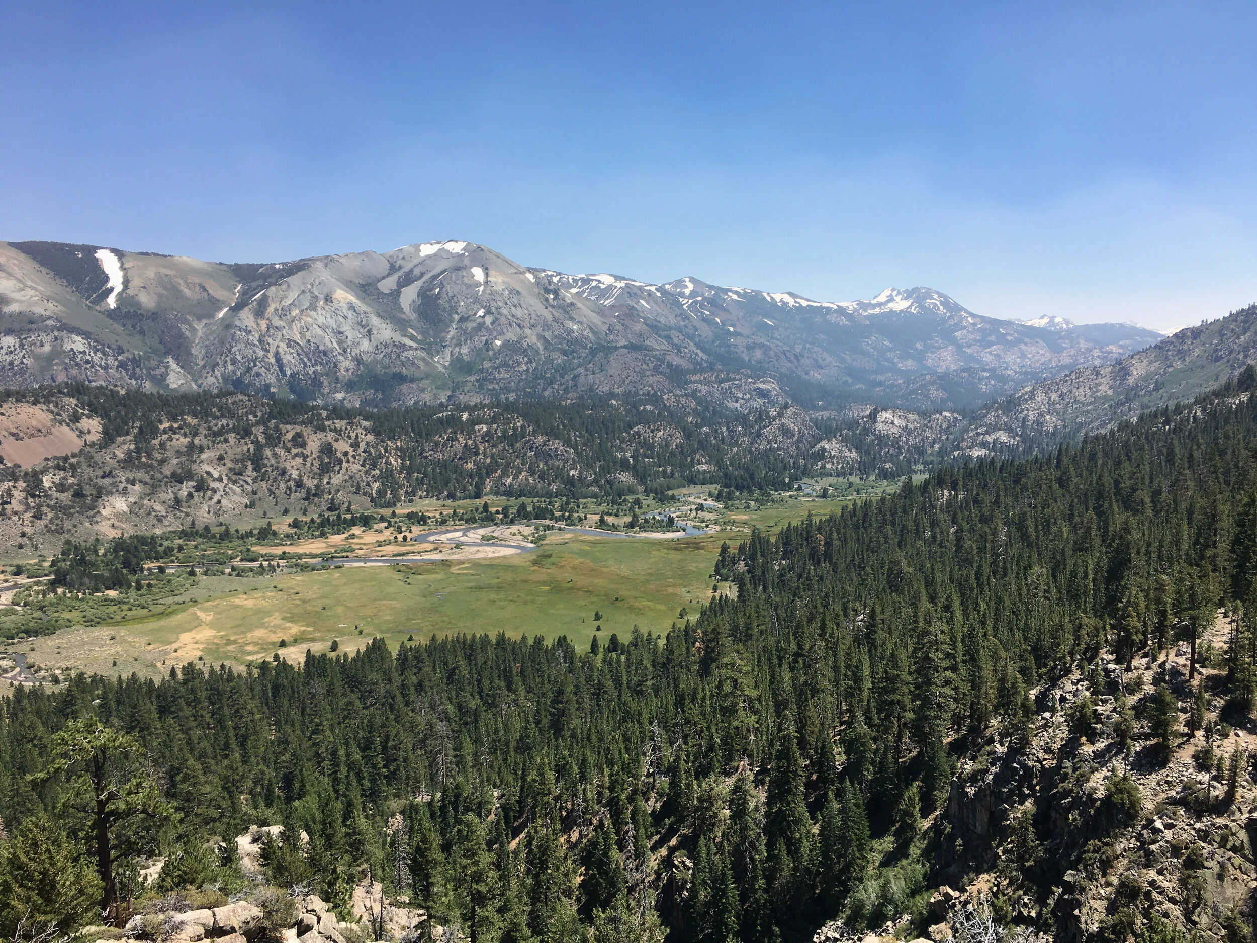
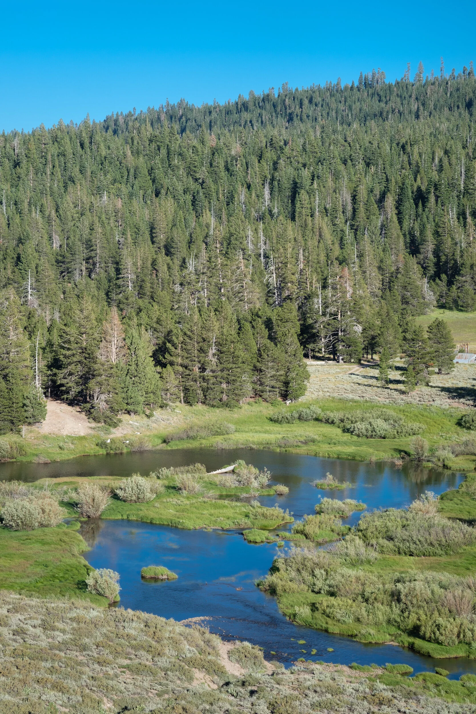
From our perch, we could see down towards where we were heading.
And as we made our way down, we made a couple more stops to check out some Eastern Sierra locations.
One interesting location was just above a lovely valley where the Marine Corps has their mountain training facility, and as we drove down the mountain we saw a couple units doing exercises with facilities set-up on side tracks that led into the hills.
The morning had passed quickly and we’d made it over the Sierras with lots of time to spare and us not havingfound a location that begged us to stay. When we hit HWY 395, we decided to head down to Mono Lake and to potentially photograph there for the evening and next morning.
That was a BIG MISTAKE. You can see our drive down and back as that little tail on the east side of the Sierras on the map from the previous posting. The smoke may not have fully made its way up to HWY 108, but it definitely had made its way over the Tioga Pass and flooded the Lee Vining area. The smoke was so bad you couldn’t even see the far side of Mono Lake.
So we stopped at Lee Vining for food and fuel. While eating a very late lunch (early dinner), we plotted our new strategy. We ultimately decided to head back north past Lake Tahoe and try to camp near one of the sites we’d scouted on our way down. So we raced north to Truckee and, after swinging by a couple of campgrounds that were a bit too busy for our taste, landed at a Forest Service campground only a couple of miles where I’d hoped to be the next morning.
A large family with several rambunctious boys pulled in a bit after we did and while there were only a couple of us on our end of the campground, it was a reminder to us again that wild camping has its advantages.
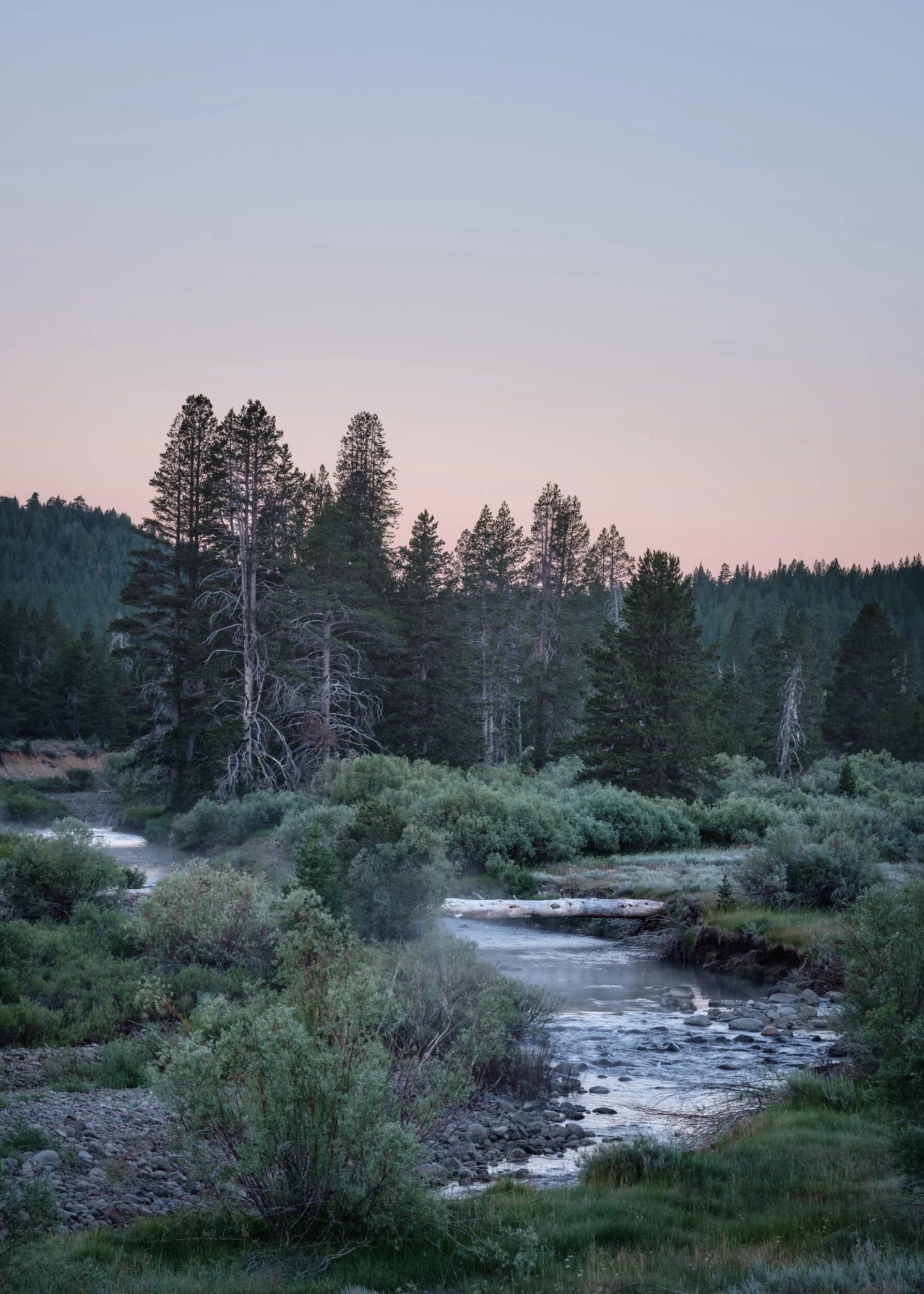
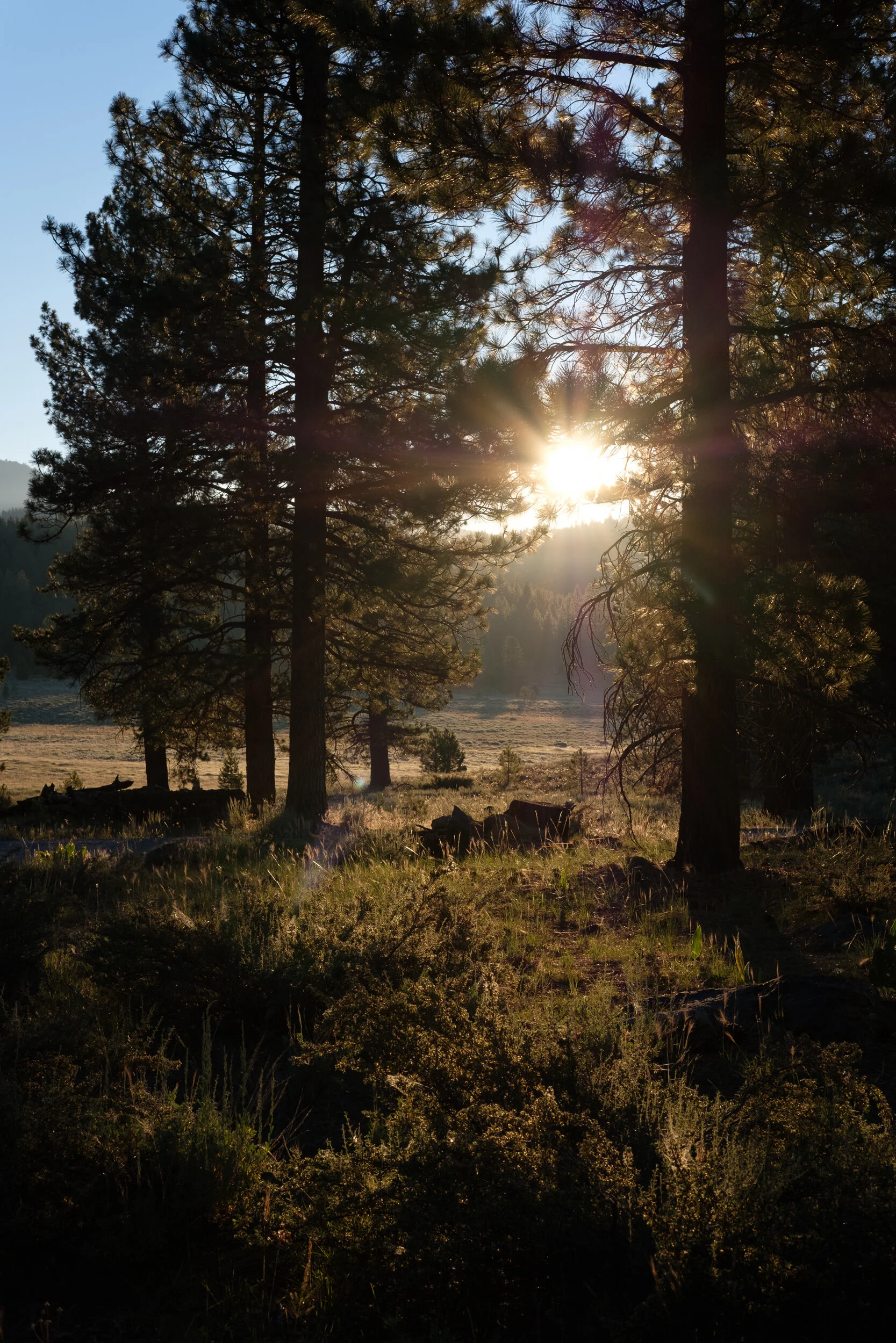
The next morning did not disappoint. We headed out well before dawn and set up along a meadow creek we’d marked on our maps on the way down. Unfortunately, the area was fenced off with a tall deer fence, but I managed to make a photograph through the large fence mesh.
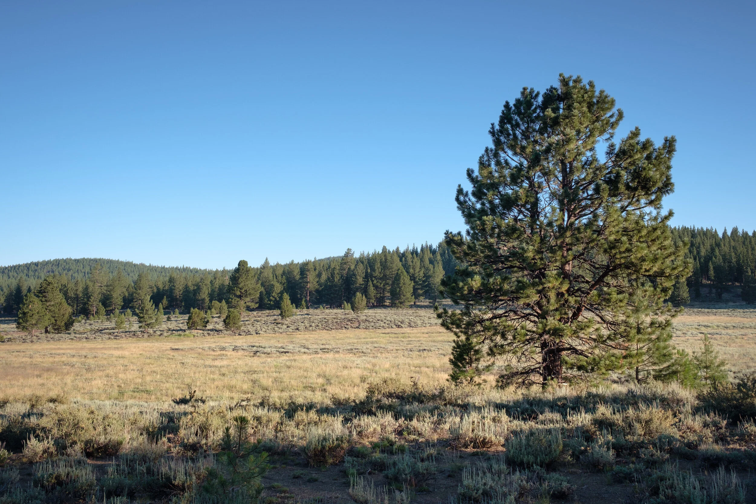
Both sides of HWY 89 had meadows in this area, so wedecided to explore the off-road areas and see what we could find. We headed on Henness Pass Road towards Kyburz Flat. A sign on the road said there was an interpretive center there.
After a mile or so of fairly decent gravel road, we came across the first of the three interpretive sites. There, we found a large slab of rock, weathered and broken over time, that contained a native American petroglyph. It consisted of a series of round pits called cupules, ground into the rock to form patterns. We couldn’t tell what the patterns revealed, but it was beautiful nonetheless.
The early morning light falling on the petroglyph gave it a real presence and I had to pull out the camera to photograph these patterns made by human hands some 2,000 years ago.

The whole area had a presence to it, so I turned around and photographed the area where the formation was located.
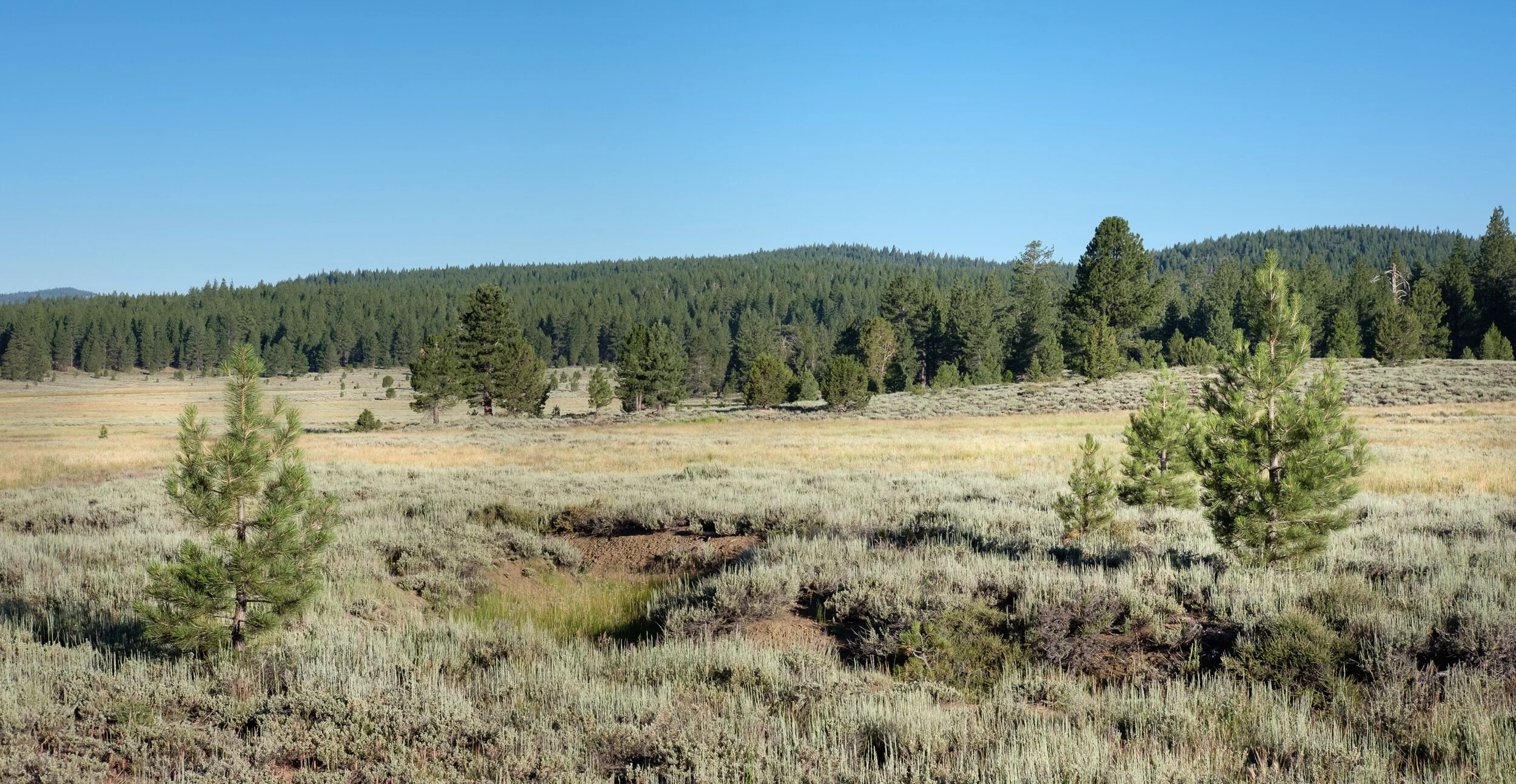
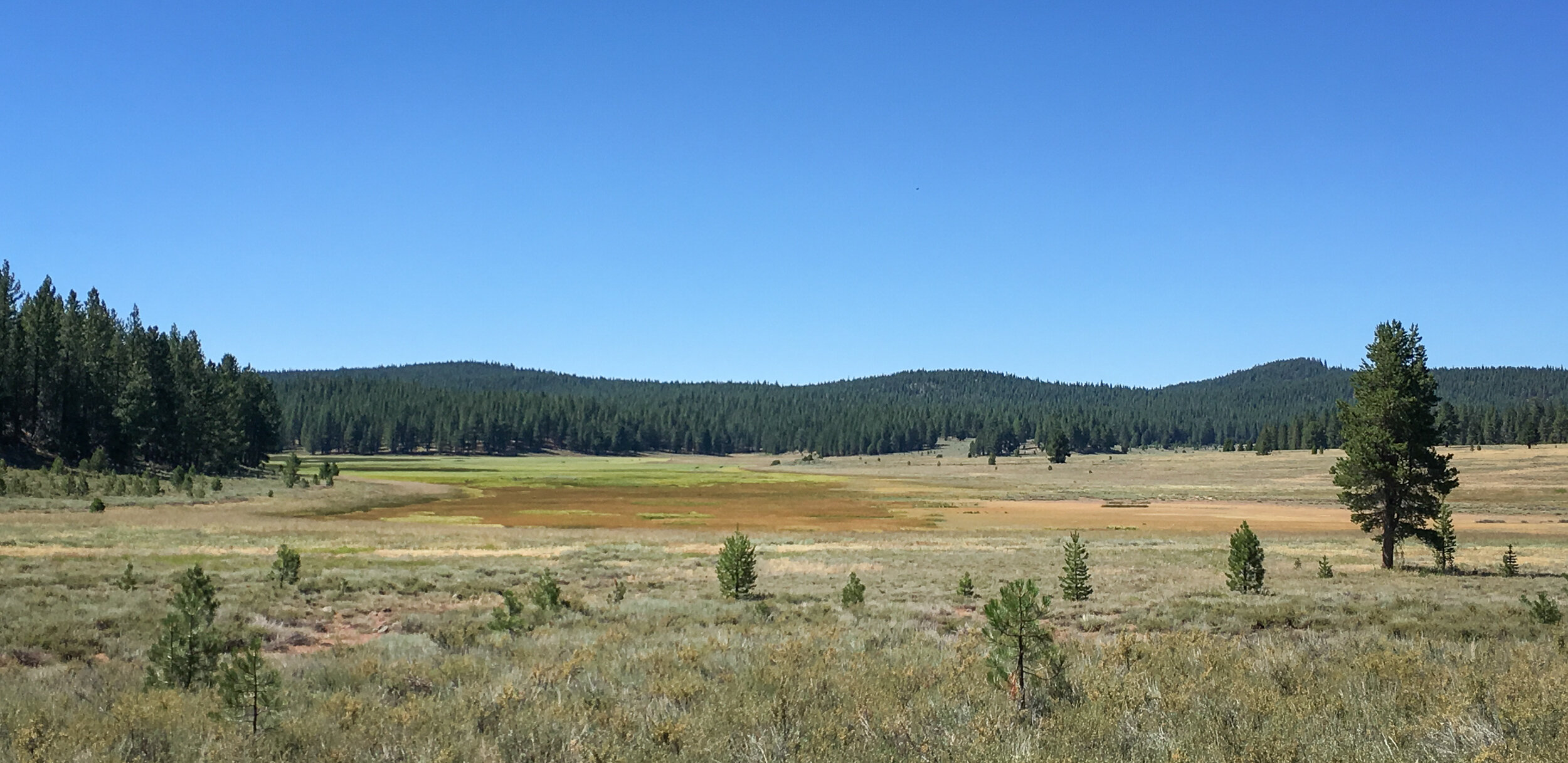
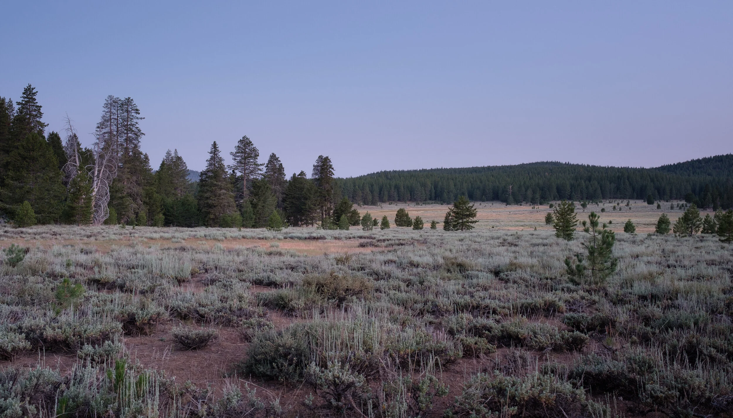
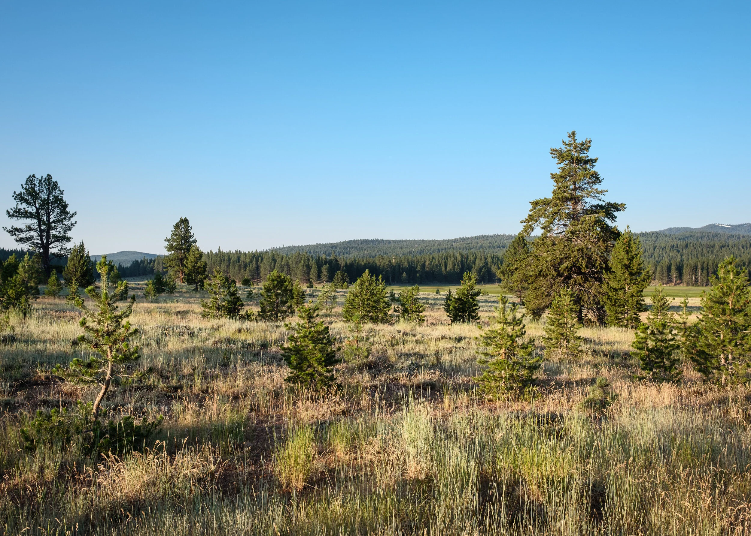
We traveled onward down the road, finding a possible camping location for the night, and stopping at one of a series of connected meadows.
Try as I may, I never quite felt like I captured the sense of openness you feel standing in these vast spaces.
We finally decided to call it a morning, having also decided to spend the day in the area exploring. After checking out another of the interpretive sites, we headed to Sierraville for breakfast and to fuel up. We also stopped into the Sierraville Forest Ranger station to get some ideas of where to explore. (Ranger stations are a wealth of information if you just ask the people there).
On the way back, we turned off on Jackson Meadows Road heading towards Webber Lake. Ann had seen some aspens on the way to Sierraville, and the person at the ranger desk said she thought some might be at Perazzo Meadows, which was on the way to the lake. From Jackson Meadows Road we found a lovely viewpoint down into Perazzo Meadows that we thought might make an ideal location for late afternoon photography, and continued to Webber Lake.
The lake wasn’t quite what we’d hoped for, so we headed back, following the Henness Pass Road, which paralleled Jackson Meadows Road, only it was definitely a 4x4 track for a good part of the way (parts of which which happened to be along a very steep drop-off, which was on Ann’s side of Beast, and . . . didn’t make for a very fun ride for Ann. Me, I was too focused on navigating the rocky road without trashing Beast to notice how steep the drop-off was.). Once we made it to the valley floor, things (read: road conditions) improved substantially, and we got to explore Perazzo Meadows from below.
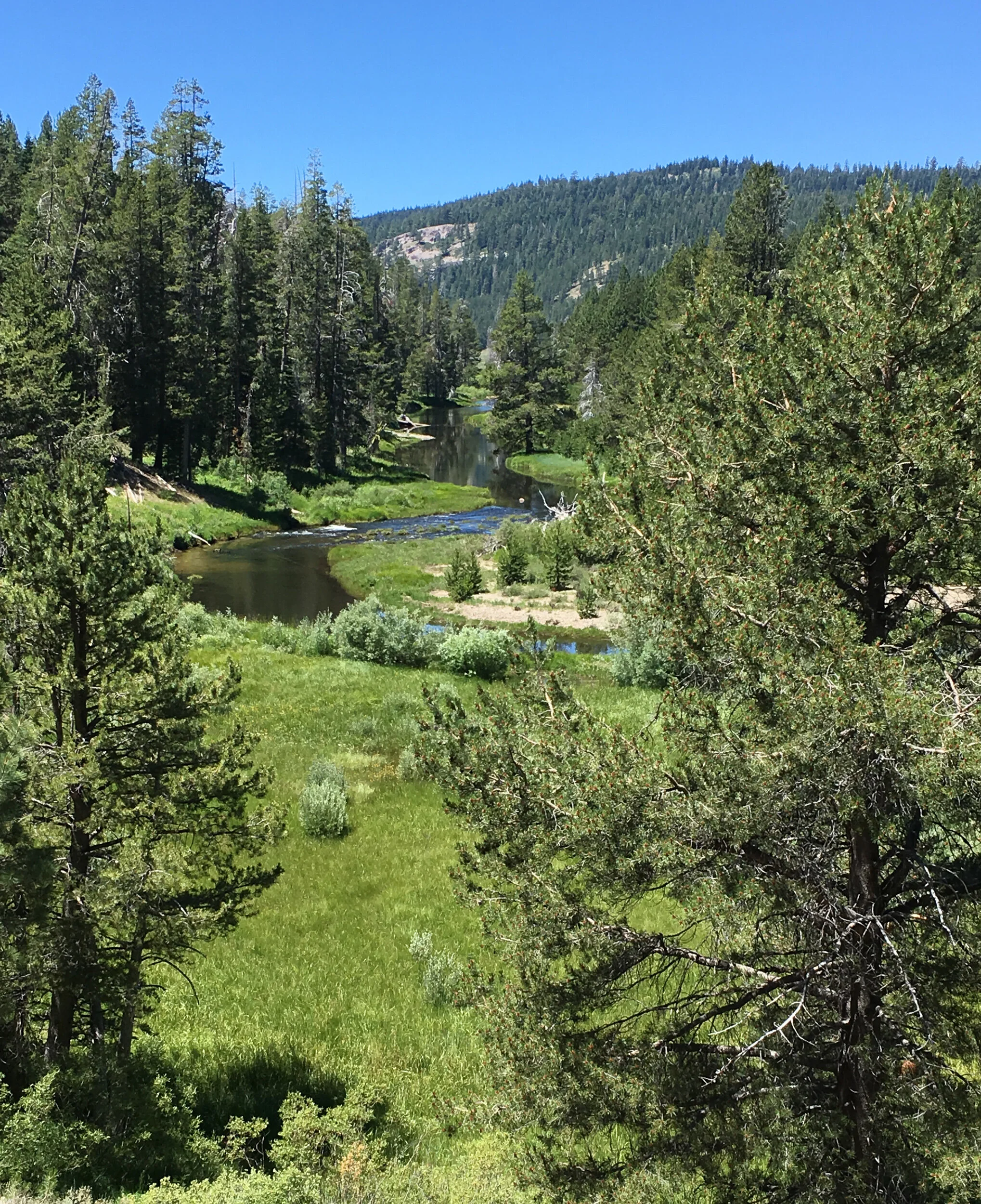
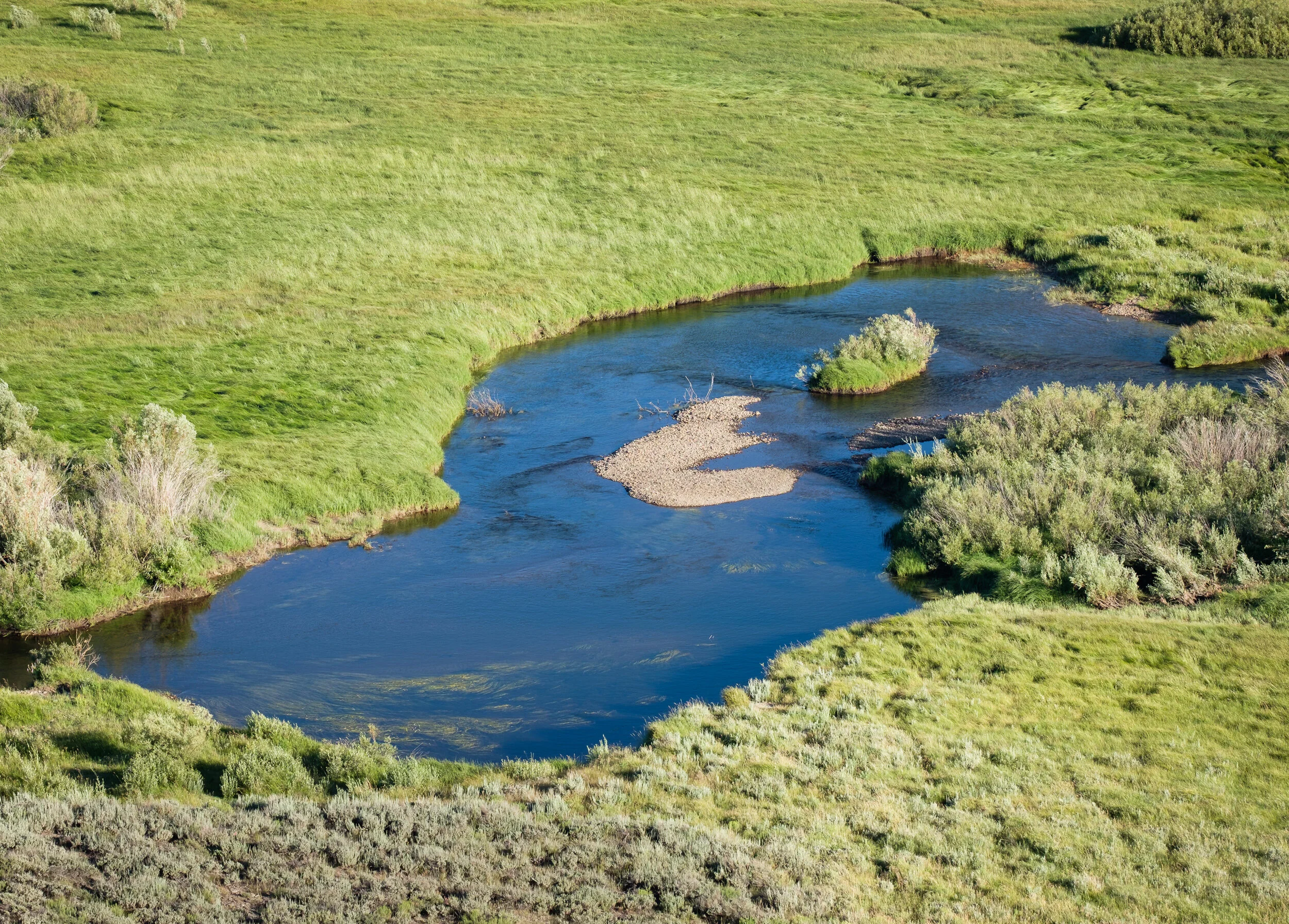
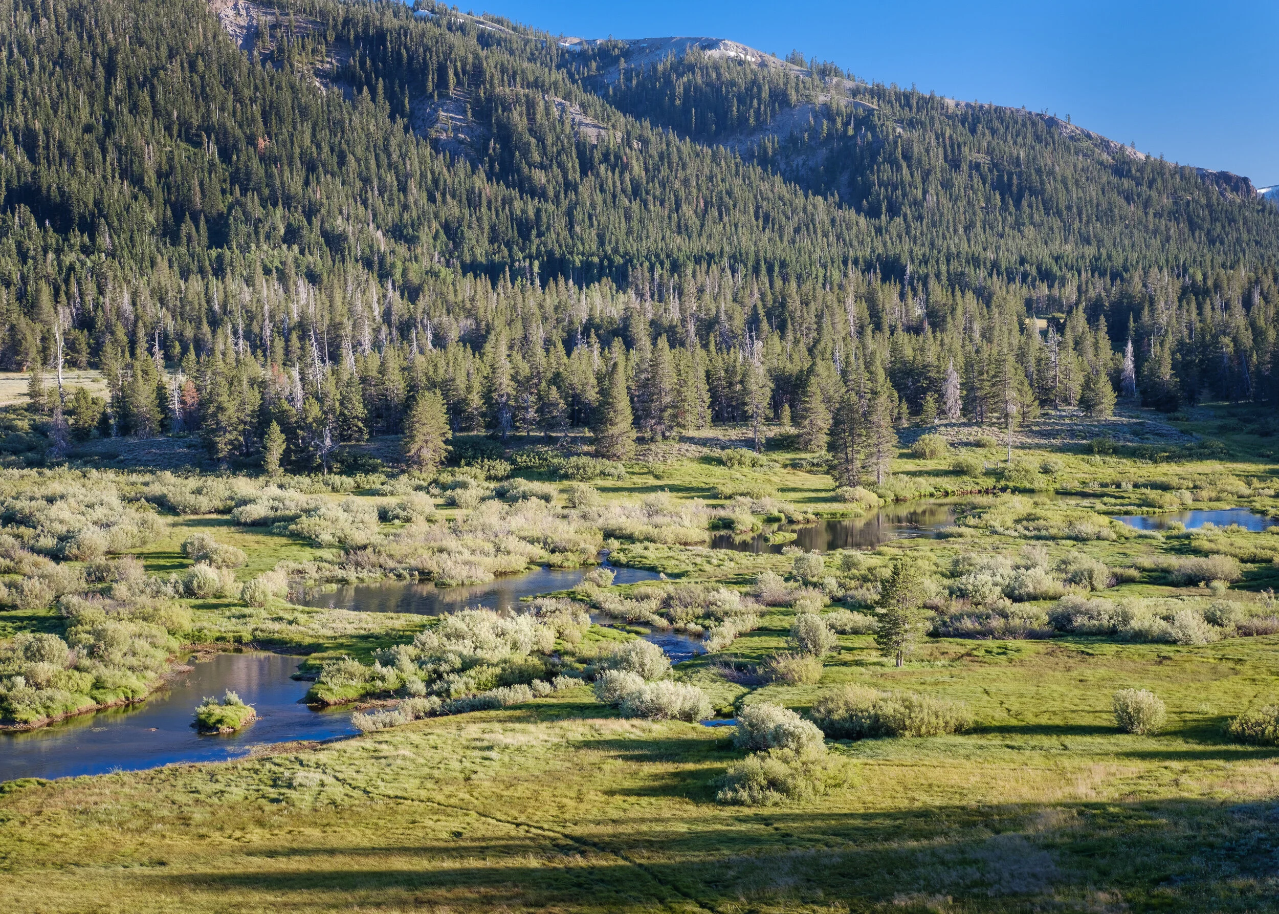
The Little Truckee River flows through the meadow and, while we stopped several times to scout out photo locations, none seemed as appealing as the one we’d found looking down into the meadow. The most difficult thing about photographing along rivers is that there always seems to be a lot of brush along the river banks, which makes getting clean images quite difficult.
We made our way back to Highway 89 and returned to the Kyburz Flats area. We headed off on side tracks to follow some of the other fingers of the meadow that shot off in directions we hadn’t explored that morning. But just as in the morning, we found out that while meadows are beautiful to look at, they’re extremely difficult to photograph well.
On one of our stops, one Ann spent a lot of time trying to find a good vantage point for our morning shoot. I, however, found one of my compositions and ran back to Beast to grab my camera.
Having not found a good location to shoot from (then or the following morning), we headed back to Henness Pass Road and drove, and drove, and drove. It transitioned from a graveled road, to a rutted road to a rough rocky 4x4 track that went up over a couple of ridges, and followed the meadow valleys below. At a “T” intersection we opted to turn right instead of left because that road looked somewhat better, plus we knew left would involve more climbs because it eventually led to Sierraville. We wound up driving through some lovely little meadows, and eventually drove past a couple of reservoirs, ultimately winding up a few miles away from Truckee on Interstate 80. So we drove back to HWY 89 and headed to our evening photo location.
Sometimes you arrive at a photo location with certain image ideas in your mind, and something comes along to make you throw your plans out the window. Well, at least for a little while. That’s what happened to us from our viewpoint over Perazzo Meadows.
Our photo location was a giant rock outcropping that looked down over a lovely stretch of the meadow where the Little Truckee River sinuously wound its way across the valley floor. Ann knew the part of the meadow she wanted to photograph, but it meant getting out on a rocky ledge a bit closer to the edge than she really wanted to be. So I helped her set herself up in an area where she felt secure and could move around a bit. It included not only setting up her tripod and having her camera backpack in a convenient location, it meant also bringing her accessory bag, which included her long telephoto zoom lens.
Once she set up, I grabbed my gear and set up on a different part of the rock outcropping.
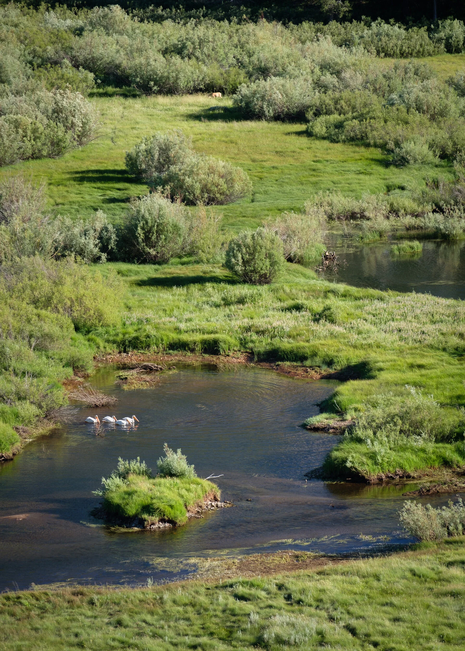
Just as I was set up to make the photograph I had originally envisioned, I noticed a group of pelicans flying down into the meadow and landing in the river. Our plans went out the window! I helped Ann climb off her little ledge, where she couldn’t see where the birds had landed, and then helped haul her gear out as well. She then grabbed her long lens, and I grabbed my less long, but by no means totally inadequate lens and we both did our best to make some wildlife photographs.
Truth be told, I was definitely too far away to make anything other than environmental photographs, and even then, more like landscape images with wildlife. But I worked with what I had and did manage a few where you could see not only the pelicans, but a grazing deer. One even had a composition that wasn’t half bad.
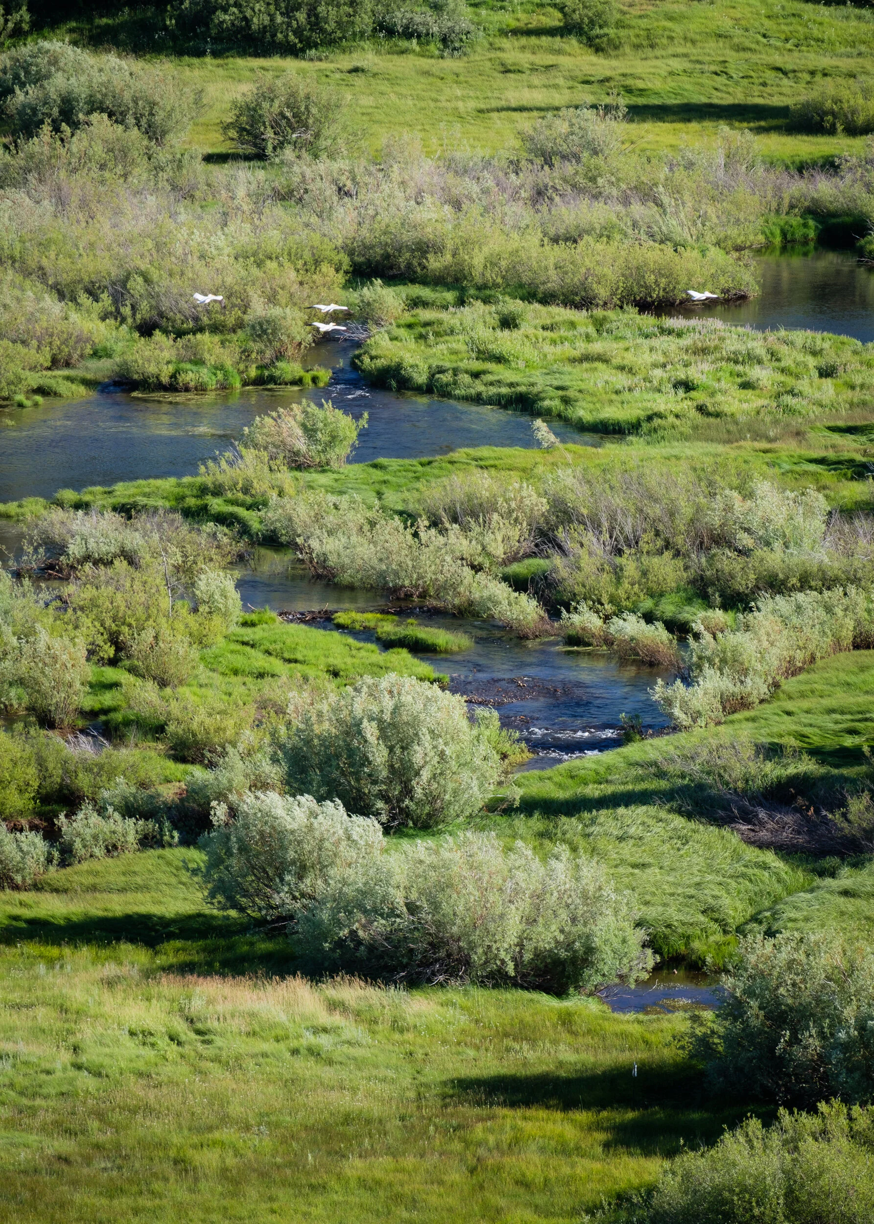
And at one point, the pelicans took off and I unlocked my tripod head and did my best to track them as they flew up the meadow. Believe me, it’s a lot harder than it looks. Wildlife photographers deserve a lot of credit.
After awhile I called it quits, and returned to the image I’d originally envisioned. Except this time, there are 4 pelicans in the image . . . if you can even see them. It just gives you an idea about how far away they really were and just how powerful the zoom lens I carry in my bag is when fully extended.
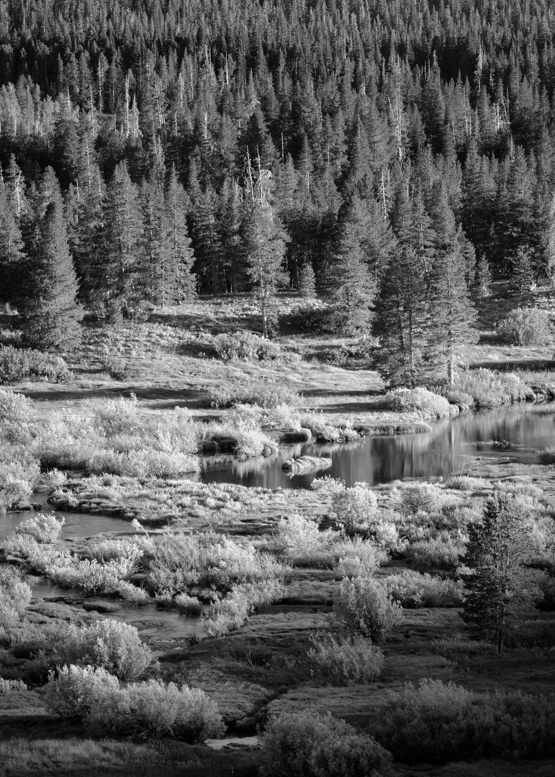
As the sun worked its way towards the horizon, I moved around the rock outcropping to photograph other areas of the valley. Some of them were at locations we’d explored from ground level earlier in the day.
I used a variety of lenses and tried isolating different parts of the Little Truckee as it made its way below.
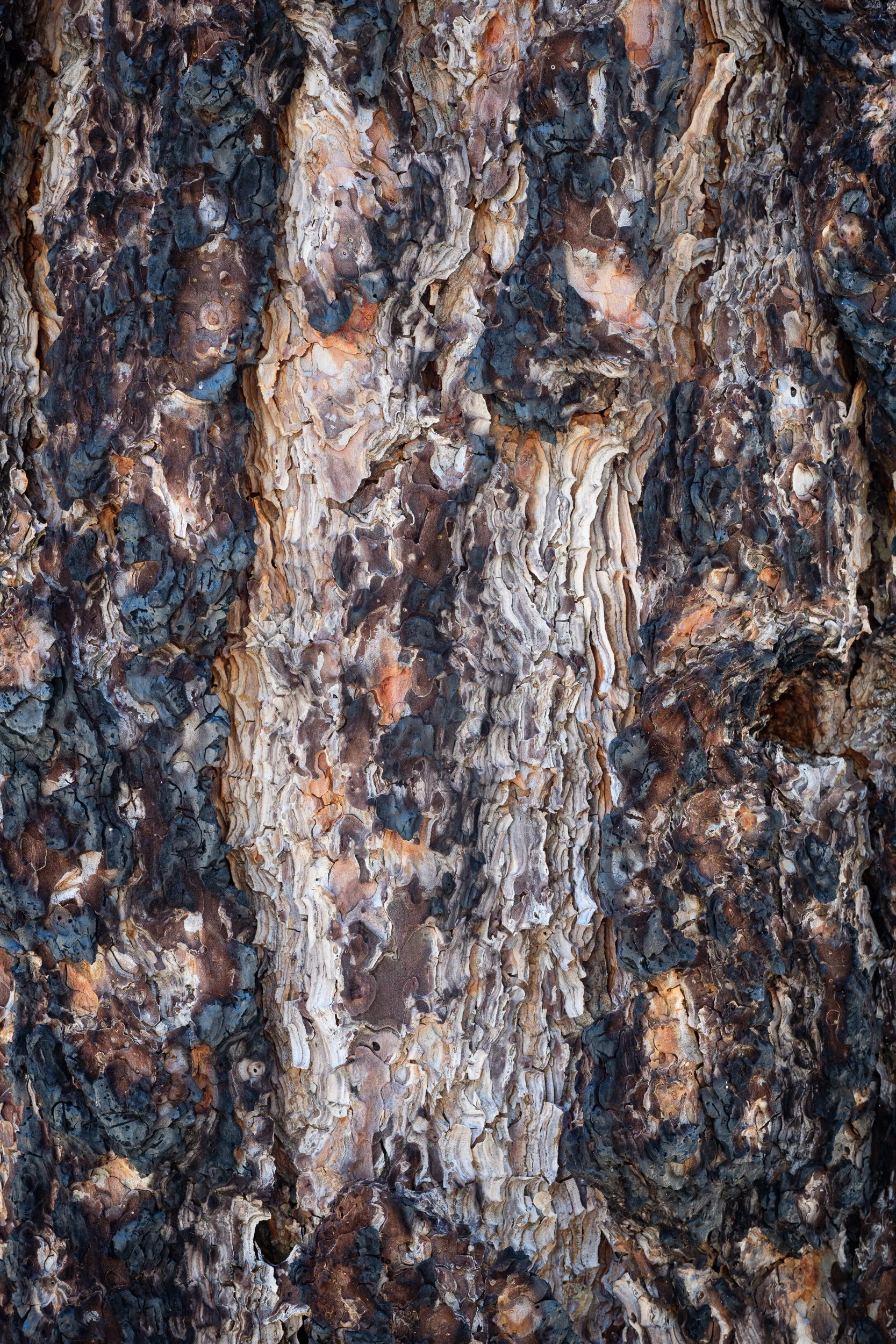
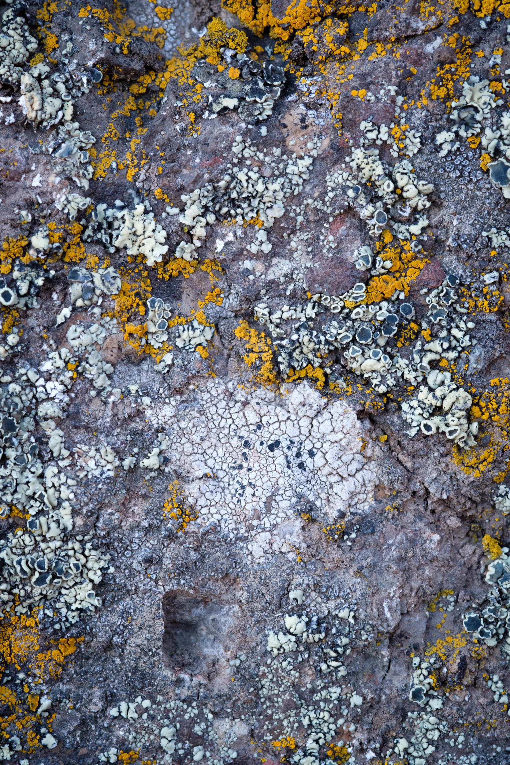
Eventually I’d exhausted the range of possibilities I could think of from our one vantage point and, while waiting for the sun to lower even further, started noticing the lichen on the rock that became ever more colorful as the sun lost its intensity.
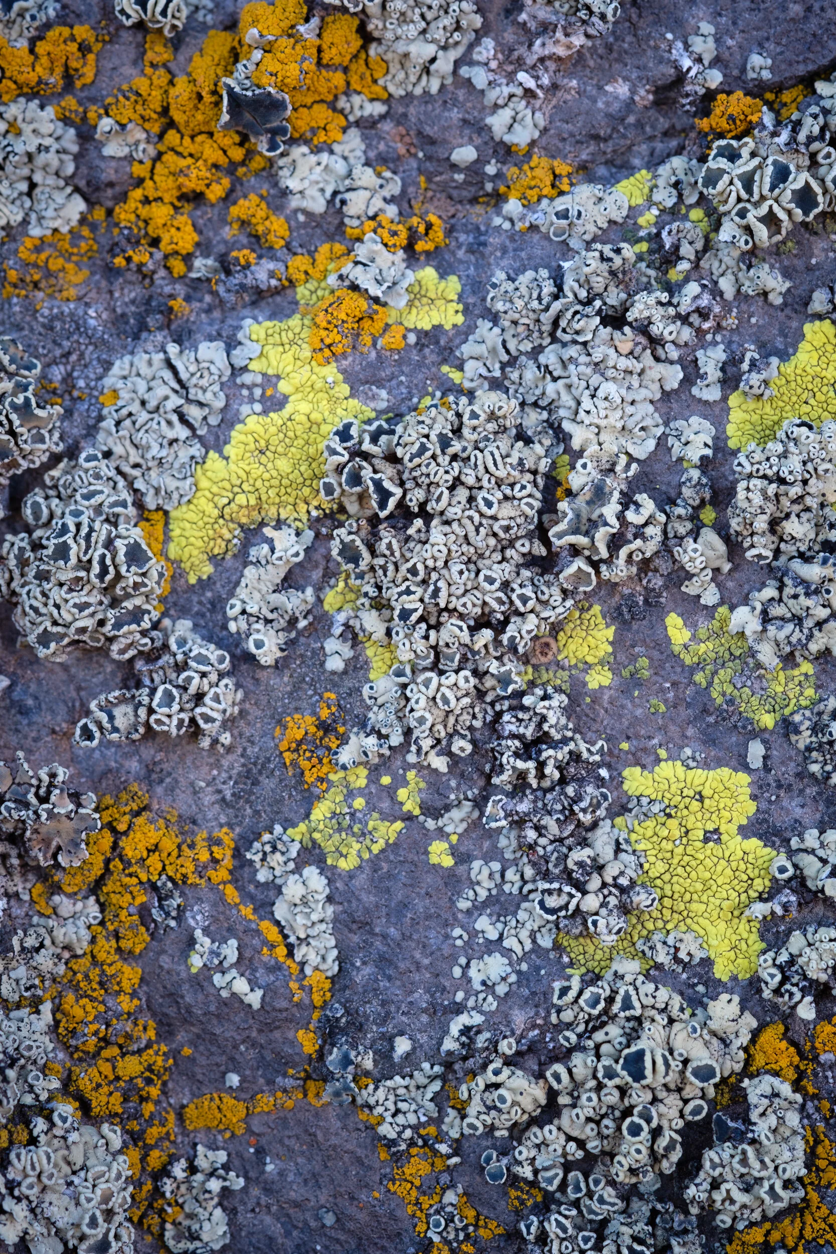
Fortunately, since Ann had her accessories bag it meant she also had her macro lens, so I could get really close up. Unfortunately, most of the interesting leichen was on the underside of the rocks, which meant I had to set my tripod up very low to the ground and sit/lie on sharp volcanic rock. This type of photography isn’t easy (or comfortable) either.
After playing around on the ground a bit, the sun was finally starting to cast some interesting shadows in the meadow, so I returned to my previous vantage point.
And as the shadow of the ridgeline made its way across the meadow floor, we made our final photographs.
We then packed up and headed back towards Kyburz Flats, to the potential campsite we’d found earlier that morning. We were in luck. Although the site had plenty of evidence of campers using the location before, we were alone and were able to enjoy the peace and quiet of being miles away from anyone with only the sounds of nature to sing us to sleep.
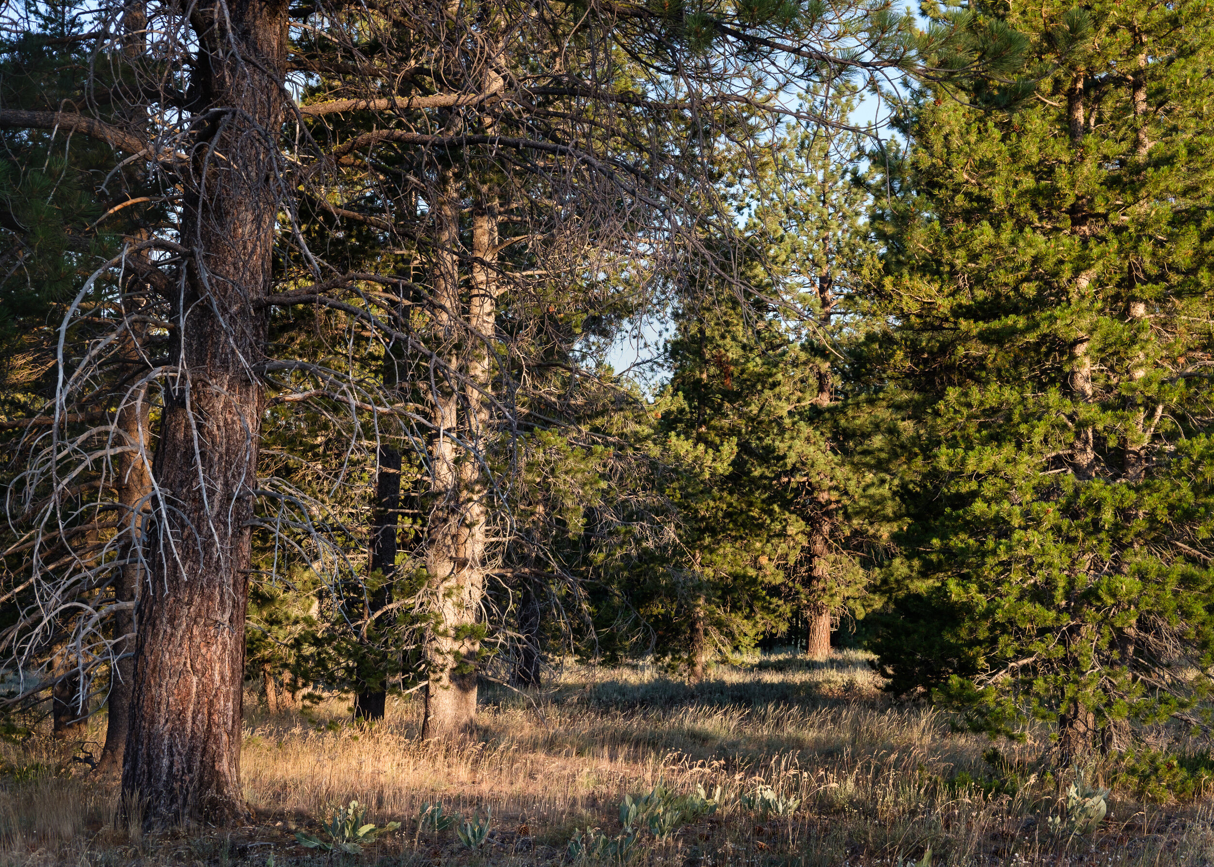
The early morning shoot started off with a misfire. We started out going into a meadow to the north of the road. But after a couple of photographs, Ann and I looked tentatively at each other and, pretty much at the same time said, “This isn’t really working for me, do you want to move somewhere else?”
Fortunately, I made one decent image from that first location.
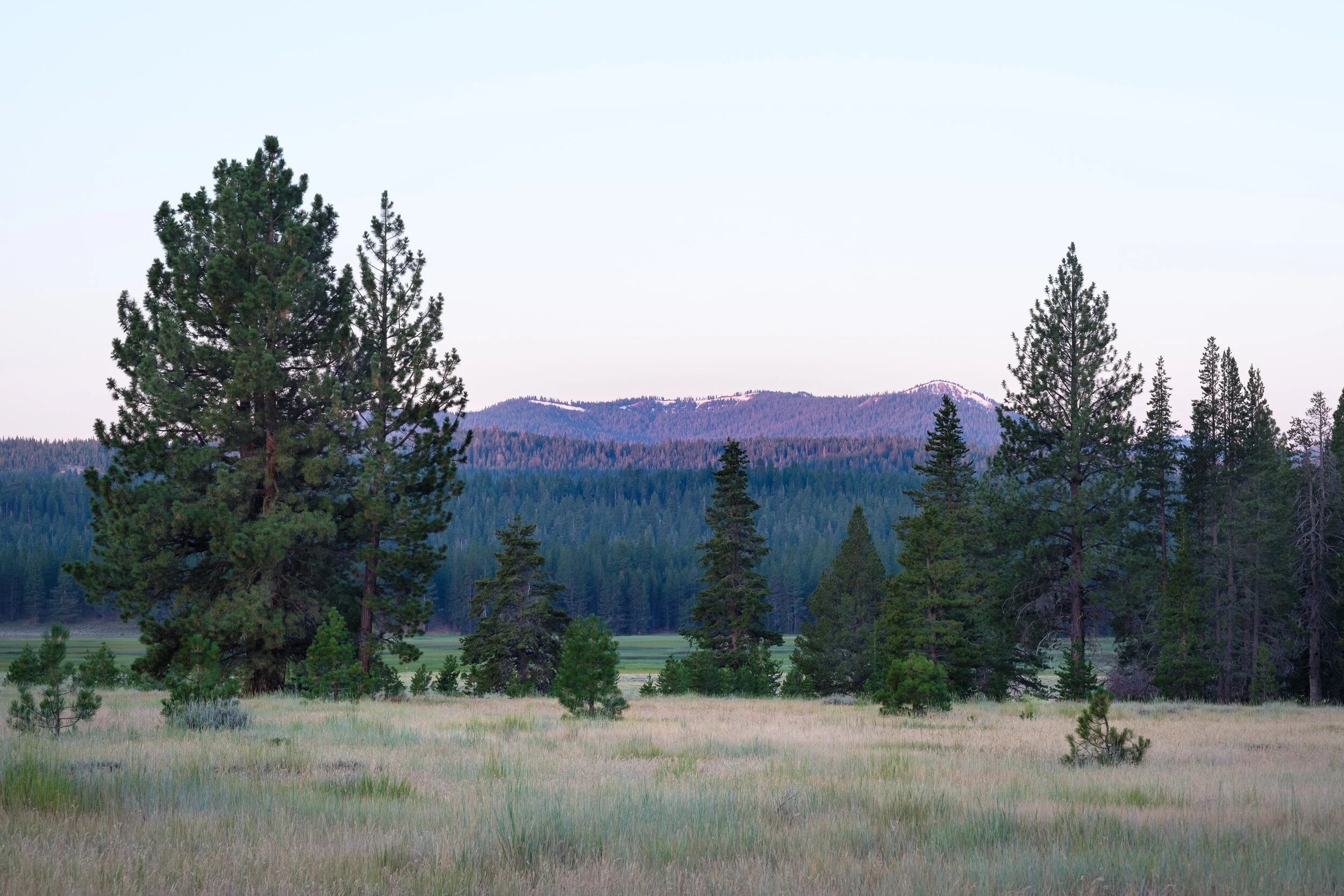
We drove down the road only a few hundred yards, and entered a meadow on the opposite side of the road. The results were immediately better.
While it was still difficult to capture the feeling of the meadow in the morning, there was a much greater variety of foreground elements to work with, as well as views off into the distance.
As always, the sunlight raced its way into the sky, and forced us to change what and how we photographed. It also had me rushing to capture the momentary qualities at specific locations that would appear, and then quickly disappear.
And try as I may, I still never quite made an image that captured that sense of meadowness.
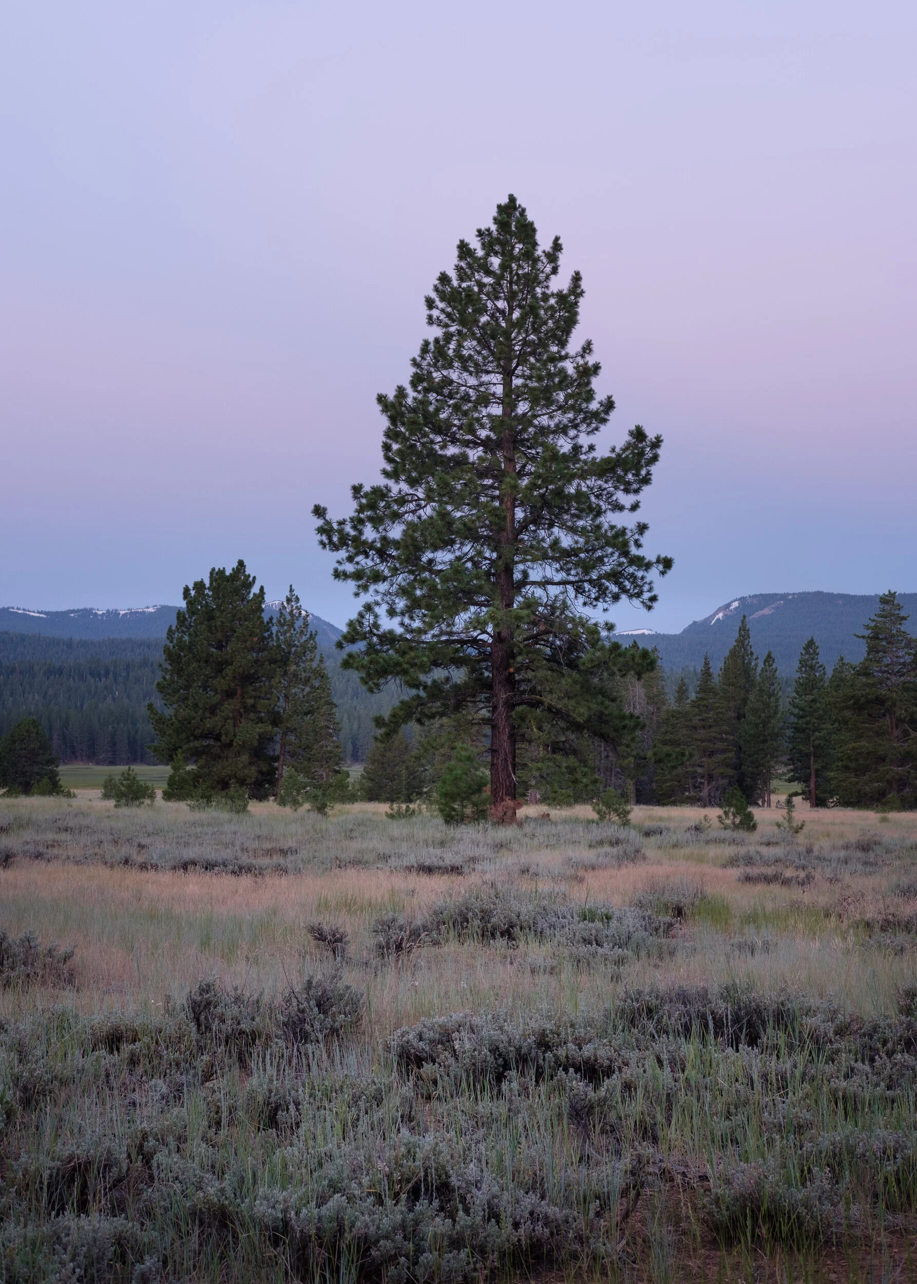
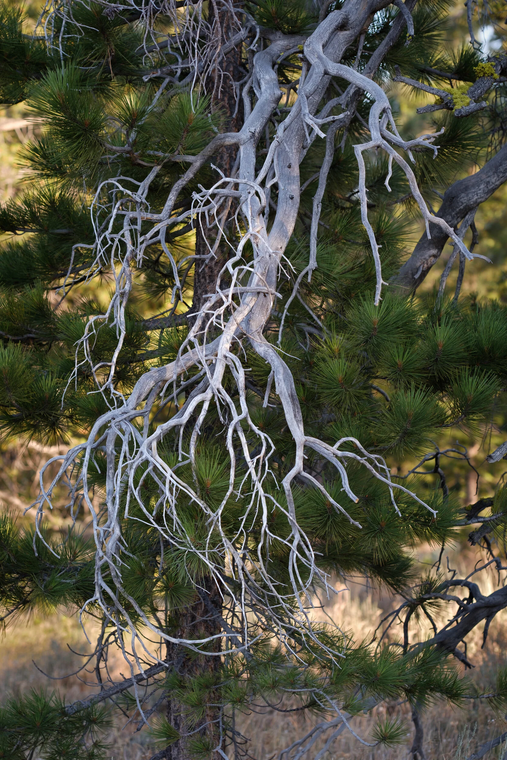
I eventually made my way over to Ann, who had spent quite a while working different images of this gorgeous tree. Me, I immediately saw a detail that led me to one part of it.
That was the end of our morning photo shoot, but not nearly the end of our day.
We continued northwest up HWY 89 all the way to Lake Almandor, headed back east to Susanville for gas, then back north and west on HWY 44 to reconnect with HWY 89 (which was closed for the part that runs through Lassen National Park) over to Mt. Shasta, for a short leg on I-5 to Weed, to take HWY 97 north east to Klamath Falls.
We stopped at the Klamath National Wildlife Refuge, but smoke hung over it from fires that we’d heard about as we drove past a week earlier. We might have stayed, but even the campsites around Upper Klamath Lake had little to offer given the haze. So we called it a trip and made it all the way home, content to have spent the morning photographing and the rest of the day criss crossing the Sierras and the Cascades.