Fresno - The Long Way Down
Our July trip was a maintenance trip to Fresno to get Beast’s mud room sprayed with waterproof liner (an item that didn’t get completed before our April pick-up date) and to repair a couple of things that worked loose during the May expedition. Everything was covered under warranty while Ann and I spent 3 days telecommuting from a hotel room while Fresno experienced 100+ degree days. But as is our way, we made the trip down there and back another adventure.
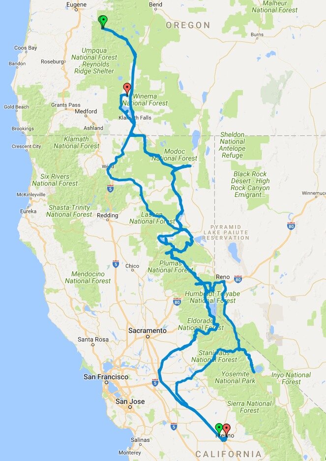
As we planned for this trip, we kept facing one frustration after another, in large part due to the much needed Sierra snow pack. Yet again our desire to explore Lassen National Park was defeated by the closed through road, buried under several feet of snow. The same was true forthe Tioga pass on the north end of Yosemite (well, until just before we left - the forecast was that it might not open at all this year due to road damage). Instead, we decided to borrow a chapter from our May expedition and just wing it. The plan was to criss-cross the Sierras as much as we could on the way down and back, more to scout than to photograph, but to photograph whenever possible. Call it taking the long way down.
And criss-cross we did. Here’s a map of our trip route.
I’d like to say the trip went smooth as silk, but that would be stretching it a bit.
The first day started off just fine, making it down to Klamath Falls bright and early for breakfast at Cinders Cafe. A drive by the Klamath Wildlife Refuge showed that a good part of it was low and dry (the area where we usually photograph), although the grasses in other areas were very attractive. Driving east, I decided to drive through the Lava Beds National Monument. There we got a tip about a nice mountain lake just to the south west that really struck my fancy and I was thrilled to have a destination.
Driving out of the park I realized I really should have gotten gas at K. Falls, so looked on a map for a town. Well, I had to head east instead of west where we wanted to go, but it didn’t look very far. No gas station. Next town, no gas station. 50 miles later - gas. By that time I was fuming, and diesel fumes at that (pardon the pun). I find a place I want to go to and and wind up an hour in the wrong direction. Not good.
But instead of back tracking, we decided to head south and explore the west side of Eagle Lake a bit north of Susanville. We’d driven past it a couple of times, and some sources said it was a good place to stop by. Well, not so much. It was your typical big lake, with lots of boaters. It may be nice during other seasons, but during the summer there are way too many people. Sowe kept on our way, checking out the map for smaller lakes. We spotted one south of Susanville, Antelope Lake, and set our sights there. It was much smaller, with some very interesting coves, but again the typical packed campgrounds full of boaters and screaming kids, so we kept on driving.
Back to the map, we found yet another lake, Lake Davis, further south but close enough to call it the end of the day. We set the GPS and headed out. As we were driving, Ann and I got into a really interesting conversation that lasted quite awhile. Suddenly a light bulb went off in my head - why exactly were we driving west, and had been driving west for quite some time? We pulled over yet again and, after zooming the GPS out as far as it could go and cross referencing where we were on a paper map, realized that whatever address we had entered into the GPS (a Lake Davis Drive address), it wasn’t at Lake Davis. It took me a few minutes to figure out where exactly we were, and then to find a campground relatively close by. Well, we were heading quite the opposite direction from the one had intended, and would be heading towards Oroville, where a huge fire was raging, but with any luck, the campground would be fine.
It was. We found a spot and called it the end of a really long day driving. Lots of beautiful roads, but a heck of a lot of driving.
The next morning started fairly early. I’d slept well, was pretty refreshed and, while I didn’t have a precise destination in mind, I had a very clear route in my mind that I wanted to follow - I’d had enough of aimless driving that first day.
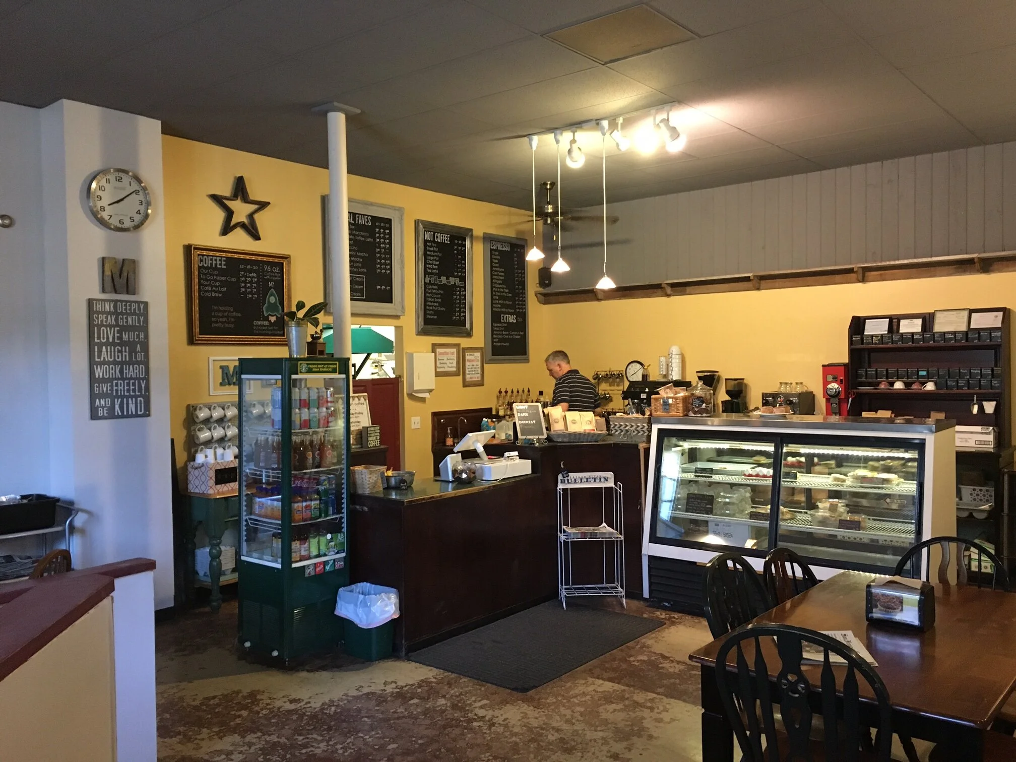
And again, the day started well because we found a great coffee shop in near-by Quincy for breakfast and had a couple of great mini-quiches (you can hold the “real men don’t . . .” comments) and delicious, well crafted lattes.
Along the way made a couple of stops on HWY 89 north of Truckee to mark places of interest, followed 89 along the west side of Lake Tahoe (Don’t ever need to do that again! [You might if you like the hordes.]) and then headed east on HWY 88 across the Kit Carson Pass.
It was a beautiful drive.
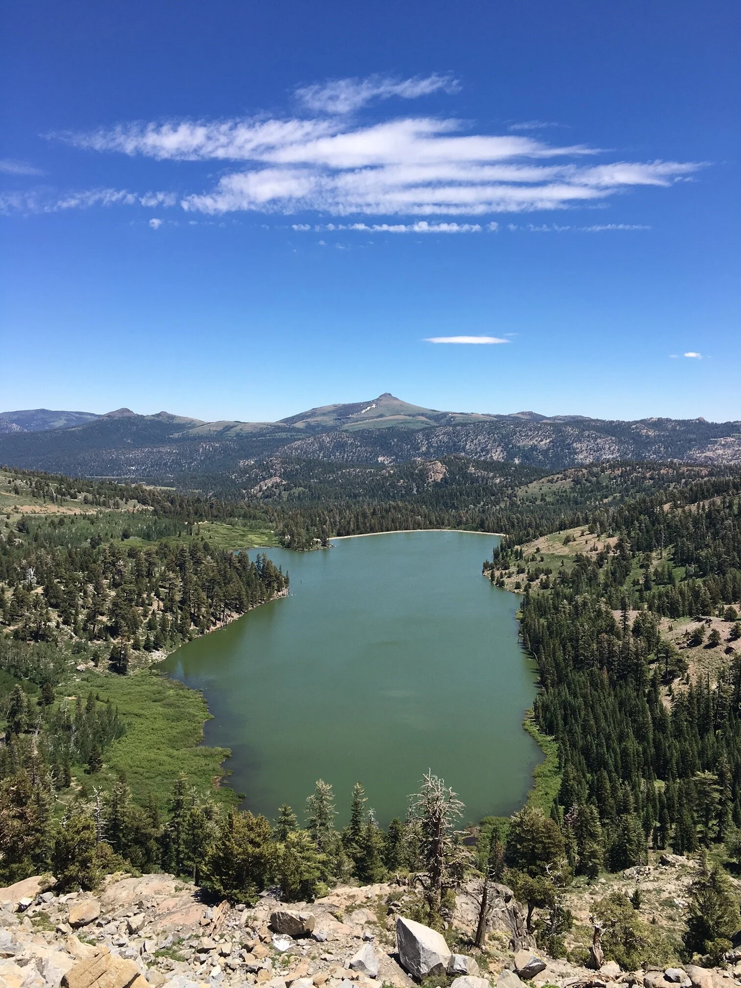
Our atlas showed that just over the crest was a series of campgrounds, so we decided to check them out one-by one. The first one was a miss. About a quarter mile down the road leading to Woods Lake was a sign “Campground Closed.” We were to later find out it was closed due to a couple of feet of snow. Too bad, it looked to be the most isolated of the bunch.
We continued onward and didn’t even slow down for the Caples Lake campground. We could see from the highway it was way too large and way too packed with people. Then we came upon Kirkwood Lake campground - a sharp turn off the highway that descended quickly. Just our kind of route.
It was a narrow road down, so we had to pull over and let folks leave, but eventually we made it to the campground area. I walked up to the campground hosts and asked about availability. One spot open, they just left! Not bad for an 11 spot campground. We took it.
We had a good chat with the camp host, finding out that they had just opened the day before and that Woods Lake was still closed, (“Yeah, we know, we tried there first!). He then said, “You folks look like you don’t mind doing a bit of hiking. There’s a great set of falls down the way. Just walk past site 6 and keep the wall to your right. It’ll descend a bit, but it’s a nice set of falls.” We also got some pointers on other potential photo locations down the road towards Sacramento for the next day’s explorations.
After we scouted Kirkwood Lake for our morning photo shoot, we decided to check out the falls. Now, I’d thought about doing a blog post just on this side-trip, but decided against it. I would have titled it: “The Best Camera is the One You Have With You - Or Numb-nut Dan Doesn’t Follow His Own Advice.” The first part of that title comes from a book by Chase Jarvis and it’s about using your iPhone to make good photographs; the second part is the fact that all I had with me on the hike was my iPhone. I should have brought my good camera and a couple of lenses. That said, I used the camera I had.
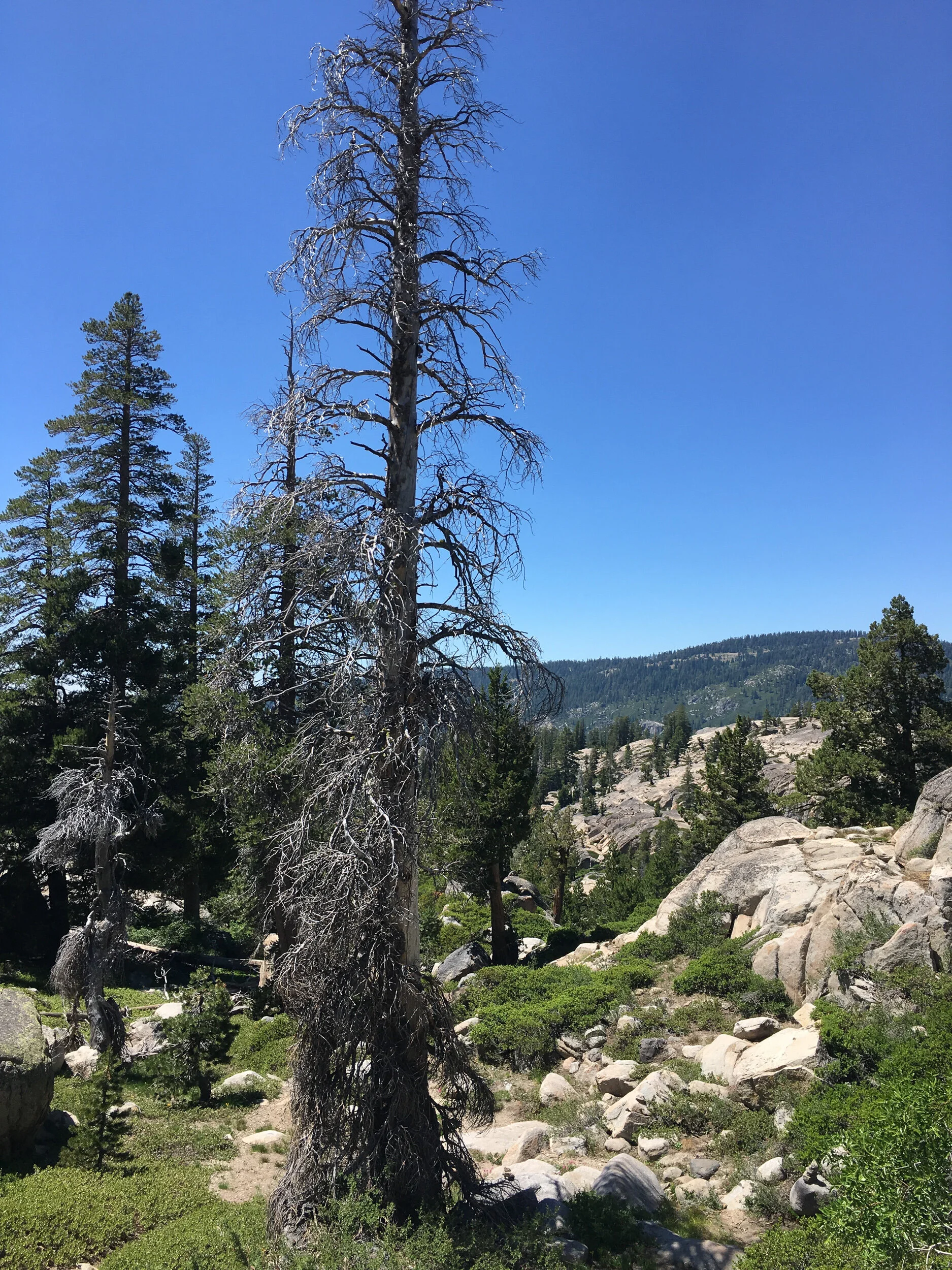
The hike wasn’t too terribly long, probably a mile or so each way, nor was the descent - several hundred feet at best. However, the trail got re-routed at a couple of points (thank goodness for cairns), ran through some brush (while descending, it’s hard to walk down a rocky slope when you can’t see your feet), and then required some scrambling down boulders on the draw leading to the creek (my comparatively longer legs making it much easier for me than for Ann).
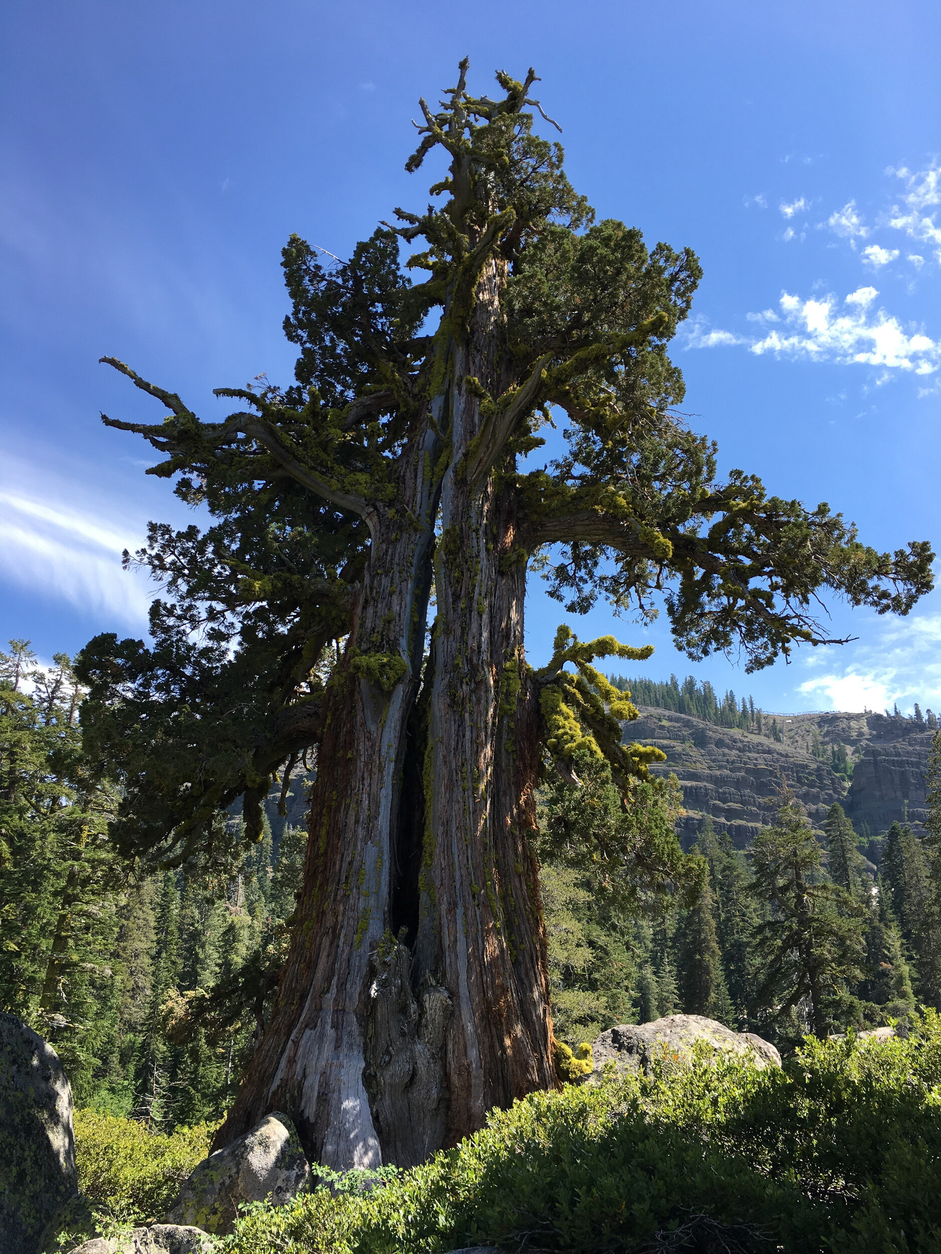
The route took you down a draw, that led into another draw with a creek and the falls. The views were splendid.
When we finally made it down to the Caples Creek falls, we’d realized the mistake we made in leaving the cameras back with Beast. (To be honest, it would have been tough, if not dangerous, climbing down the rocks with our full packs and tripods. But still . . . maybe we need a super-light setup for small “hikes”).
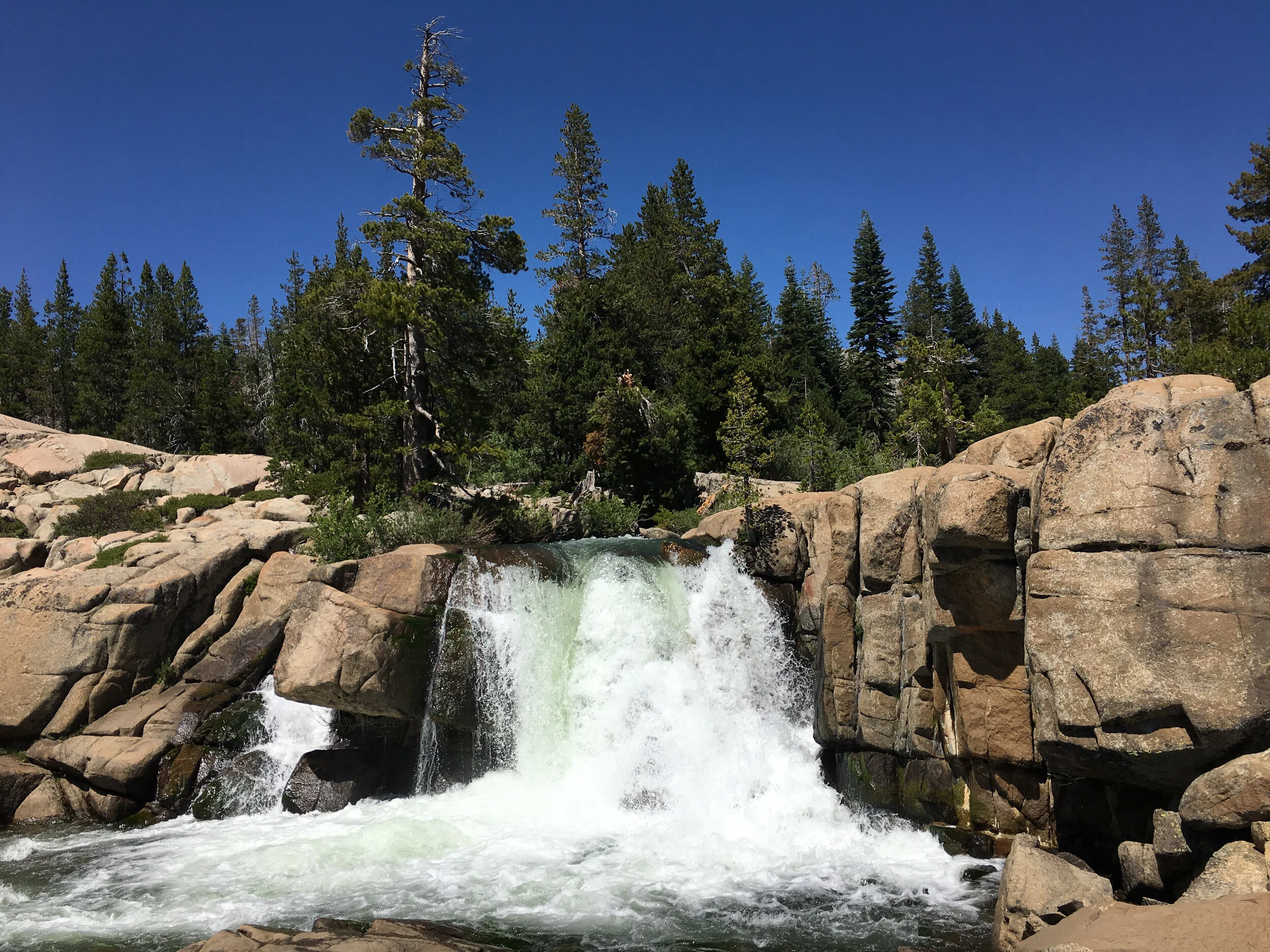
At 7400 feet elevation, the skies are an incredibly deep blue. No need for a polarizing filter here!
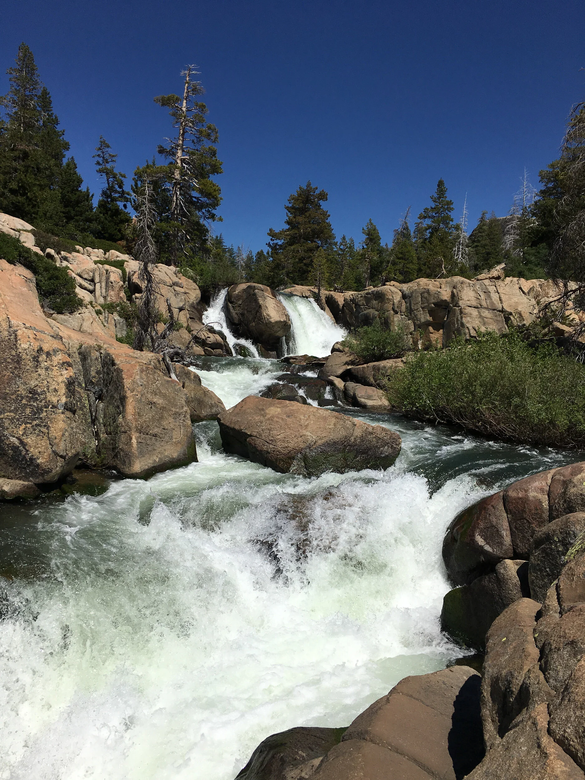
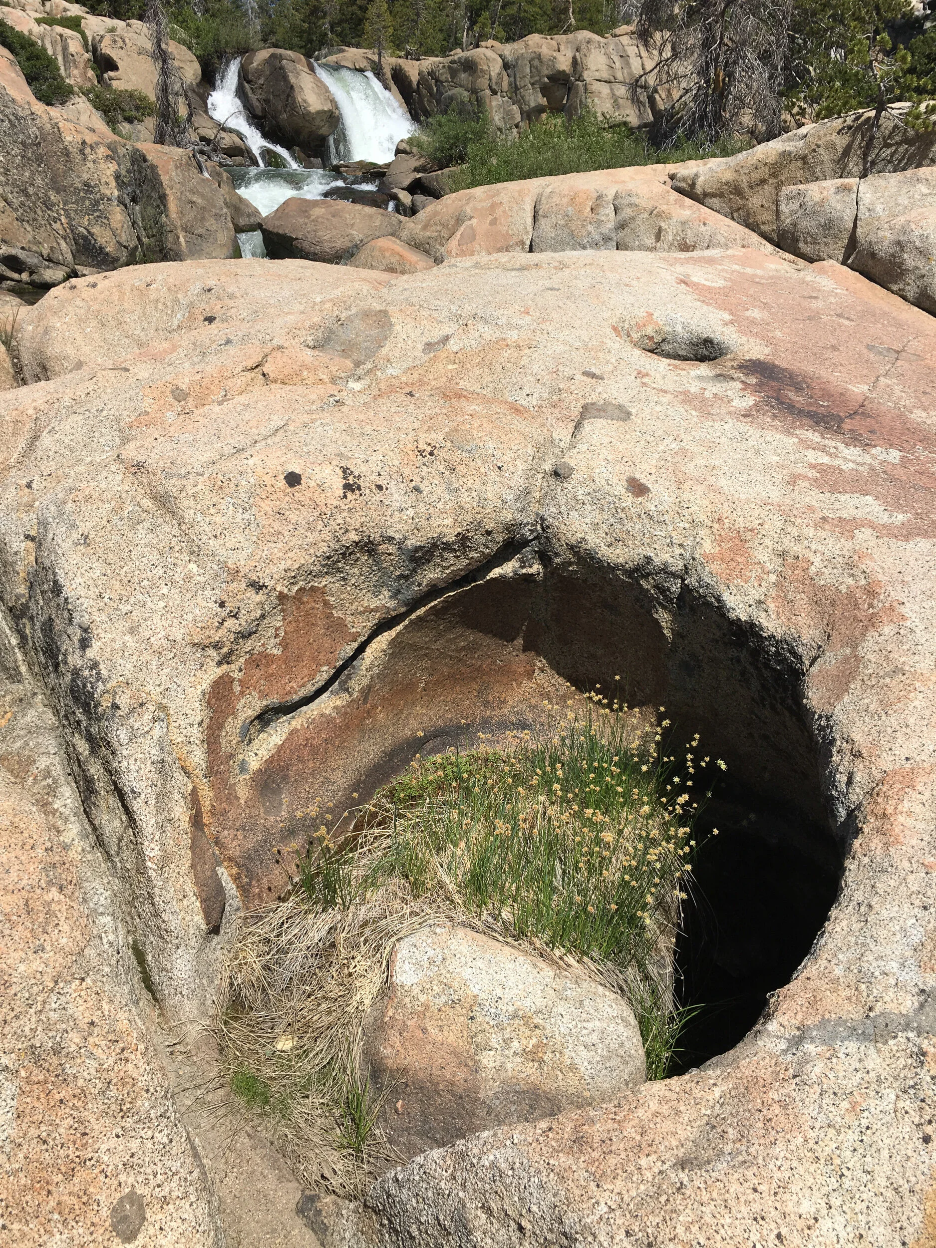
The landscape around the falls had a lot to offer, not just of the falls.
There was simply a plethora of images to be made.
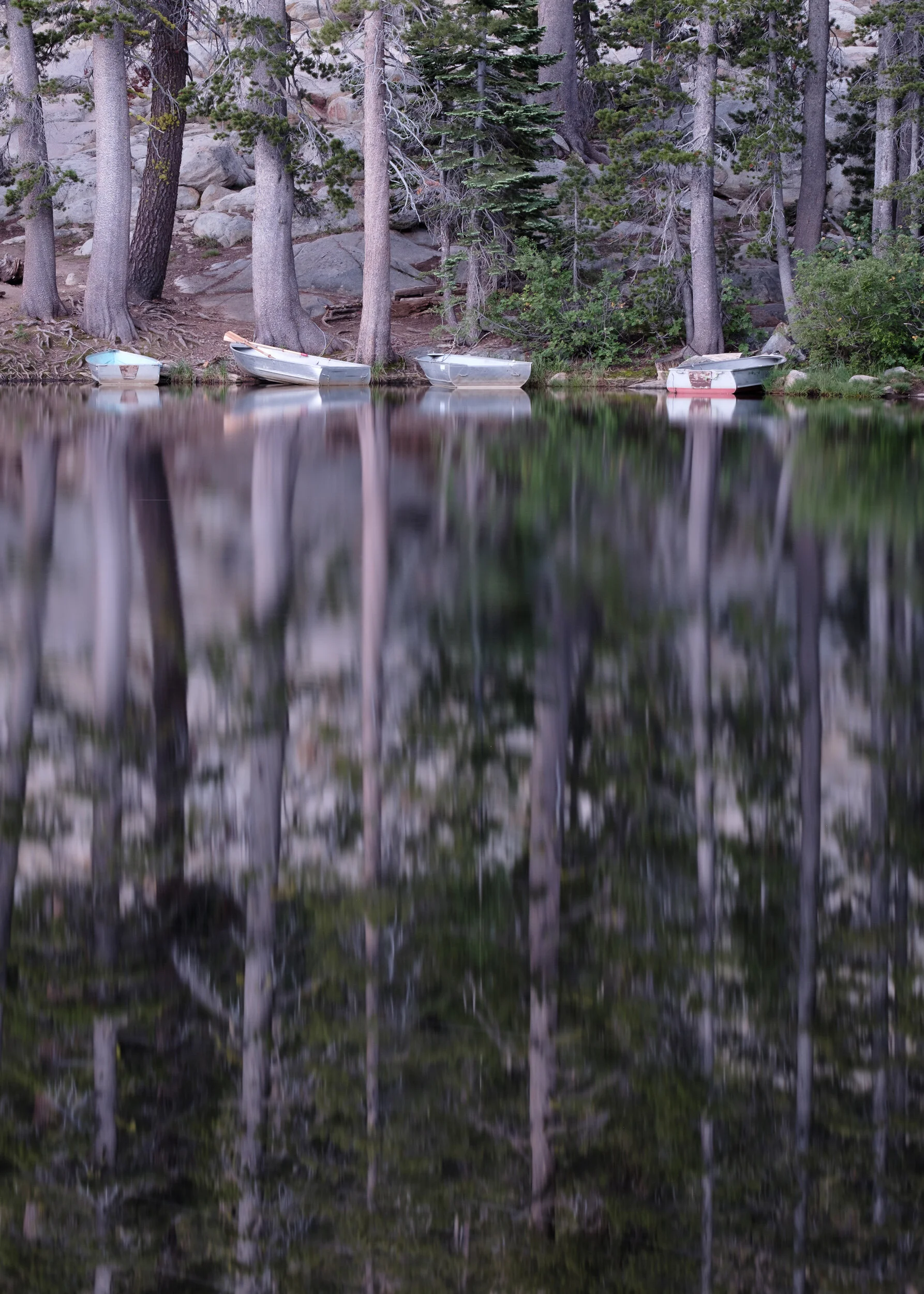
After seeing a few potholes here, Ann and I decided we wanted to check out a hike to the potholes near Silver Lake that the camp host had told us about.
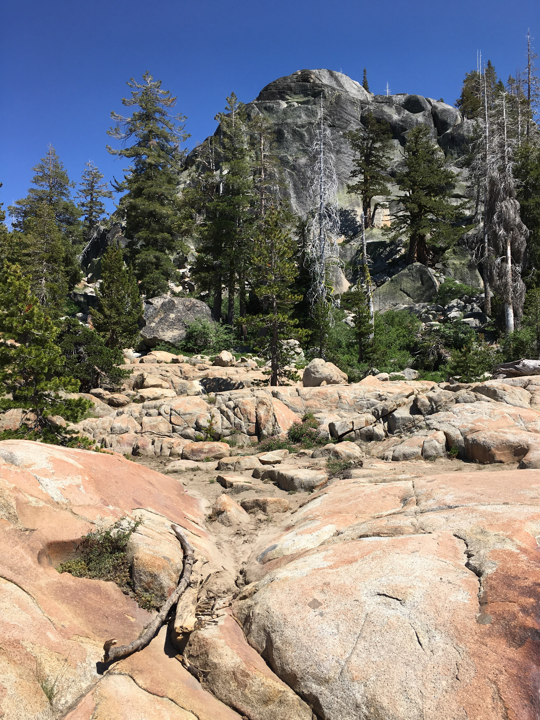
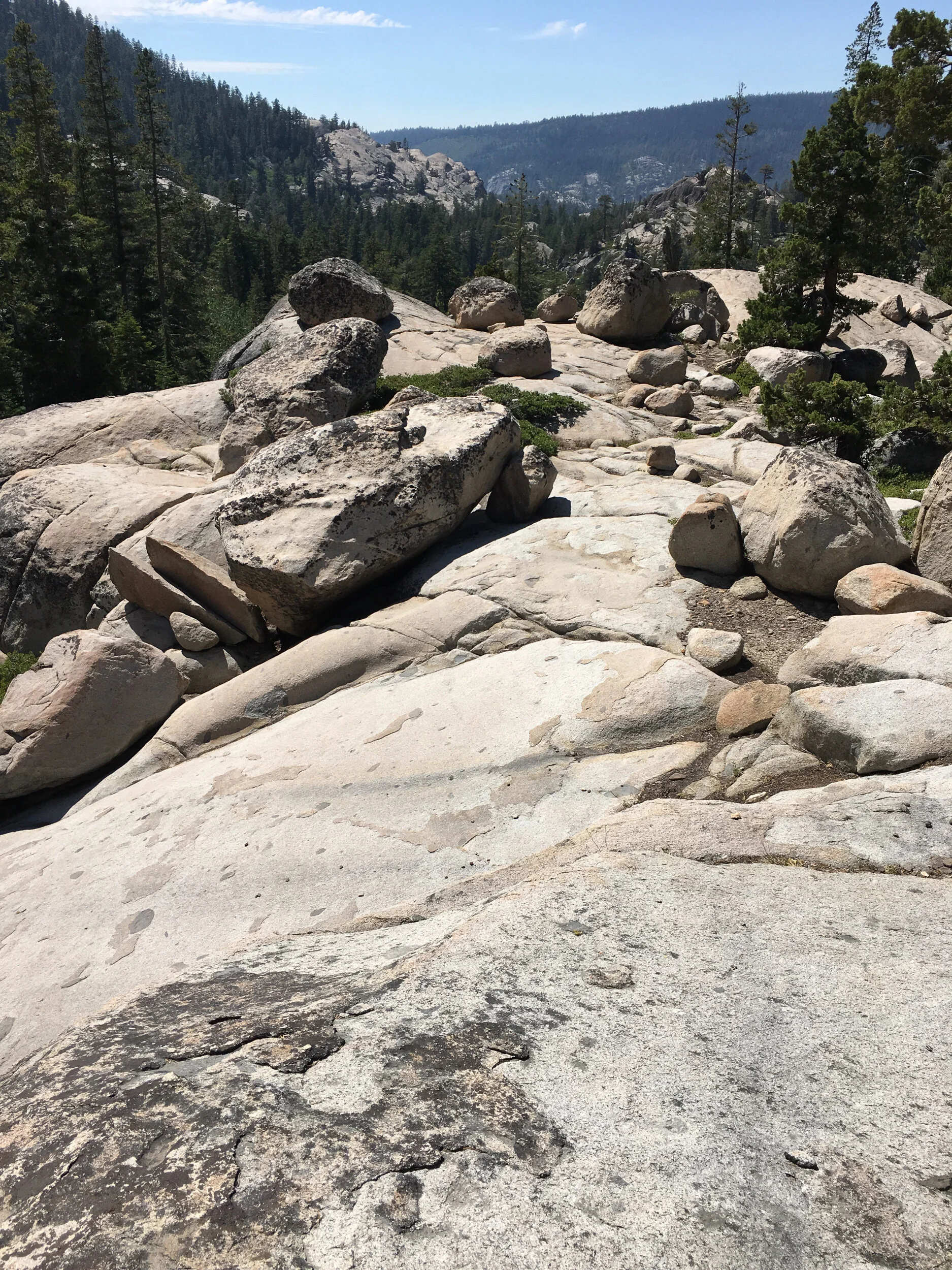
Eventually, we started on our way back, which meant climbing upwards and over the boulders we slid across on the way down. And no, that is not the trail, we are not mountain climbers - I said boulders. The trail ran to the right of the photograph. This was part of the wall that we now wanted to keep to our left.

We stopped way more often on the way up than on the way down. To take more photographs of course. . . . (the sound of huffing and puffing in the background).
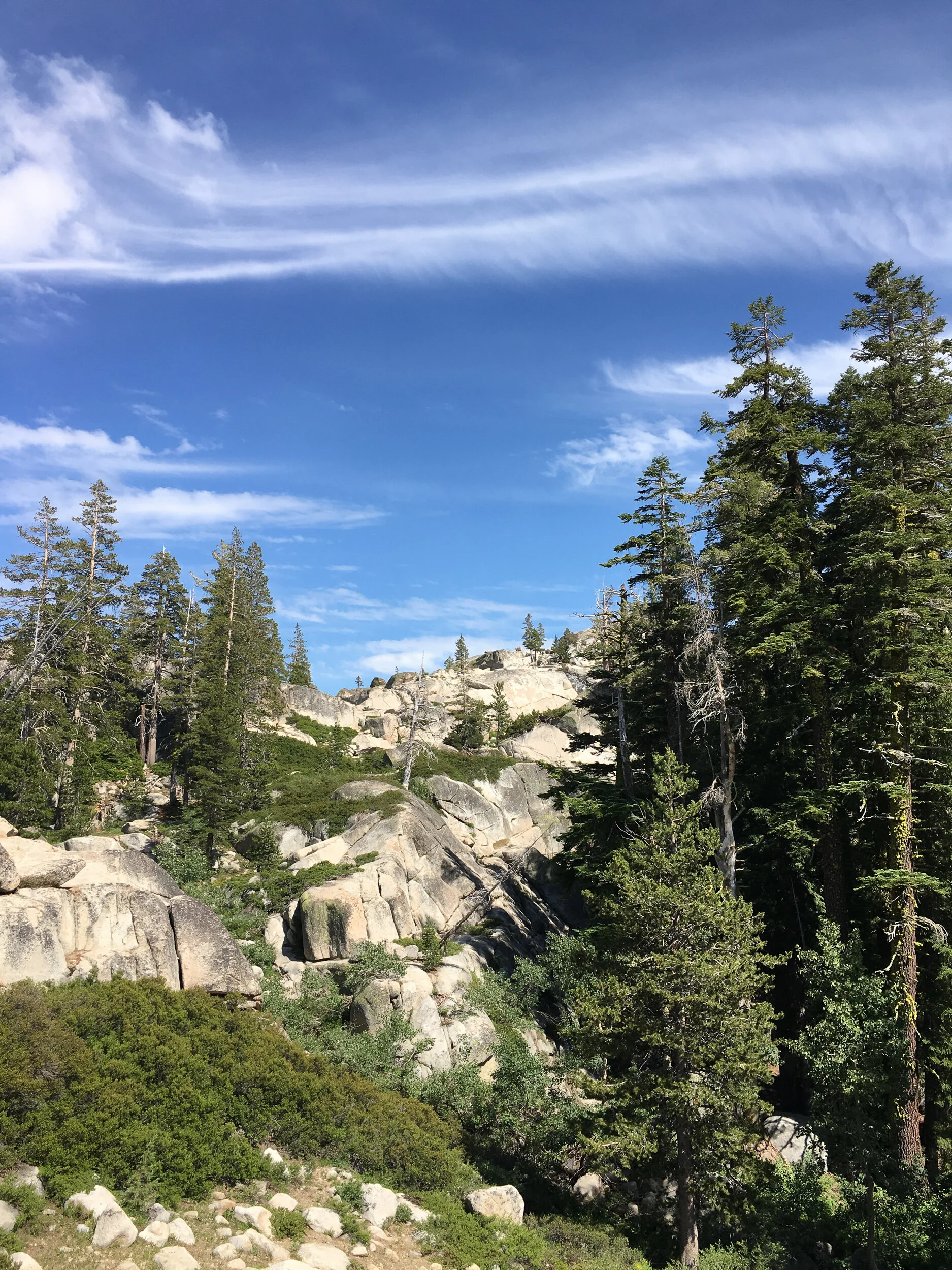
It was great climbing around in the Sierras. They are so different than the Cascades, it’s hard to imagine.
And by the time we were nearing the campground, afternoon clouds started blowing in.
We’d joked that we should head back down with our gear because sunset should have hit the falls. Lucky for us we didn’t because the clouds really did roll in and we weren’t even given a lovely sunset. Which was fine, because we were pooped! (And imagine trying to climb out of there in the dark). So we headed off to an early night’s sleep for an early morning rise to hike the 50 feet or so necessary to get to Kirkwood Lake.
Now the campground might have only had 11 campsites, but that doesn’t always count for much. At one point, I’m pretty sure it was around 11, I was awoken by a crying kid. You could tell he was exhausted and just too wiped to fall asleep. Annoying, yes, but not nearly as much as the person in the campsite next to us who yelled out “Shut that kid up!” and then went on talking in a loud voice to the folks sitting with her by the campfire bitching about the kid for another 20 minutes or so. I felt like yelling out to her that the only thing more annoying than a crying kid is . . . . but then calmed myself down and relaxed myself to sleep.
We got up early, did our usual thing and, just before we shut things up to go photograph, there was that woman’s angry, braying voice griping to someone to get her a pillow for her back and how uncomfortable she was, and . . . . And people wonder why Ann and I are tired of people. Why are some people so angry and miserable all the time? She should have just stayed home, for everyone’s sake. It got under my skin.
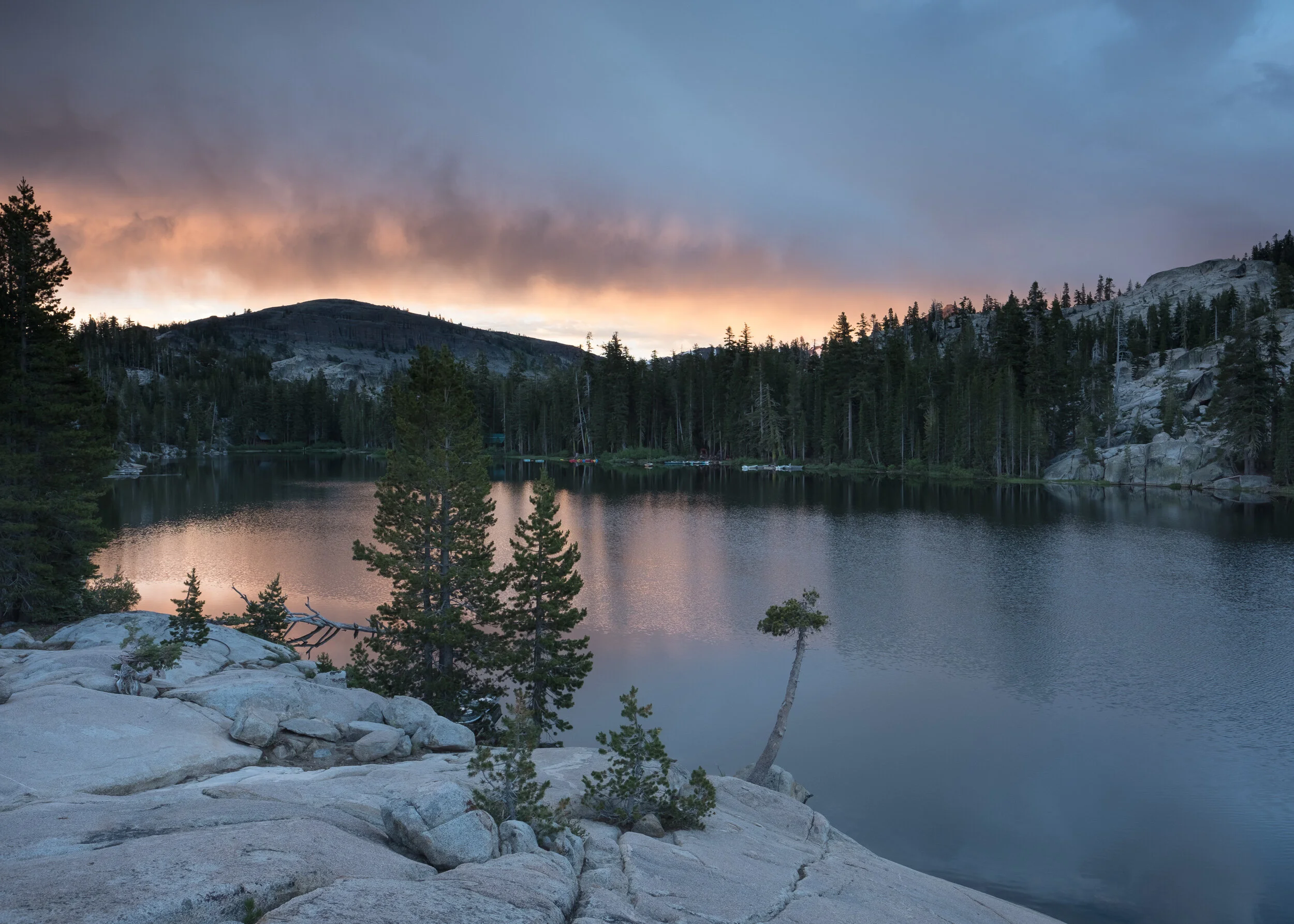
I’d like to say that photographing swept all of that aside, but it didn’t. Instead of clear skies like we’d anticipated, the pre-dawn got even cloudier. And while the lake was lovely, my images weren’t particularly inspired. Try as I could, my mind couldn’t let go of the sour taste in my mouth from that woman’s anger. Fortunately, Ann had found a different spot and had more success than I did - at least she was in a mindset to experiment (in large part because she hadn’t heard the griping).
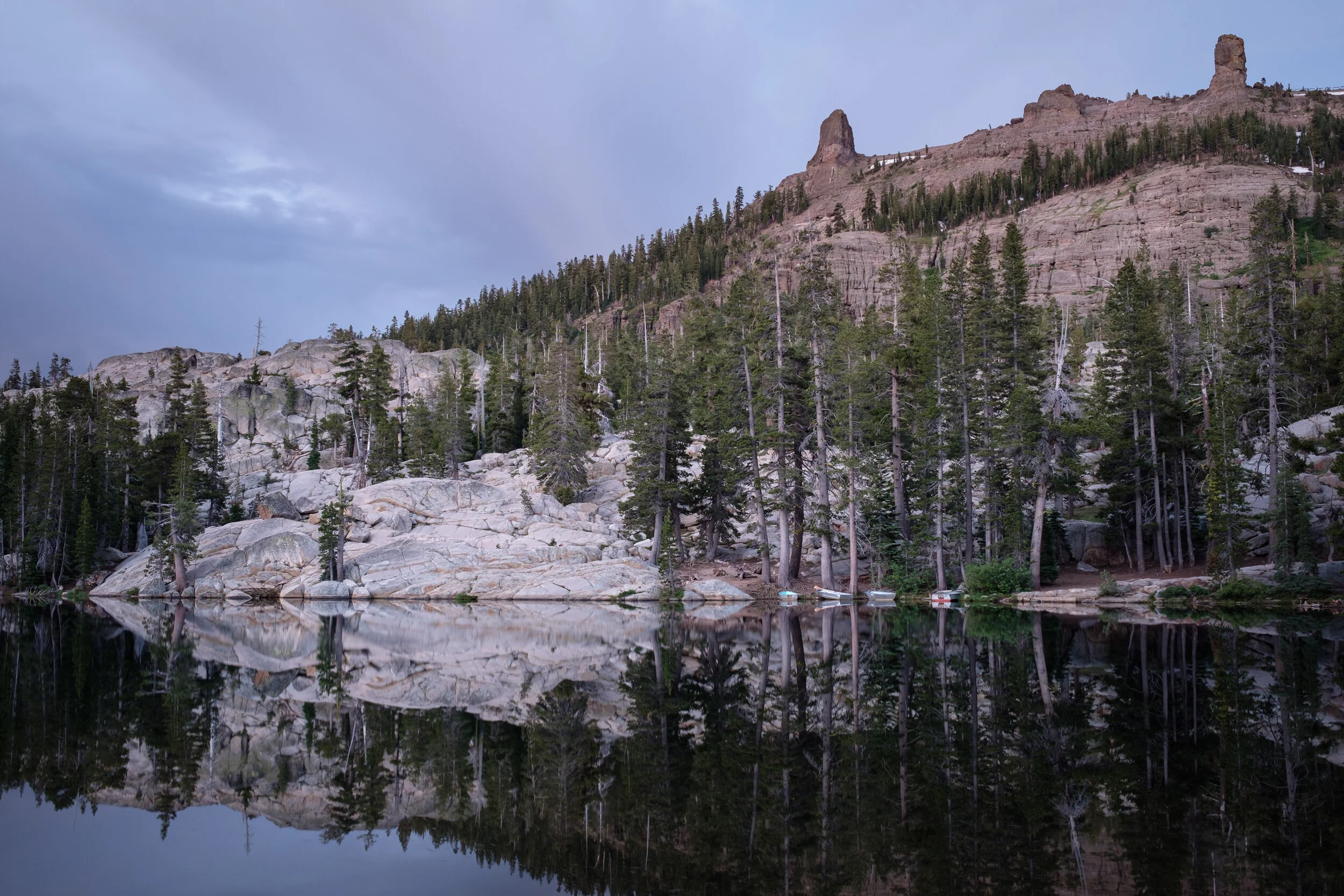
I eventually got around to a better mindset and began working with reflections and the interesting light you get in pre-dawn, so the morning wasn’t a total waste.
And after we’d moved up on a granite face as the sun was rising, we did get a bit of cloud color, though it never expanded beyond that leading edge of the clouds.
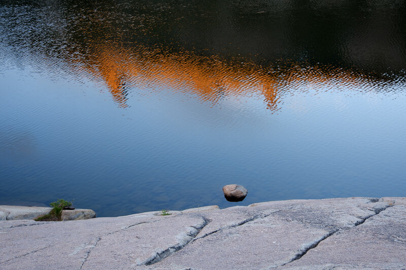
Then for less than a minute, the light hit the rock face above the lake. I was focused on photographing the far side of the lake with a longer lens (the rock outcropping by the lake in the middle right of the image above). By the time I noticed the lit ridgeline and grabbed another lens to put it on the camera, the light was gone.
Ann however, managed to get the rock face, and to also make a photograph I think just might have been the best image of the day.
(Sorry Ann, I saw it in the DropBox folder and just had to grab it. What an image!)
We packed up and headed down the road for more image making (and you know who was still griping away). But the potholes trail was closed for restoration, and a track leading to a meadow we thought we might explore ran through heavy, low tree cover (way too low for Beast), so we wound up driving all the way to Fresno without making any more photographs. We did make a few stops at some scenic viewpoints and did a big loop-around on some back roads just off HWY 88, but it was mostly just a lovely drive through a different landscape.
As far as a meandering scouting trip through the Sierras might go, it wasn’t too bad. Plus, we had three days in Fresno to figure out what route to take on the way home!