The Grand Staircase-Escalante - Part 1
We woke up the next morning in the Grand Staircase-Escalante National Monument. Given that we arrived so late in the evening, we hadn’t had a chance to scout out a decent photography site so we didn’t quite know where we wanted to be at first light. However, we’d photographed in the area during our last trip to Utah and had a few ideas. So we made some coffee, packed up Beast and headed up the road towards Boulder once there was enough light to see the surroundings.
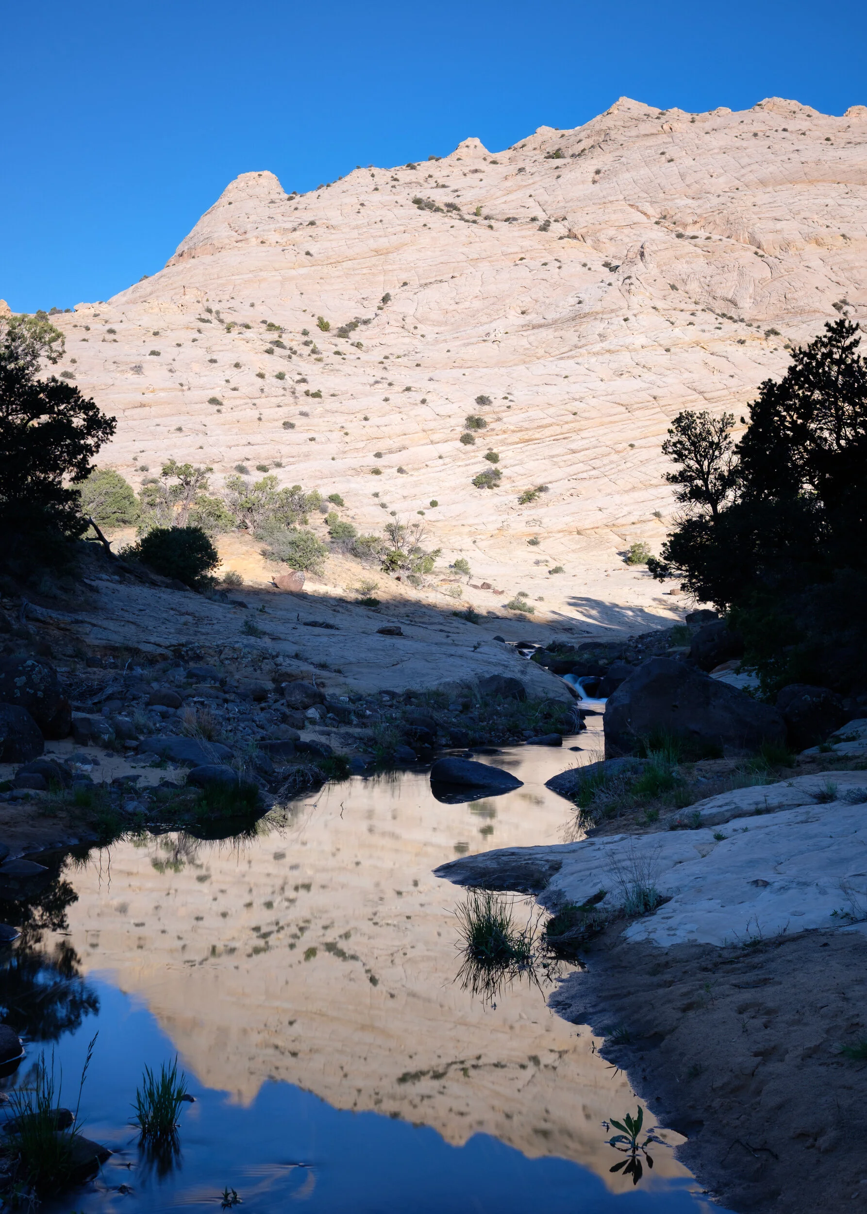
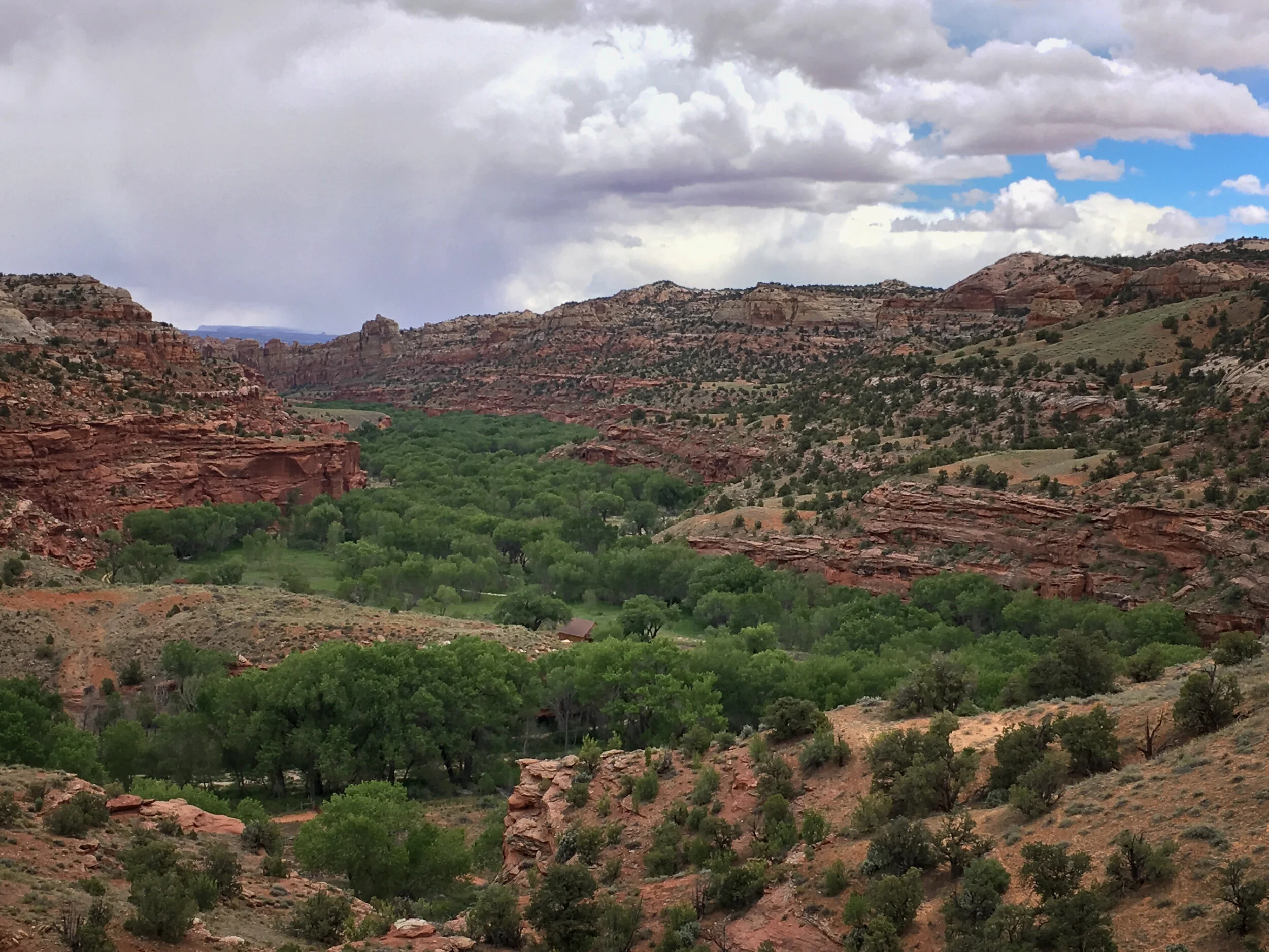
We didn’t go very far before we found a creek just off the Burr Trail and, given that the sky was getting brighter and brighter, decided to try to make it down to the creek before the sun topped the horizon. By the time we clambered down the hillside and made our way to the creek, we’d entered that odd period in the morning where the sky is too bright and adds little light to the ground. The first shots were mediocre, but it helped push me to make a better composition. Then it was only a matter of waiting a few minutes until a different type of light arrived.
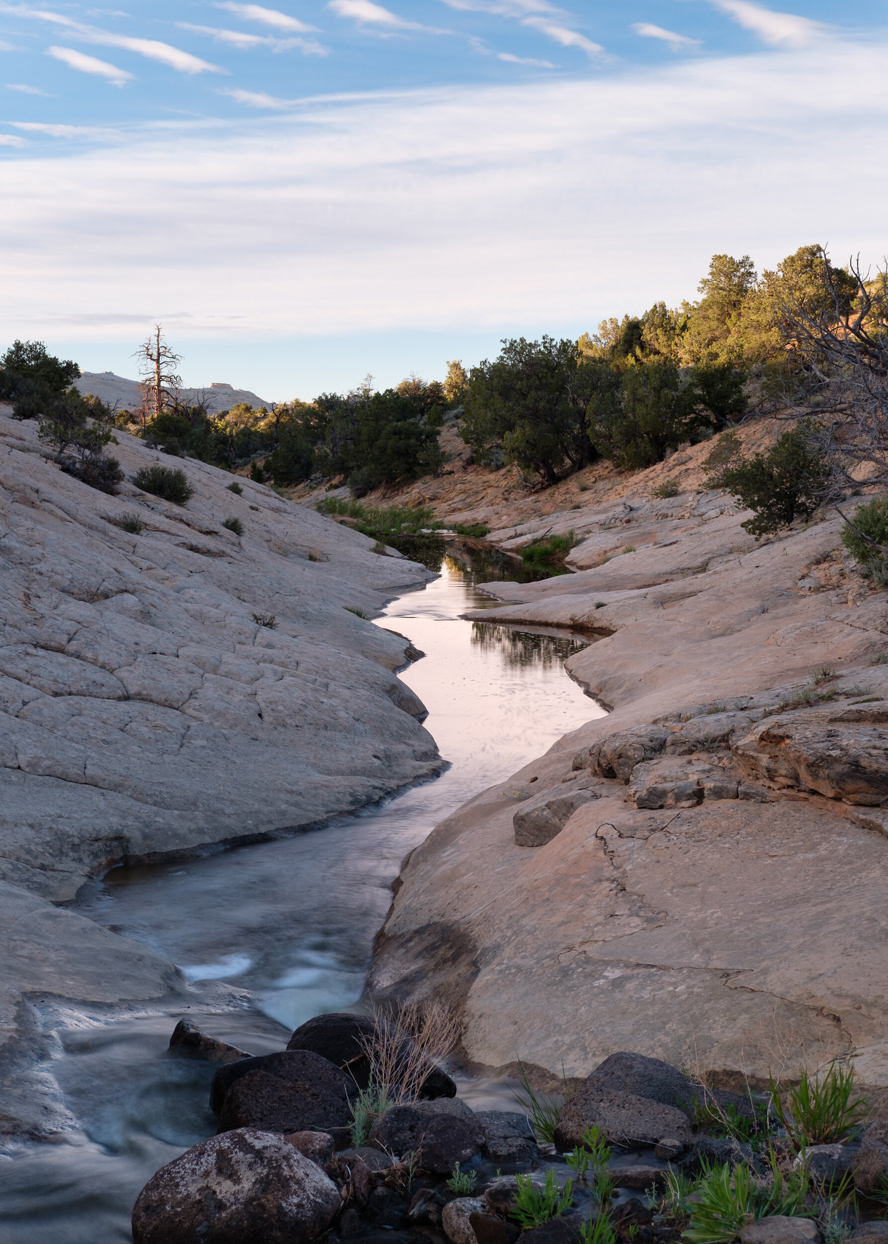
And given the bends in the creek, we had a few different opportunities for image making from the same area.
As Ann made her way over to take advantage of the view I’d just left, I took advantage of what the site offered me on the rock right next to the foot of my tripod. You really can find photographs pretty much anywhere.
A few minutes later we were awash in light and hungry. It wasn’t too difficult a decision about where to eat breakfast - Hells Backbone Grill!
While enjoying yet another savory meal, we started planning the rest of our day. I’m not sure if it was there, or our stop for coffee later, but at one point we checked the weather and saw more bouts of rain for the day. I decided to see what the weather was like at the Grand Canyon (where we would have been heading to this day) and found out that not only did they have steady rain, they’d had so much snow this year that it had damaged the Visitor’s Center and resort hotel’s water system so they were on a water shortage. When I’d purchased our back country camping permits for Point Sublime campground, I’d been warned that since the date was so close to opening, the camp area may actually be inaccessible. It sounded like the off-road trail there probably wasn’t clear if they’d had such a huge snow pack. Maybe tossing out our plans was really the right thing to do regardless!
In any event, we decided that we’d take our time heading down the Burr Trail and go past the slot canyon we’d visited during our last trip. My goal was to at least make it to where the road turns from pavement to gravel/dirt. In any event, we’d photograph where we wanted and if we didn’t find anything really worth staying for, we’d head on to Escalante to see about photographing along Hole-in-the-Rock Road. So off we headed back down the Burr Trail.
Sometimes it really amazes me what will catch my eye and say “PHOTOGRAPH!”. Especially from a moving car. On a windy road. When I'm driving. At least I have enough common sense to take my foot off the accelerator and occasionally glance forward to make sure I’m not about to run into anything as I’m looking to see if, indeed, there is a photograph to be made. We did that a few times along the drive down the Burr Trail. Once I stopped and made an iPhone shot from Beast. Another time I slowed down and decided that the time was wrong and I should remember the location for the way back. And one time it was, “Ann - look at that rock over there!”
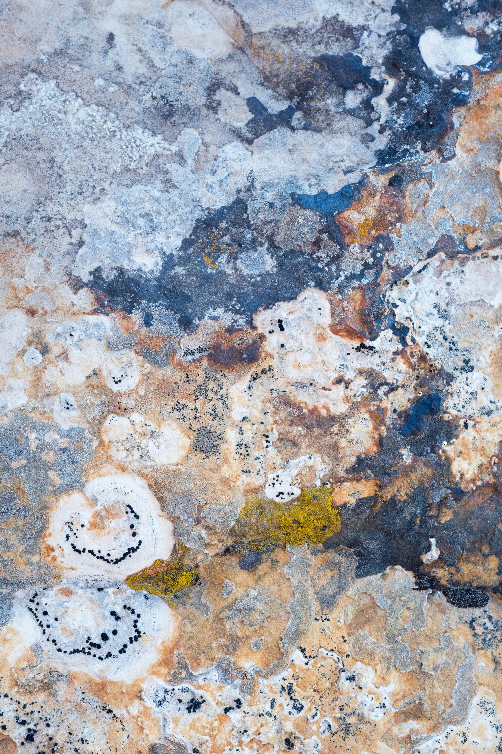
Now, it wasn’t really a rock, it was more a boulder about 8 feet tall, but from where we were on the road - probably 50 yards away - it was a rock. A bizarre and unusual rock in the middle of normalcy - but it caught my eye. And fortunately, there was a place to pull over not too far away. It took a bit of scrambling up and over a dirt mound, down into the stream bed and then over to the rock, but it was worth it.
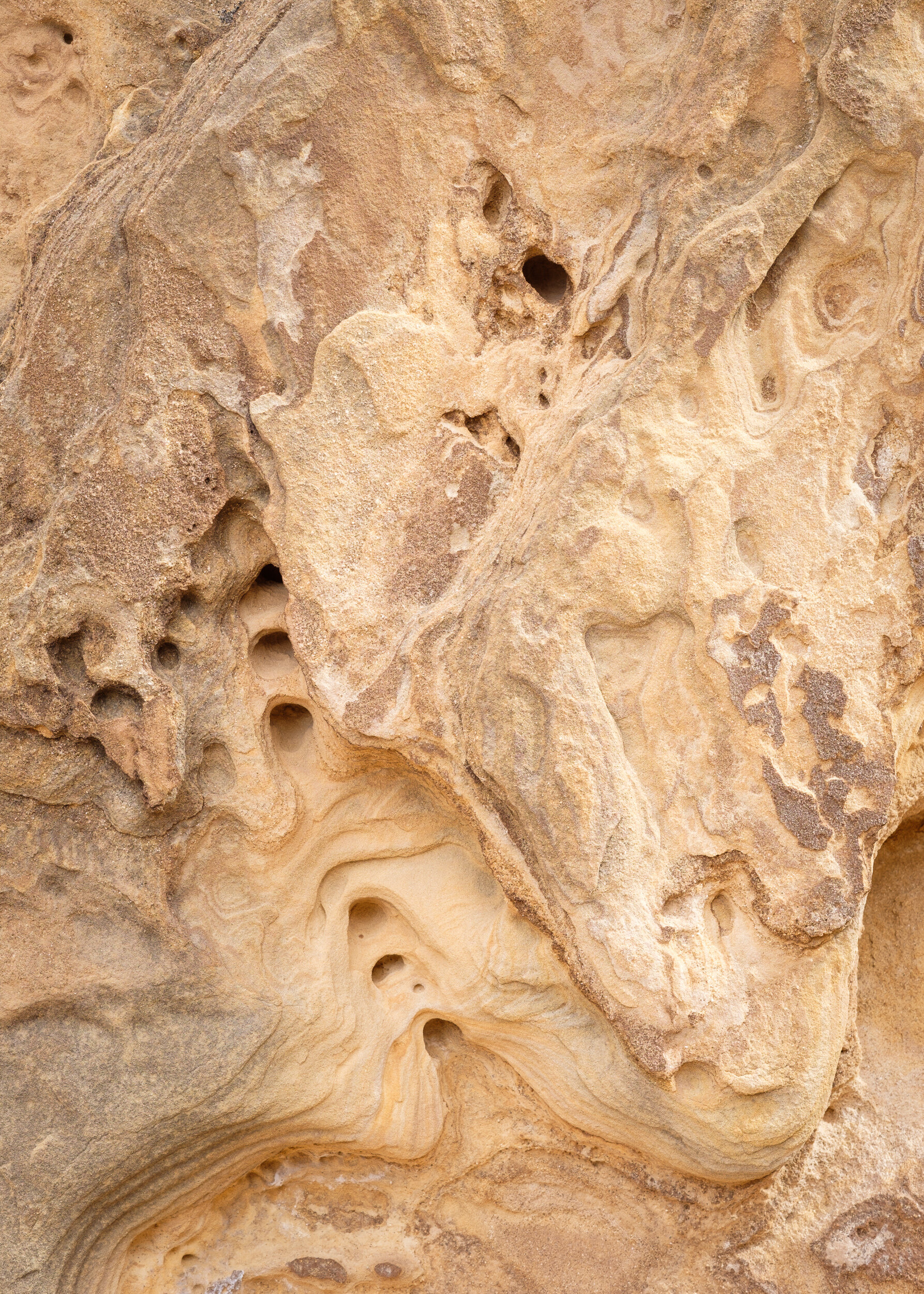
I wound up making a half dozen images from this rock. The funny thing is that this side was sand colored and very fluid in its form. However, the other side of the rock (the side I didn’t see until we were passing it) was dark and quite frankly looked like something made by the creature from Alien(s) (I do not recommend that you try to psychoanalyze the sub-conscious inspirations for my image making - it would probably scare the bejesus out of you).
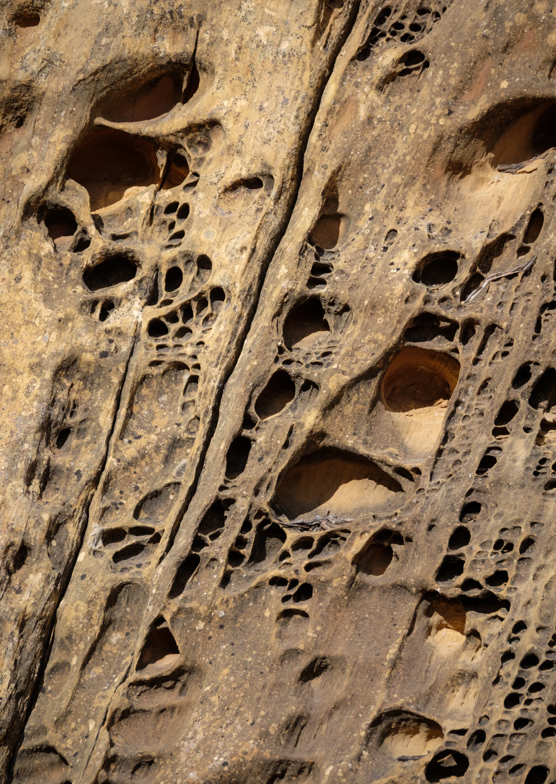
The first one was made from about 3 feet away from the rock. But the second shot was so high up on the boulder that I had to go to the hillside by the road to even get a clear view of it. So I wound up going into Beast and grabbing Ann’s 400mm lens plus extender so I could zoom into the part of the rock I wanted to frame. Strange how that works out - you see what you see, but then have to figure out how to capture it. And yes, it was an abstract composition I saw from the road, not a broader landscape!
Once we were done we headed on our way. Not too much farther down the road we started rising out of the canyon and then hit a pull-out at the top of the ridge, just before a long descent down from the escarpment. We could see the dirt road way below. I’d gotten as far as I’d wanted, thinking that for our 2018 trip we may want to come up the Burr Trail from that end (and of course eat at Hells Backbone Grill!).
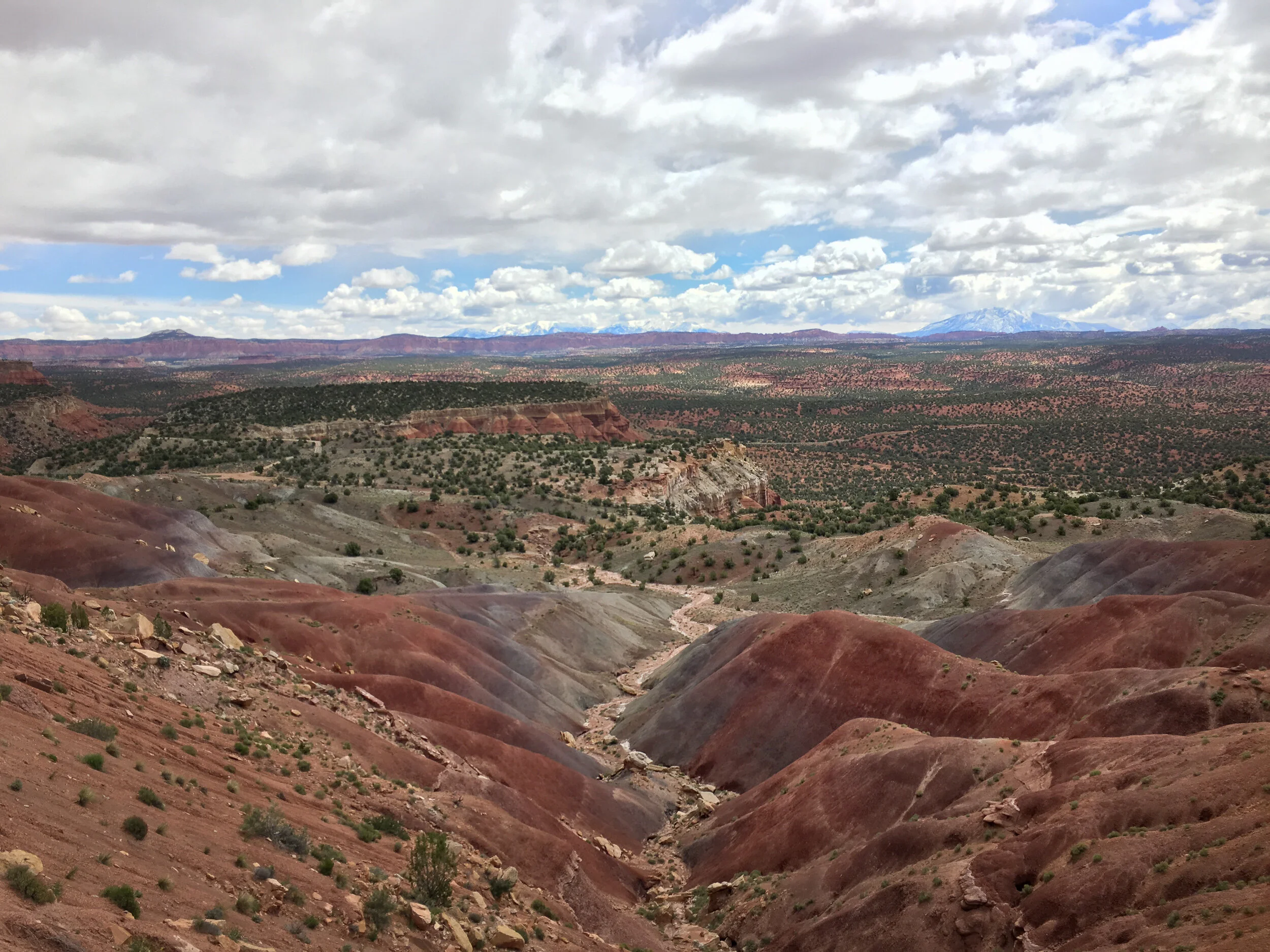
After discussing it a bit, we decided not to make the long descent downward, so we turned around. We passed our rock, and a few turns later I slowed down, glancing backwards. The sun was pretty much obscured so I didn’t get the light I had hoped I would, but I decided to stop and photograph at the place that gave me pause on the way up. There was something about the tree in the dry creek, with the wall behind it that I found appealing.
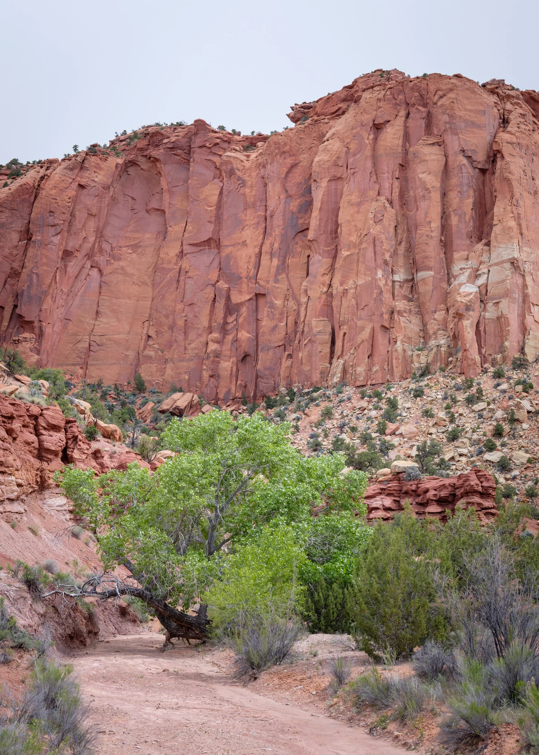
Too bad I couldn’t get light raking across the face of the cliff, but sometimes Mother Nature just doesn’t want to cooperate.
Photograph made, we slowly made our way back towards Boulder, stopping a couple of times to see about potential photo sites, but concluding that nothing seemed terribly compelling right then. We decided we might as well head towards Escalante, and since it really wasn’t very late, we mourned the fact that we would just have to skip lunch at Hell’s Backbone Grill. The reality was, we were still stuffed from breakfast!
Utah State Highway 12 is one of the most beautiful drives you can do. Certainly the stretch from Bryce Canyon to Torrey just outside of Capitol Reef National park is stunning. Don’t just take my word for it, Google “Utah Highway 12”. You’ll see. Drive it if you can!
We took the drive at a leisurely place, stopping a couple of times along the way. The first took us to the trailhead for Upper Calf Creek Falls, which overlooks a lovely open slick rock valley.
The next stop was at the Kiva Koffeehouse after following a hairline ridge where it seems like you start in one world (sand colored) and end in another (red), then descending down past Calf Creek Falls (parking lot full of people) and then steeply ascending up a canyon wall. The Kiva Coffee house is on a bluff at the top of the canyon lip with the Escalante River passing by far below. Not a bad place for a coffee shop. The view is quite impressive, though as you can tell from the photo, it was cold and windy.
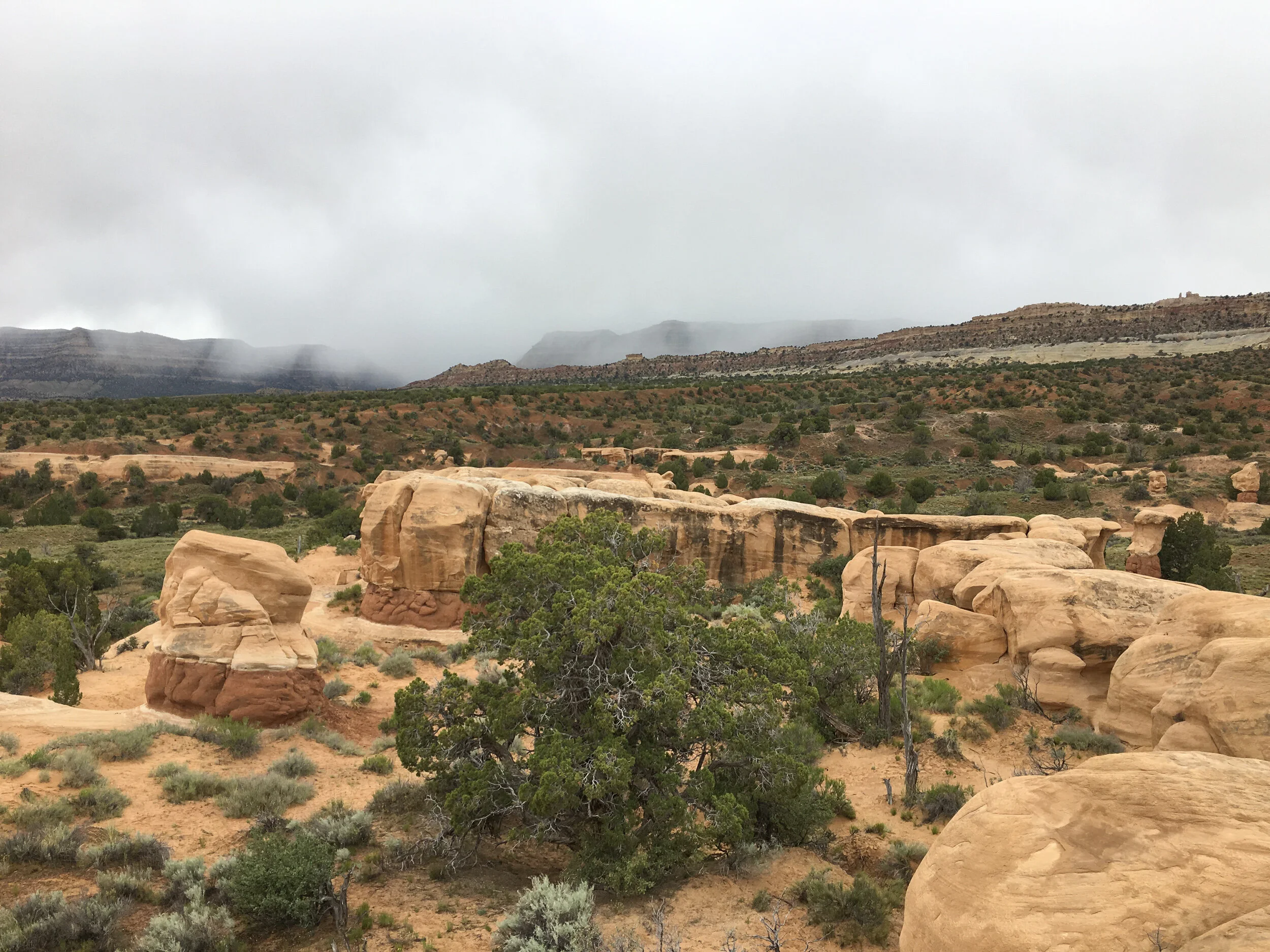
Not long after our coffee stop we were in Escalante. We gassed up, headed over to the Escalante Visitor’s center for a bit of information, stopped by a food store for a final restock, then headed down Hole in the Rock Road. Our destination was the Devil’s Garden, a place we enjoyed our last trip and a place where we had decided we wanted to spend our kind of photography time there.
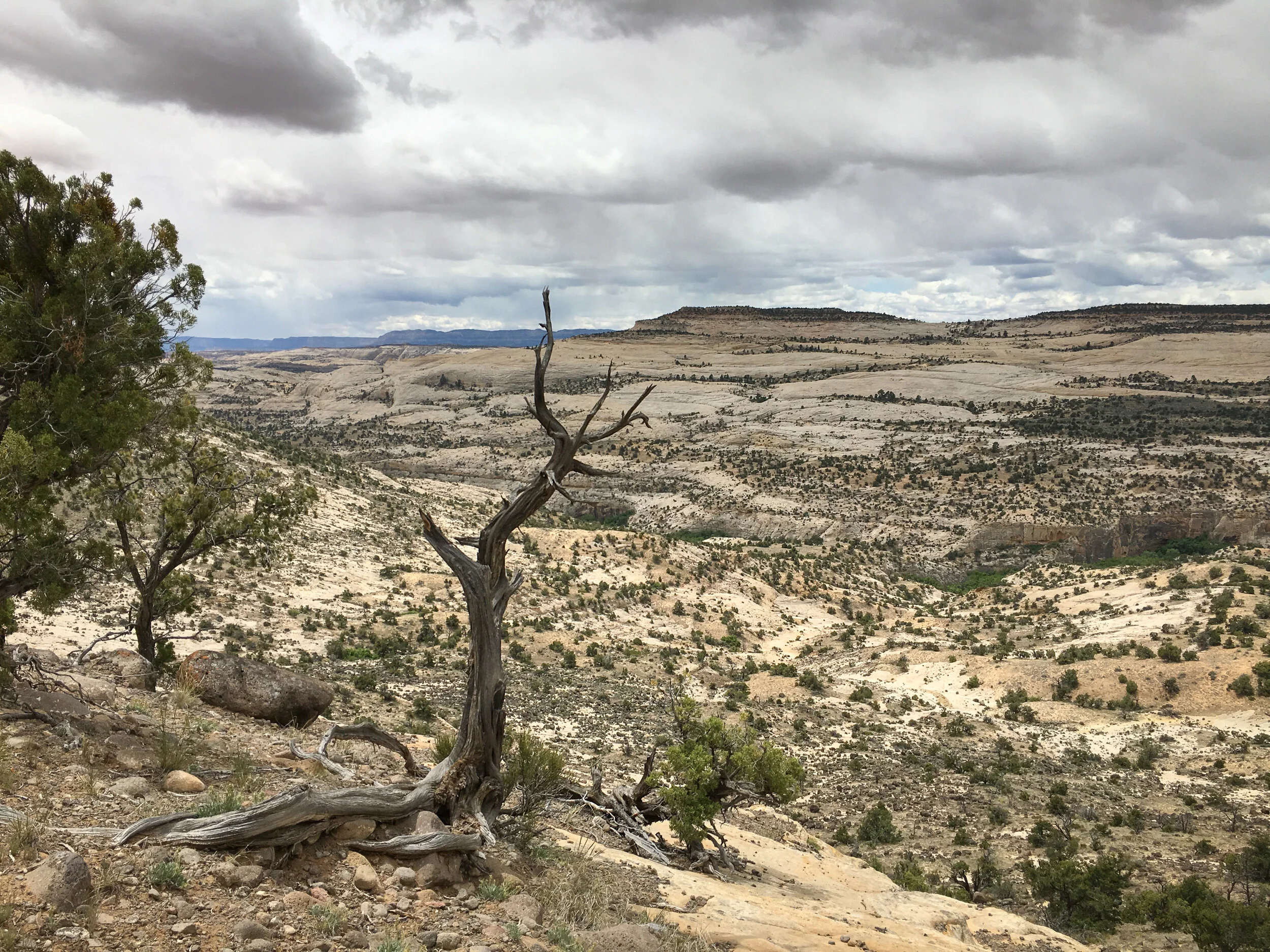
As I mentioned earlier, the weather was iffy that day - rainy, sunny, cold, windy, rainy, cloudy . . . just one of those days. It hadn’t really improved by the time we got there so we decided to scout out photo locations for the next morning and to leave the main gear in Beast. As you can see, the weather still wasn’t playing too nicely that afternoon. At least it didn’t pour on us.
We decided that we were indeed right to come back here and that there would be plenty to photograph the next day, and possibly even the day after that. The next item on our agenda was to find a place to stay.
The Ranger had suggested a couple of locations near the beginning of the Hole in the Rock Road - yeah, with lots and lots of RVs there - and about 45 minutes away. He also suggested we check out Harris Wash Road, which was a much shorter drive back, but who knows what was there. I suggested we check out a trail I’d noticed on the way in that shot out away from the access road just before it descended into the Devil’s Garden parking area. So we did. A bit of it was, how would one put it, very undulating. No problem, put it in 4WD low and drive slowly. Beast doesn’t mind getting rocked back and forth a bit. Ok, a lot.
That didn’t last very long and after about a quarter mile we came across a corral and a couple of what looked to be camping loops. And a US Government vehicle. As we pulled up, we saw someone pointing an iPad down a recovering trail (there was a sign that said it was closed). So we asked her if the area was closed for camping. “No. Just don’t drive that way! Enjoy your stay.”
There it was, we’d found our spot! Only about a 5 minute slow drive to the Devil’s Garden. Not too bad a location, huh?
After we’d settled down a bit, I walked out in front of the rig a ways and took this shot with my iPhone.
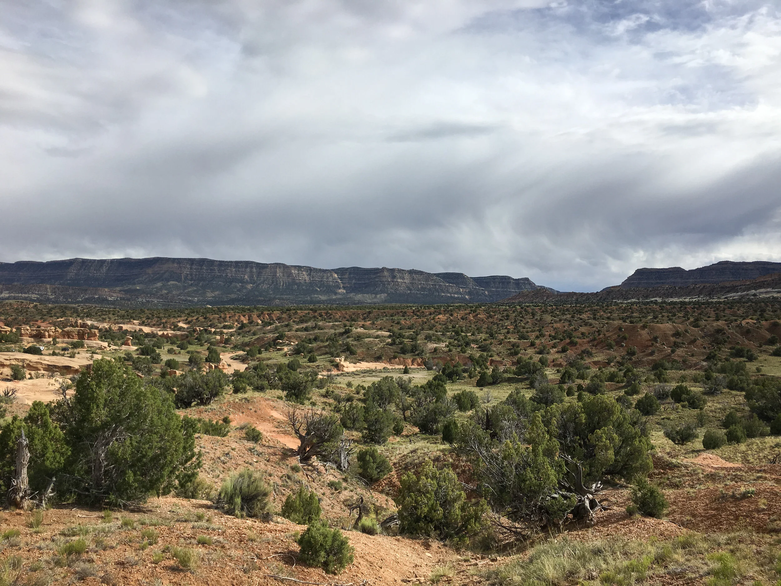
That is the Grand Staircase-Escalante. And you can see the Devil’s Garden off to the left.
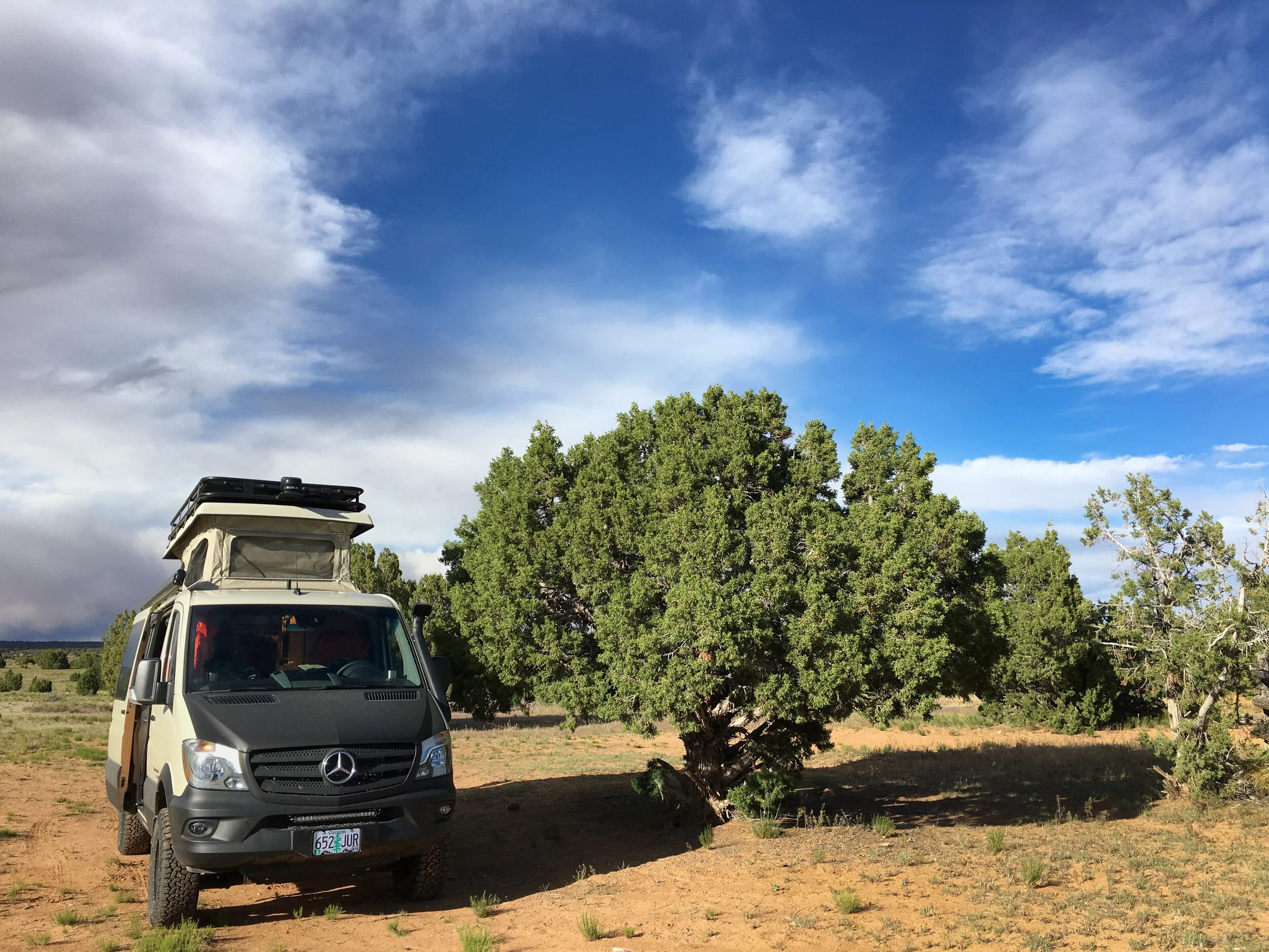
We settled down for dinner, then started getting ready for the next morning. At one point I looked up from what I was working on and decided I just had to capture the view from inside Beast.
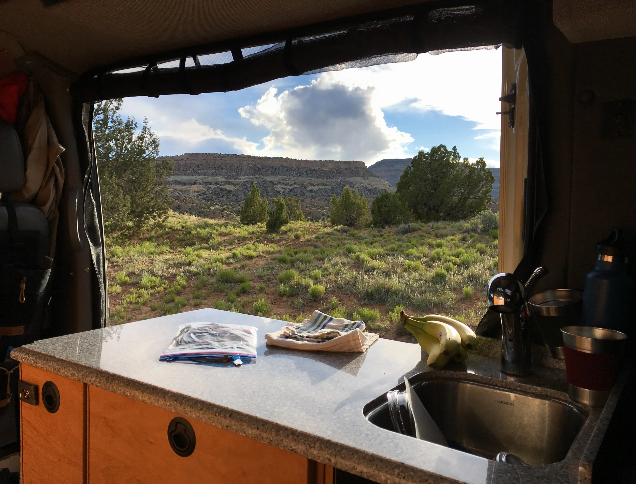
Yeah, things were working out just fine winging it.