Bears Ears
Heading out from Valley of the Gods, my itinerary had us heading towards Comb Ridge, driving north along its western side, and then exploring a couple of sites we had visited during our trip to Utah a couple of years ago. Here’s a map of the area
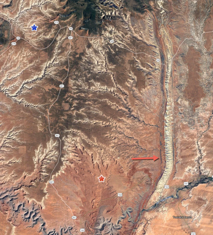
We started the day where the red star is located. Comb Ridge is a massive uplift (see red arrow) that shows up as a bright, wide line that runs north-south through the area. The sloped side is towards the east, the drop-off faces west. And there are unpaved tracks that run up both sides. We would take the nearly 30-mile Comb Wash Road that tracks the ridge at the base of the uplift. Eventually, we would wind up at Natural Bridges National Monument (blue star) just to the west of the Bears Ears themselves. The entire day would be spent within the Bears Ears National Monument (yes, monuments within monuments, but that’s ok by us!).
We took the short drive east on Hwy. 163 and then turned north on Comb Wash Road. There is no doubt where the ridge is located.
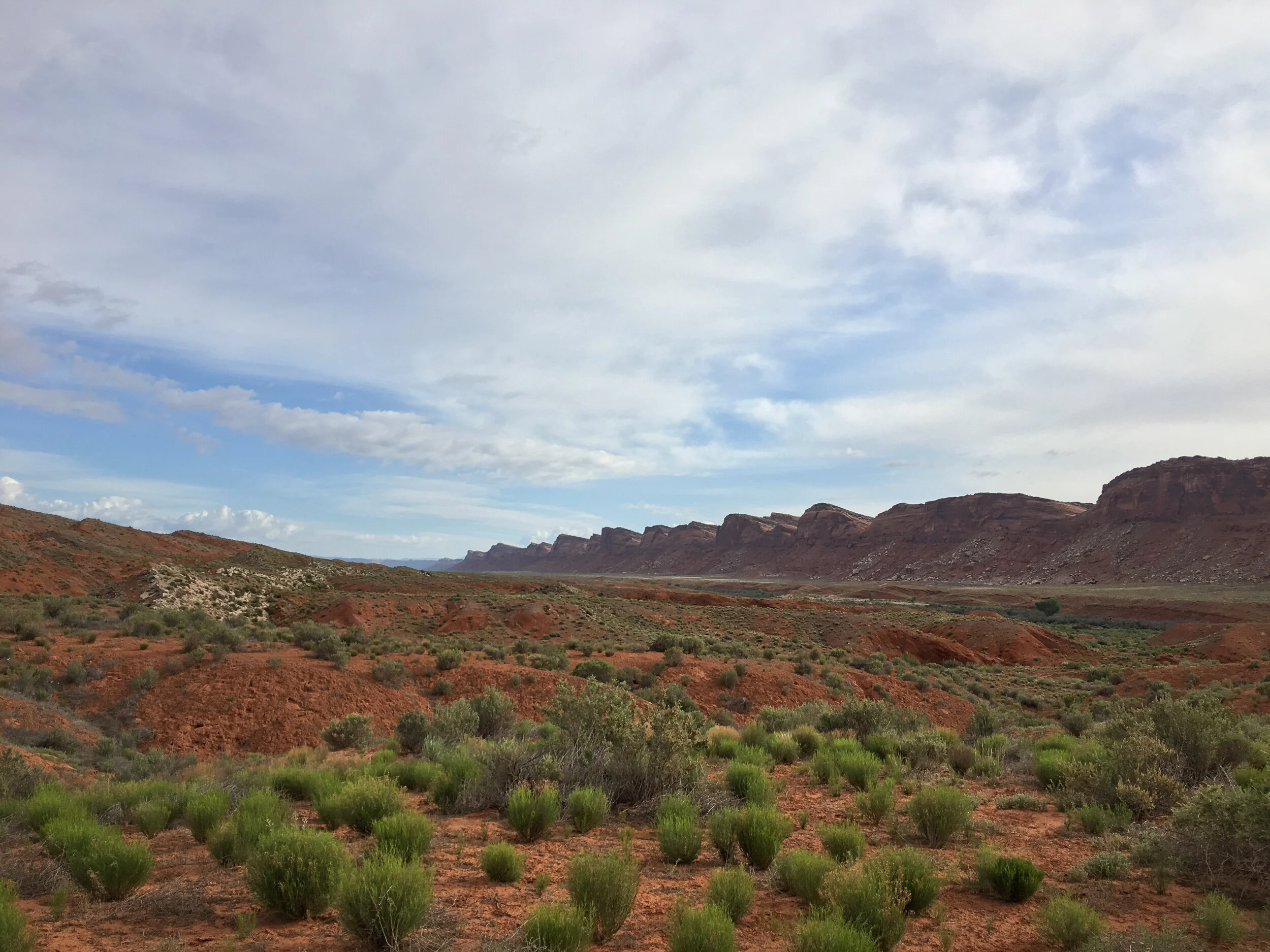
There are a couple of routes one can take before you’re forced to either drive along the base of the ridge or to turn westward into the plateau above. We opted for the route that would have us away from the ridge as long as possible, but the found out that the track back towards the ridge was heavily overgrown with brush and, after the scratches from the (mis)adventure (yes, that constant reminder . . . and no, I don't need to see a counselor about it, at least not unless I start dreaming about it) we opted to turn around. The 25 mile detour was of no matter, it just gave us a closer view of the stream-side area and a different perspective of the landscape.
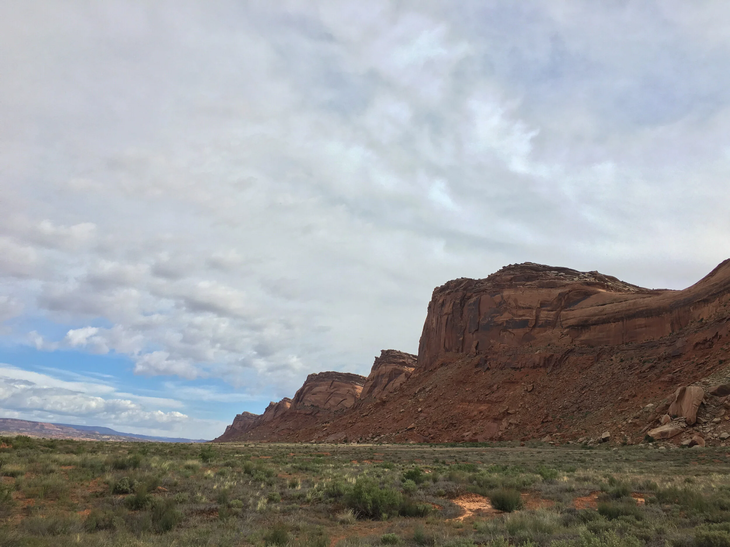
We returned to the first fork and headed towards the ridge, getting a closer view of just how tall it is.
As far as tracks go, it was a fairly easy track (easier than the initial one we’d taken, which had many more sandy spots that required much more attention to how one drove it).
Comb Ridge is one of the reasons why the Bears Ears National Monument is so large. This whole area is full of Native American ruins, and the entire ridgeline is dotted with ancient sites. Most of them are accessed from the eastern side, which would make a several day exploration trip of that side worth while, but one of the main drivers of the Monument was, in coordination with the local Tribes as well as residents, to protect these heritage sites. Claims by the local ranchers that they were not consulted is BS - the making of this monument involved all interested parties and everyone had to make sacrifices.
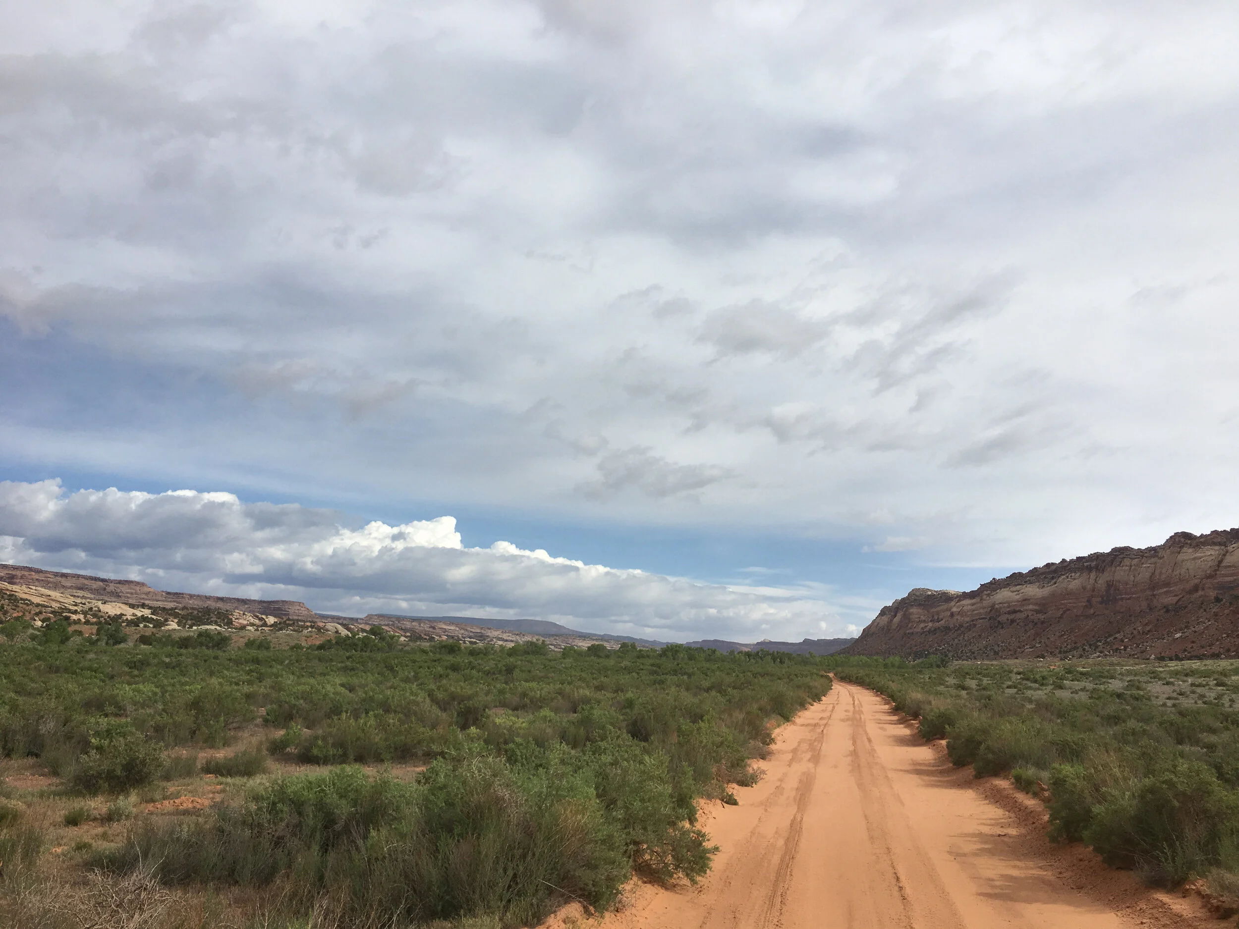
As we drove north, the coloring of the rock started to change, and at its farthest north section, we got closer to the creek again and hit patches of trees (fortunately away from the track).
Once we hit Highway 95 we headed east to check out Target Ruin, the site we searched for and couldn’t find during our last trip out here. However, upon approaching the small parking area for that trail, we saw there were four vehicles there (one with a photographer unloading his gear) and decided there were just too many people heading out to photograph the same thing, so we headed onward to Natural Bridges National Monument.
The dropping of our Target Ruin stop worked to our advantage because we managed to get one of the last few campsites at Natural Bridges (they were full by the time we wound up paying our campsite fee). Site acquired, we grabbed a bite to eat and headed out.
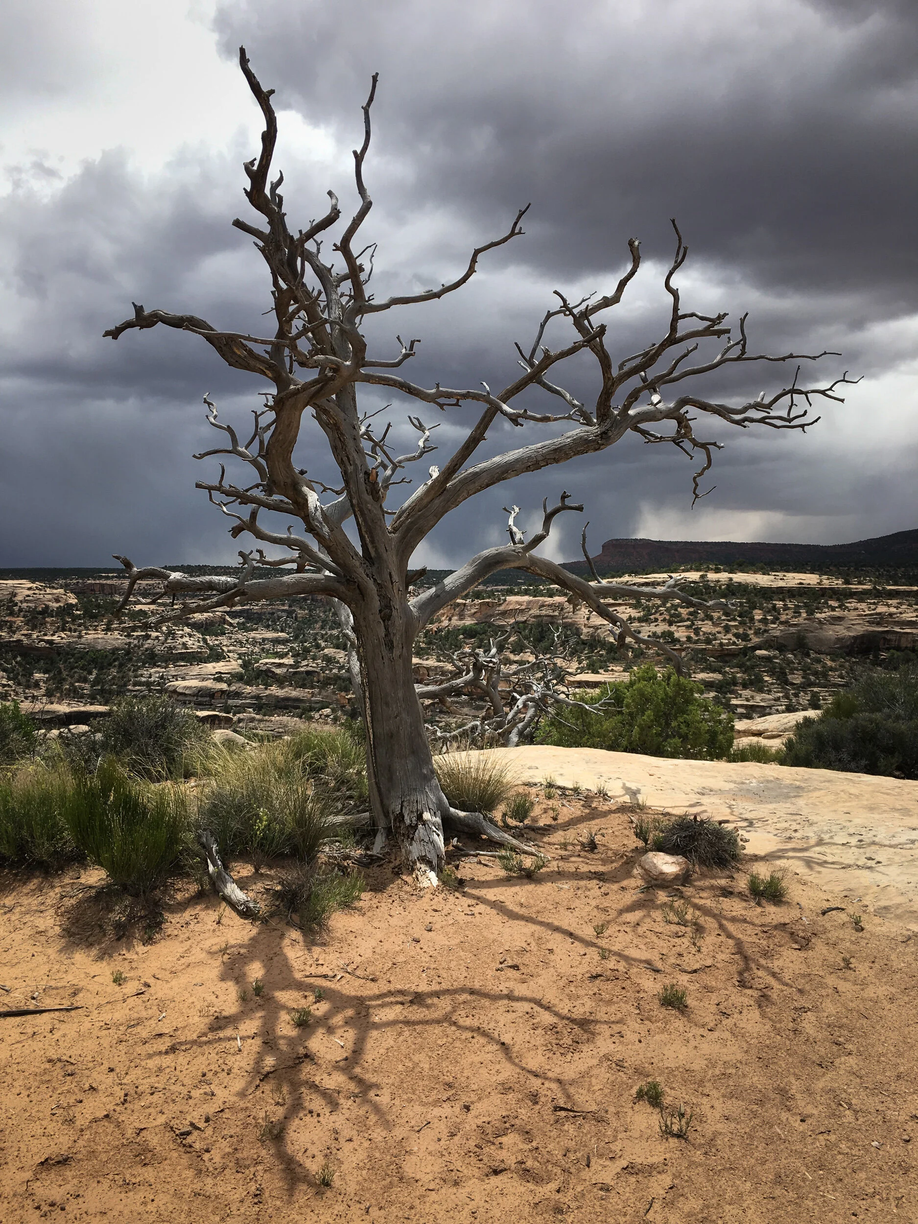
The weather forecast called for showers and as we headed out, the clouds and drizzles came. Our first run through Natural Bridges turned into a re-familiarization and scouting trip. Still, I managed a nice iPhone shot of a tree,
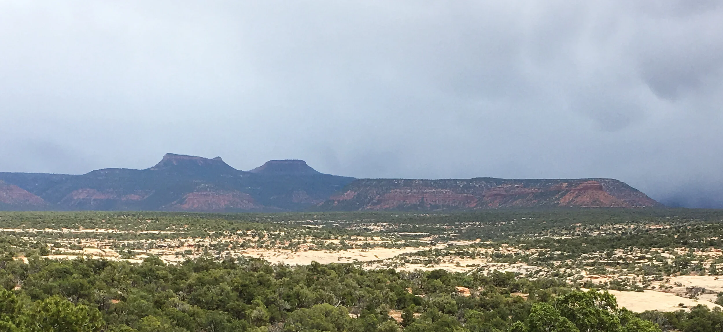
and a photograph of the Bears Ears overlooking the monument.
By the time we finished the loop, the rains were coming down, so we decided to park it and relax until later that afternoon.
While we were waiting for the rains to clear, Ann posited a question that was, well, somewhat painful. Apparently I’d grumbled a few times that day (and likely the previous days) how photography just didn’t seem to be working out this trip. Ann asked why don’t we just toss out the itinerary and basically wing it the rest of the trip and focus on photographing. At one level, I was devastated. I’d put so much work into planning the trip, and including places Ann mentioned that she’d like to return to (Natural Bridges), or had never been to and would like to see (the Grand Canyon), along with some off-road traveling between the various end-of-day destinations that could break in Beast. However, Ann was right. I’d frequently commented that in my mind the trip was more of an overlanding trip than a photography trip, and that we probably wouldn’t do a trip quite like that again because we tend to work better after staying at a single location for a couple of days. But if the plan of photographing at a location in an afternoon and morning, then moving on to the next site was affecting me the way it obviously was, then why keep it up, especially if photographing itself was so rewarding when we’re immersed in it?
We discussed things a bit more as the rains eventually died down and I tossed out some ideas of where we should still try to hit, and where we could drop things so we could spend more time in fewer places. And most of all, how to not feel like we had to go from point A to point B on every single day, yet still see some of the places we wanted to see.
With the sun starting to come out more often than not, we headed out for more photographs.

Natural Bridges is an interesting place that offers great viewpoints as well as some wonderful trails. Given that we were only there for the day, we decided that we would only try one of the shorter trails, and focus on doing what we could do at the main viewpoint and the one trail.
The nature of the rock at the monument really lends it to black and white work, which was really in my mind as I focused increasingly on closer views of the formations.

We eventually descended down into one of the sites to appreciate the structures from a very different angle.

After I made this shot I descended down underneath the bridge, where Ann was waiting for the right cloud pattern to flow across the background (she’s hidden by the trees in the lower right corner). I decided to descend past the bridge and to check out the creek that ran along its length. While I didn’t make any photographs from there, it sank in that Ann had been right. There’s was just too much to explore and get to know before making great photographs of places like this that stopping by, even for a few hours and then running off not only didn’t do the place justice, but wouldn’t let us even get a real feel for what it had to offer. If we wanted to make quality images (as David duChemin puts it, deeper images), we were going to have to spend time in the environment to understand it a bit better and to feel it.
That evening Ann and I made the decision, the itinerary was pretty much going out the window. Except for a few choice locations for which we already had reservations or other needs (like laundry the next day), we were going to wing it and make it up as we go along.
And it was going to start tomorrow - instead of heading south, we were going to head west into an area of Utah that I hadn't even scouted. We would have no more of a destination than a laundromat, which we hoped we would find in Hanksville.