Our Great (Mis)Adventure
I might as well get this out early. I owe Ann. I owe Ann big time.
Although in my defense the guide book rated the trail as “Easy. The canyon bottom is rocky and sandy in places. This is a well marked route.” Which is no worse than what it had for the Alabama Hills - “Easy, on graded roads. Spurs are rougher.” And we handled the Alabama Hills spurs just fine (face it - we had camped on one). Perhaps it was that the condition of the trail had changed drastically given the heavy rainfall California had received this winter, or perhaps it’s just that one can’t trust the judgment of others (as a person we met later on the road noted, who had a similar (mis)adventure on an “easy” rated trail from the Arizona guide book from the same company). Regardless, the trail was not “easy.”
“Dan, Master of the Understatement.”
— Ann
In any event, I accept full responsibility for my choice of routes and thank Ann that she didn’t rip my head off for my mistake. As Len commented on our “Liftoff” post, “You gotta get that 1st one [dent] out of the way so you can relax, not worry about it, and photograph!” I guess we don’t have to worry about it any more and can just get on with photography. That said, it’s time to get on with the story . . . .
So, as usual, breakfast at the Alabama Hills Cafe was wonderful. One of the main topics of discussion during breakfast was what we were going to do during the day. Normally we would have just stayed at the Alabama Hills and photographed (oh how I now wish that we had decided to do that), but the day before we’d seen several signs throughout the hills (“25 k this way”; “10 k this way”; “all runners this way”) that led us to believe that something was up that weekend. Sure enough, the waitress told us there was a big race that day. Race = crowds and we wanted to get away from crowds. So what to do?
Well, in my planning I’d jotted down a series of off-road trips that we might consider doing and that I thought was a good idea so we could get a feeling about how off-road capable our new rig was. I assured Ann that the route was easy (see above) and was estimated to take about 3 hours. With us taking it easy, it shouldn’t take more than 5 hours if we stop to photograph. I was pretty excited about the idea so Ann said sure, and we headed off to Big Pine to tackle a 25-mile route called The Narrows and Papoose Flat.
““Ann said: ‘Sure’?” I think it was more like “ah...ok.....” - given that our emergency notification GPS had gone on the fritz just before this day. So we had no way of contacting Devon (our emergency notification handler!) or emergency medical services in case one of us broke a leg. But ok....”
— Ann
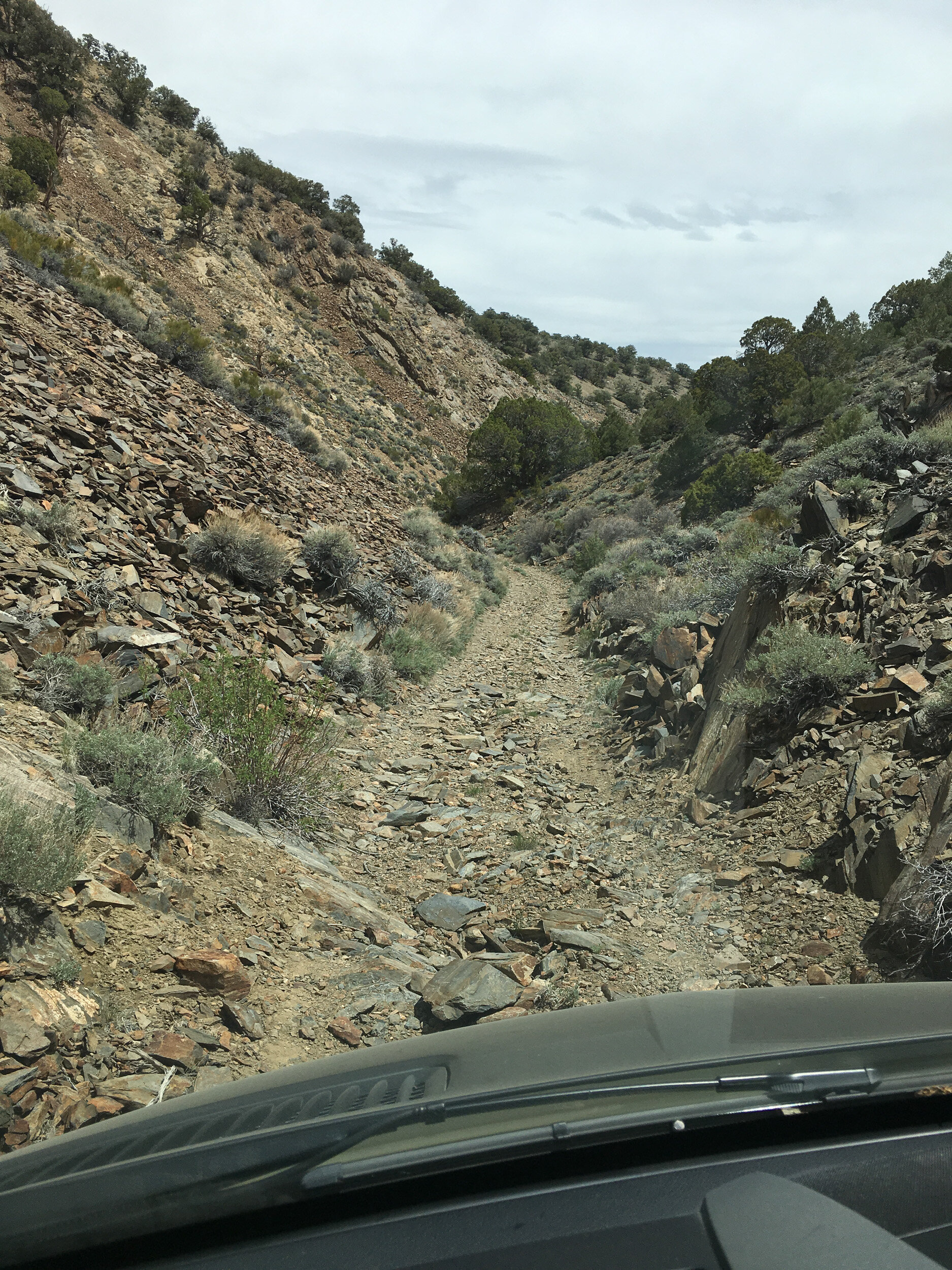
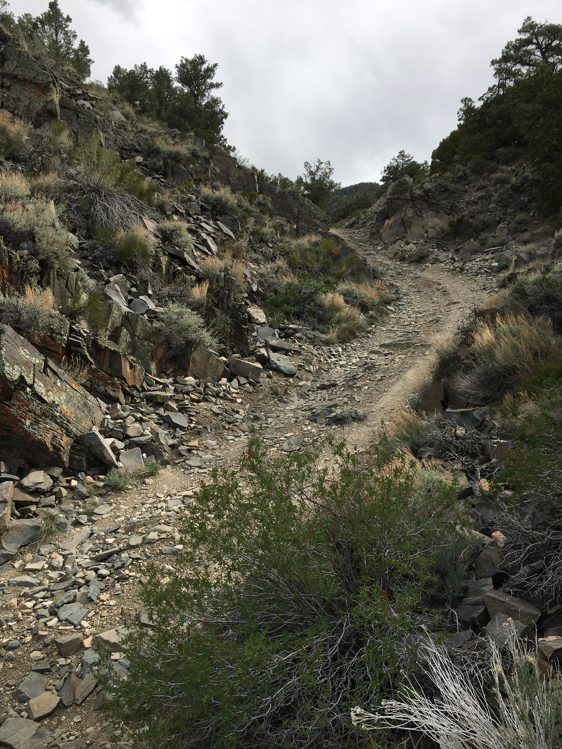
The route started exactly the way I thought it would (and the way it was described). A rocky but not impossible road that ran away from all development and up into the hills. I quickly had to stop and take a photo (note, all of the images in this post are from my iPhone). From the direction we were heading, I knew we were heading up into the hills, which didn’t seem all that big, so I wasn’t worried at all.
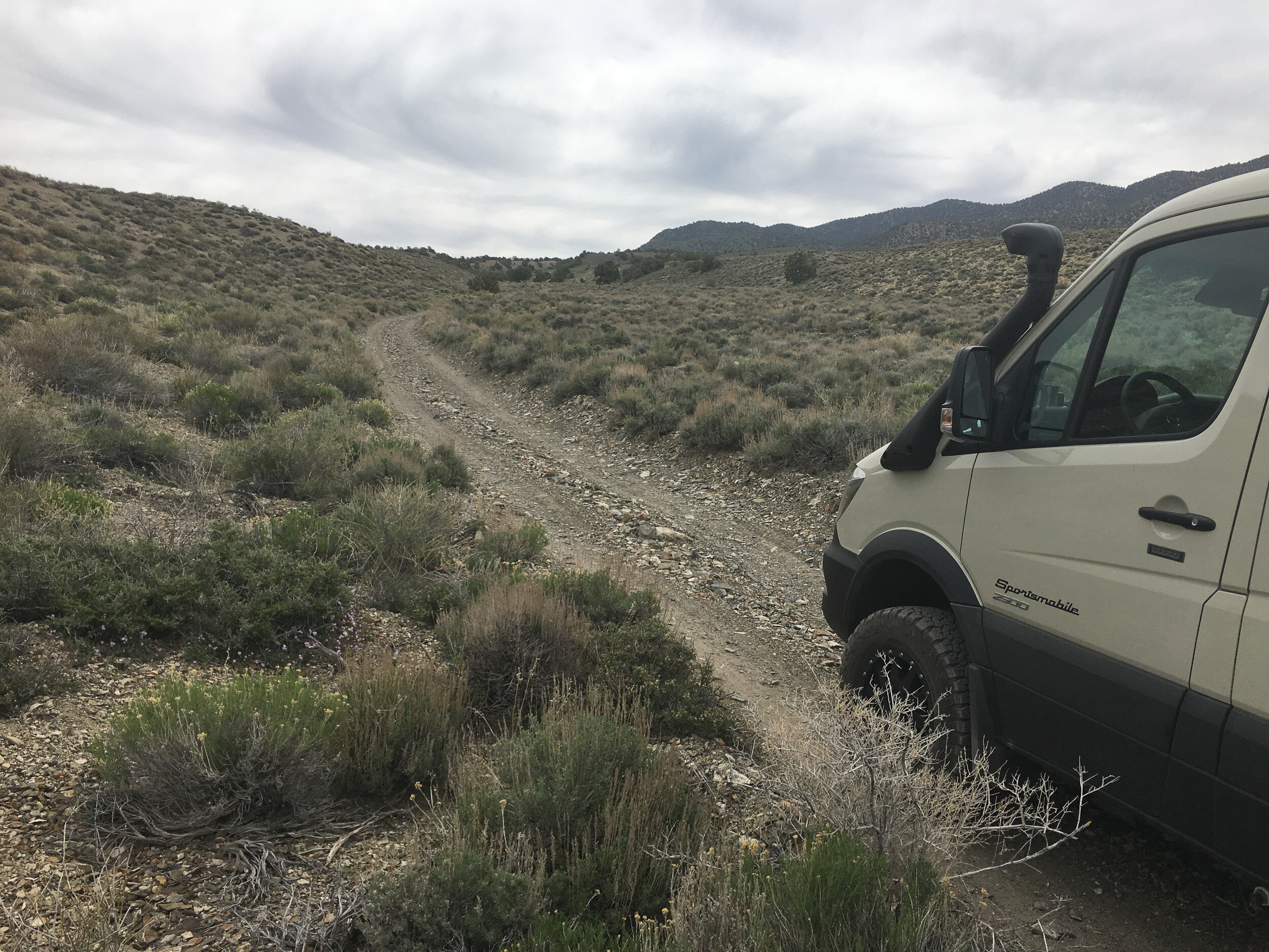
It wasn’t until I turned around that I realized that as we moved upward, our views of the Sierras would improve too
As I had guessed, we headed up into the hills and after a while we wound with with a great view just as the skies were starting to break.

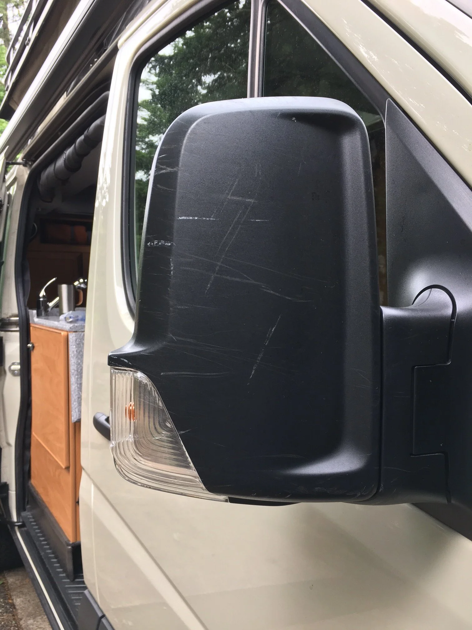
As we climbed up we entered a forested area and realized that our vehicle was not only wider than many that had gone past before, but it was also taller. I can’t tell you how many times I cringed as branches swept along the rig and confess that I intentionally didn’t look at Ann because I know what was going through her mind. All it took was one look in my side-view mirror to see the striping on the ladder rail to know that the sides of the rig probably didn’t look much better
“I suppose I could embed an audio file of the high-pitched squeal from the branches making the divots along the van. ”
— Ann
At some point, and I can’t remember if it was earlier or later in the day I said, “Hon, I think I owe you a detailing job on the rig as a Mother’s Day present.” To which Ann replied, “Yes, I think that would make an excellent Mother’s Day present.”
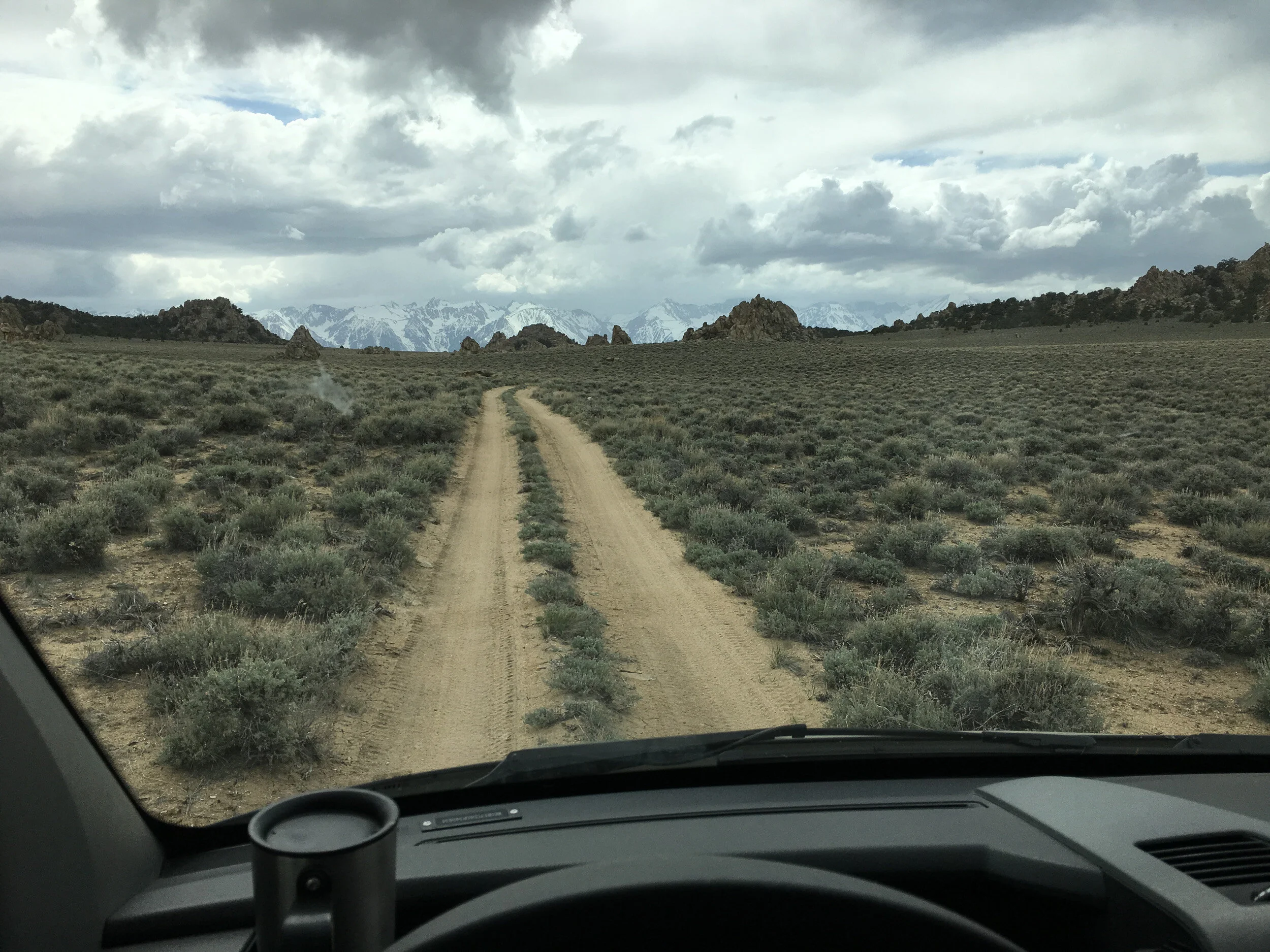
Eventually we popped over the ridge and hit the first of the “flats” described as the main feature of this route.
It really was a lovely drive, but unfortunately, was not as well marked as the guidebook had hinted, so we wound up veering right for a few miles towards the road you can see in the distance near the snorkel. Fortunately, I’d thought that this was too early to make that turn westward, so we pulled up the electronic maps I’d downloaded and realized we had taken a wrong turn. So we backtracked and wound up going down the road off to the left (which looked much less traveled than the other - but was the main road).
“I think it was a this point that Dan first said “Hon, I think that was the worst of it. The rest of the drive ought to be easy.”
— Ann
Again, we ran through some more trees (and more cringing) as we climbed again. Just as we crossed over the ridge top, and the map on our iPad showed us approaching the Narrows, we came across this:
Yup, that was narrow.
After quite a bit of discussion, walking the trail a bit to check around the bend, and a couple of deep breaths, I put it into 4WD low and started my way downward. The Narrows was a lot longer than I imagined it would be and, believe it or not, at points it got narrower. Slow and steady was my mantra, pick as smooth a line as possible and watch out for sharp rocks near the tire sidewalls. After a while, it seemed very do-able, even if it did mean going over some hefty rocks and easing our way downward
Things seemed to be going pretty well and off in the distance we could see that things were about to flatten out, we only had one big S-curve to get around and we would be back to smooth sailing.
“Of course, as we are going down the rock shelves, the van is slamming down, hard. Each time, the seat belts were locking from the impact. But we are still moving forward.
So, yes, things were going pretty well.
My memory of events isn’t as good as Dan’s, but in this case I think there were a couple of intervening “I think that’s got to be the worst of it..” comments. After the rock dry-falls (no I won’t call that a road!), there was a sandy, rocky wash and some other surfaces to deal with. ”
— Ann
“If I may respond in my defense - there were only a couple of hard drops. The seatbelt issue was the result of the steepness of the road and all the braking that was required to keep from killing ourselves. That said, Ann couldn’t anticipate the jerking back and forth as well as I could as the driver and she pretty much was flung around like a rag doll except when being garroted by the seat belt.”
— Dan
The turn left was a bear - rough rocks and a series of big drops downward through a particularly narrow area kept my focus on the road, moving at a snail’s pace making sure I didn’t hit anything or jar the rig too much as it dropped down from the top of rocks. Just as I thought I was through the tough part I looked up and saw . . . a giant boulder in the middle of the track! And by giant, I mean about stomach high and 5 feet wide in the middle.
“Hm...I think I saw the boulder first and said something like “Oh crap, we have a big problem Dan.” Cursing followed, I’m pretty sure.”
— Ann
I guess the sense of panic that went through my mind is best indicated by the fact that not once did I even think to pull out my phone and take a quick snap of our predicament, or what we did to get out of it. Once I got over my “OH SHIT!” moment, the brain went into problem solving mode and didn’t leave it . . . for the next 2-1/2 hours. Too bad, because it would have been a great series of photos. But given I don’t have them, words will have to do.
I couldn’t tell you how long Ann and I walked back and forth and around the rock dumbfounded. One look at the site and it was evident what had happened. This was at the upper bend of the S-curve and there was an extremely steep (read: near vertical) dirt rise about 20 feet straight up - no vegetation at all on the slope, and a similar-looking, somewhat smaller boulder than the one in front of the rig, sunk a few feet into the ground at the edge of the slope, looking like gravity was winning the war on where it was going to wind up. At one point I just knew it was going to fall while I was watching it. It didn’t.
Fairly early on Ann asked, “Can you drive back up the hill?” The fact that I’m still alive after my snide reply is just more proof of how forgiving Ann can be. We were still in the narrows, with no where to turn around, and basically I would have had to drive backwards all the way up the hill, something I was pretty sure I could not have done successfully. There really was only one direction to go and that was forward.
In planning for this trip and traveling with the rig, I had purchased a lot of tools and “recovery gear” - equipment you use to get yourself out of trouble, or to fix things when they break. Our goal was to be as self sufficient as possible, especially since we could not get a winch for the vehicle (I wonder whether a winch would have even budged the boulder). While originally loading the rig with the recovery gear, the thought crossed my mind whether I really had wasted a bunch of money on stuff I’d never use; money that could have been better spent on lots and lots of camera gear. Well, standing in front of the rock, I was at least comforted by the fact that I had the answer to that question - Hell NO! Wise investment Dan!
Ann and I discussed things a while and developed a strategy about how to get around the rock. There was a lower area to the right, only about 2-1/2 feet different in elevation, that we might be able to fit the rig around if possible. So out came the tools. We’d purchased some arborists saws which cut through the desert brush like a hot knife through butter. Out came the shovel and we did a bit of digging to try and level things out a bit.
Our inexperience showed by the fact that, even in 4WD low the vehicle started spinning its wheels in the loose dirt before it could get up and around the rock. So we backed up and went to work again.
This time we were determined to do it right. Out came the saw and we took out not only a few more bushes, but a couple of small trees as well. And we did a lot more digging to lessen the grade the rig had to climb on its right wheels. We also started rolling smaller rocks out of the way as best we could. We also looked ahead of the boulder, where we would have to turn back into after the cut-out and realized there were a lot of rocks to be moved there too.
As I was digging away, Ann was up ahead flipping rocks from the trail when I heard a scream! “What’s up? Are you OK?” “No, I’m not ok, a scorpion just tried to kill me!” I quickly ran over and sure enough, under a rock Ann had just flipped over was a little white/clear scorpion. He appeared none to happy that Ann had disturbed him, but he must have been particularly smart (which means he must have been vicious too!) because when I raised my shovel to slice him in two, he scattered off into a crack between some rocks before I got him.
“It’s the small ones that are have the most poison, I say. And I don’t think I screamed. It was more of a yell. And the yell might have included a reference or two to Dan. Plus, without the emergency GPS device, we had no way to call for a rescue should the dang scorpion get me.
Dan, you are building up a deficit here.”
— Ann
Once we graded everything as best we could, I pulled out the MAXTRAX. MaxTrax are roughly textured boards you can place beneath your wheels in soft ground conditions (dirt, sand, mud, snow) to help you get traction so you can get your vehicle moving. Generally, one under each wheel will get you moving and then you try to keep moving forward and not bog down again. So after digging a bit under each tire to get the MaxTrax set, we were ready to go. The plan was to veer right up the incline, and then make a sharp left just before I hit the trees and turn back onto the track just past the boulder.
With Ann in front of me giving me directions (“marshalling”), I slowly hit the gas until I felt the wheels grab the MaxTrax and started moving forward. Ann was signaling “come on” as I left the MaxTrax and I suddenly felt a big bump, jerk left and then spinning wheels - which meant to immediately take my foot off the gas because spinning wheels only dig you in deeper.
I looked at Ann quizzically wondering what had gone wrong. She stepped to the side and suddenly said, “You’re on the rock!” I looked in my side mirror and sure enough, I was. I was sure we had given ourselves enough width to avoid the rock, but I must have been wrong. So I backed up a bit and got out.
It was then that I realized what had happened. There had been a big sub-surface rock right in the path of my right rear wheel that had stopped my forward progress after I left the MaxTrax and bumped me to the left, right into the boulder. So we spent some time shoveling around the rock, and I did my best Hulk impression and rolled the rock uphill (downhill would have been under the vehicle and right in the way of our rear differential!). Who would have known that the month of rowing machine work I’d done before the trip would have come in so handy because I used the exact same muscles to move that damned rock. Think of it as setting your rowing machine resistance at 100, even though it only goes up to 10 (sorry, but I didn’t feel like paying extra for the special Spinal Tap edition).
Once the rear-wheel obstruction was out of the way we assessed what needed to be done to get around the boulder. We wound up doing a bit more grading of the land, backing up the rig a bit so that it could swing back on the original course we had planned, and then laid three MaxTrax in a row under the passenger side wheels, and only one on the driver’s side at a particularly soft spot.
Third time was a charm - I made my way up the slope, hard left (this time barely grazing the boulder), and then carefully back onto the trail. At one point the vehicle paused as it hit a small bump, I gave it a bit of gas . . . and Ann’s eyes bugged out as the rig lurched its way right towards her. Fortunately, I had anticipated this and as I felt the vehicle break free I hit the brakes hard. Ann swears I was trying to kill her but . . . I figured I owed her one, so I decided not to run her over.
“You could have fooled me! I was only about 10 feet away, and that little lurch almost got me. Dan didn’t even look sheepish, so I am pretty sure.....”
— Ann
I wound up moving about 25 yards down the trail on a firm patch of ground and we started the process of collecting all of our gear. As I said earlier, the whole recovery exercise took about 2-1/2 hours. We were hot, tired and uncertain of what lay ahead.
Wer were indeed, finally, on Papoose Flat. However, the tension level didn’t immediately go down because, while flat, the conditions had changed entirely and now we were driving through sand. Deep sand in stretches. Yet another type of condition that could bog us down. If we did get bogged, I wasn’t too worried because instead of remounting the MaxTrax, we had kept them inside the rig in the event of another “predicament.” Still, recovery is tiring work and we were already exhausted.
So as we made our way forward I kept reminding myself of all the various techniques and tips about driving on sand (although I should have aired down our tires, but didn’t) I’d read and watched about on YouTube. All the while I was trying to ignore that voice in the back of my head that kept saying, “reading about something is one thing; it doesn’t mean you know how to do it; actually doing it is . . .” and focusing on the conditions of the track. Yes, occasionally we slid from side to side a bit, and hit patches where our momentum slowed down to nervous levels, but a steady control of the throttle with only gradual increase when necessary, and keeping track of where my wheels were pointed got us through the sandy bits just fine.
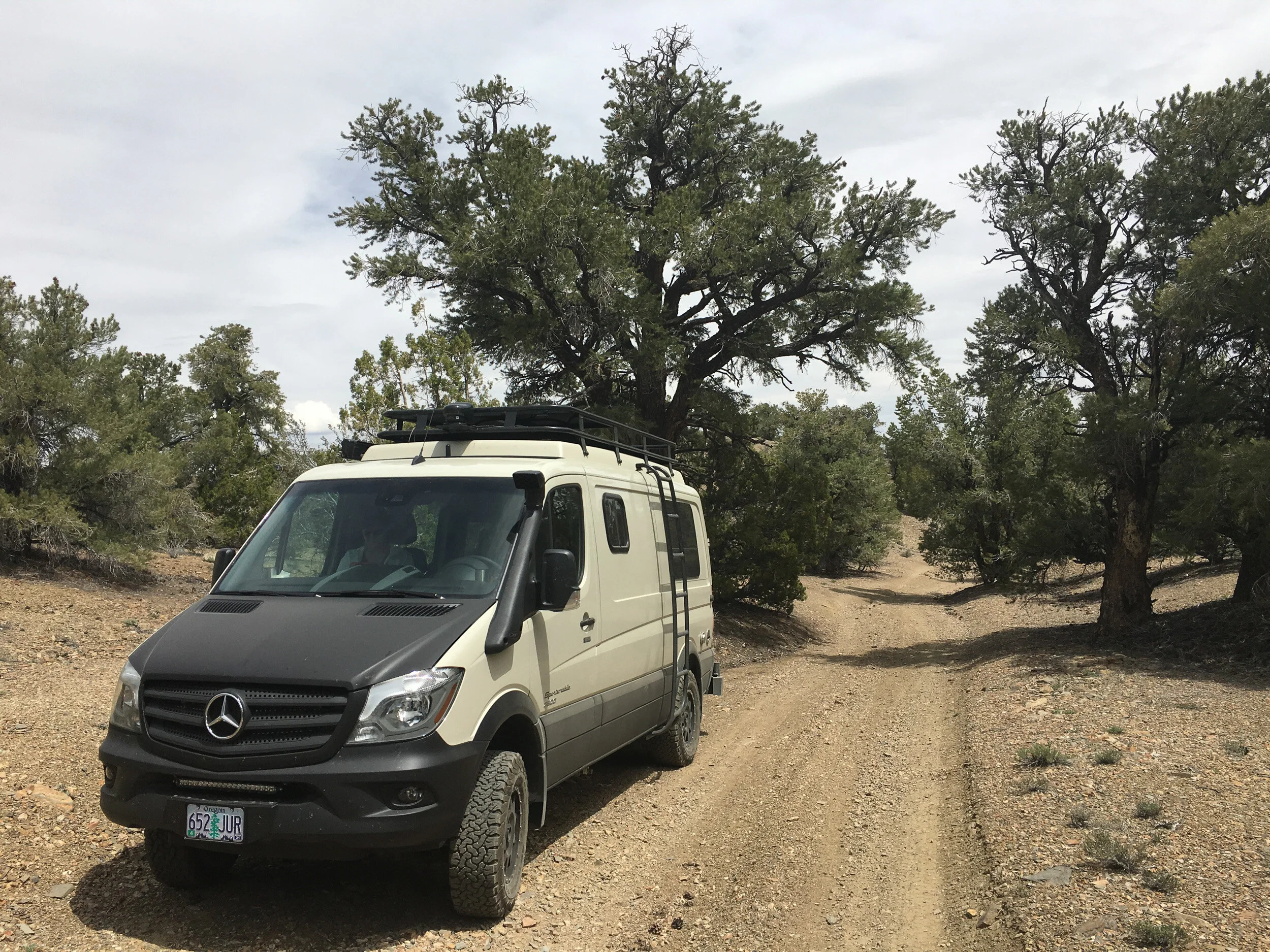
We finally turned westward on our route and the track turned back to normal - mostly dirt with the occasional rocky or sandy patch.
After awhile we approached an area that I’d seen on Google Earth and had thought might be an area we would want to stop, explore and photograph for awhile. Yeah, we stopped for a picture, but we had no energy for photography and we were very aware that the weather forecast had called for rain starting around nightfall.

I think on any other occasion, we would have stopped right there (there were several tracks we could have pulled off on), popped up the top and called it a day. But the changing clouds were a steady reminder that we’d better get off unfamiliar territory and back to pavement and civilization.
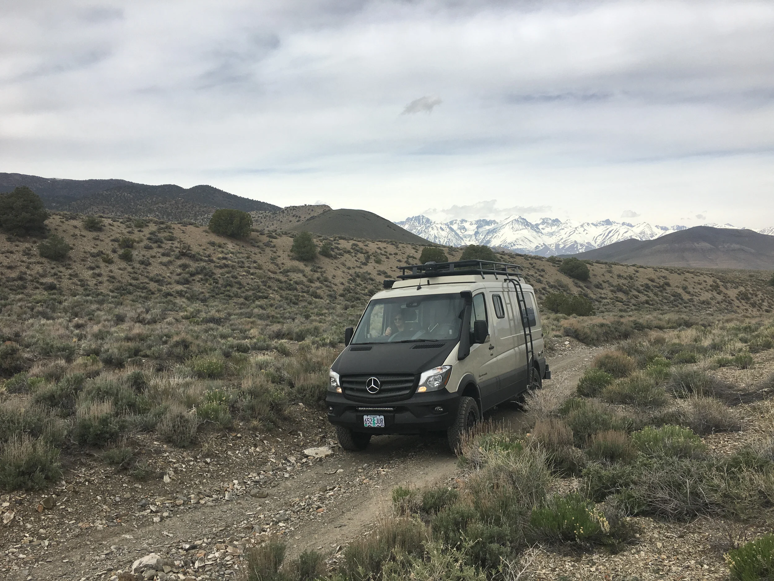
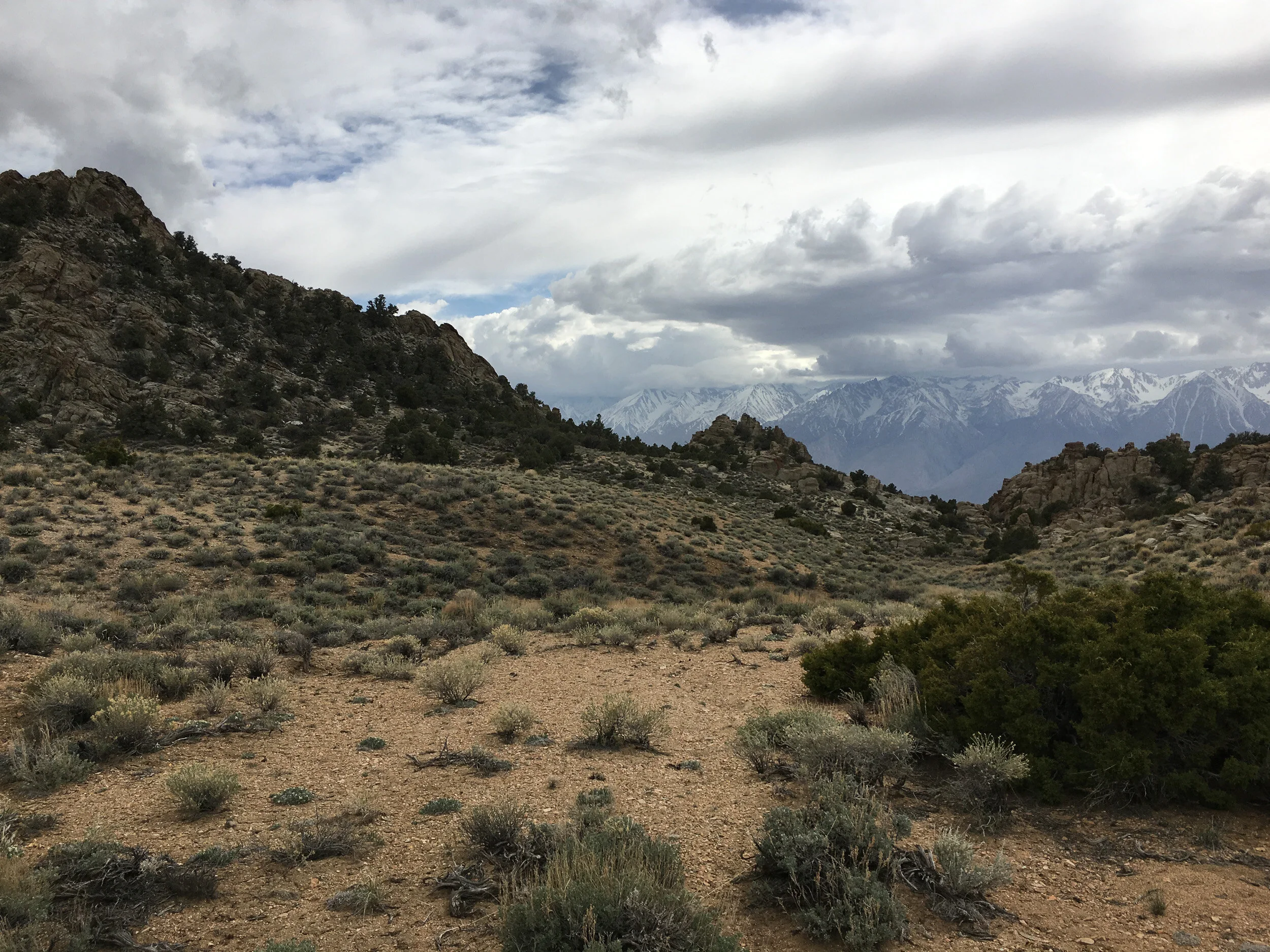
A few miles later we approached the southwest corner of the loop, and the emergence of an incredible view of the Sierras.
We stopped at the fork in the road to soak it in, and got ready to head back north (no way we were heading South - that took one higher into the mountains).
Yes, on any other occasion, I think we would have just stayed in the area to explore for another day or so.
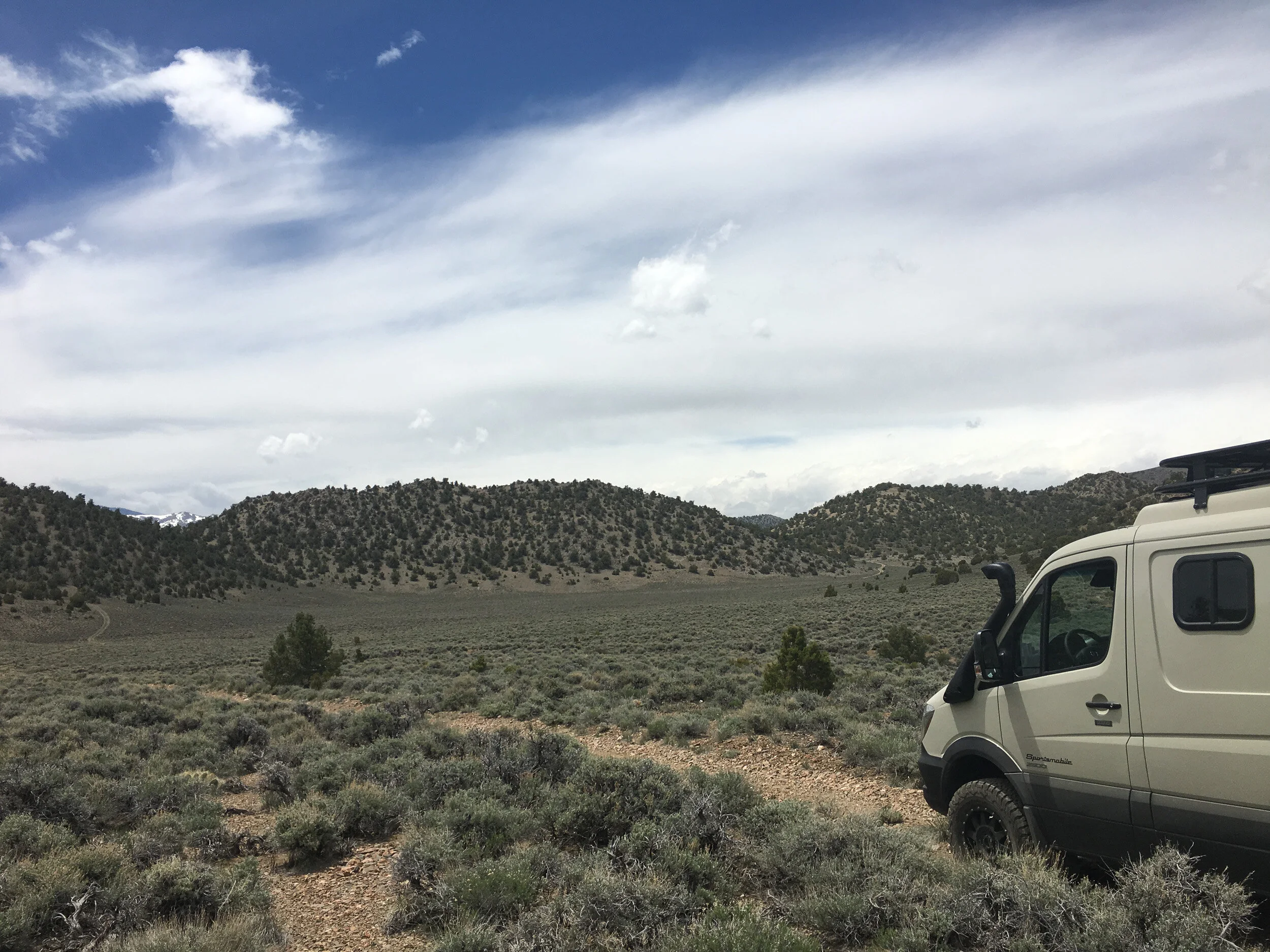
We were well past the half-way point, but we really had no idea what lie ahead. With any luck, it would be a lot more of what we’d driven on over the past few miles. If not . . . well, it would be an even longer day.
The track for the most part was good, although looking off in the distance you could see a steady rise. At one point, way off in the distance, beyond a couple of hills was a huge climb with a thin line that looked like it went straight up the hill. Ann said, “That’s not our road is it?” “Nah!” I replied. “It looks like our route takes us around these hills and off to the left.”
As we kept driving it became plainly obvious how wrong I’d been (par for the course for that day I’d say). I stopped near the base of the hill. It looked like an impossible climb. “There is no way we can do that, you think?” Ann commented. I think I mumbled something along the lines of, “Well, that’s where everyone else has apparently gone, and this thing is supposed to be off-road capable.” And probably some comment like, “And there’s no way in Hell I’m going back the other way!”. Or did I just think that.
“At least you stopped saying ‘I think that is should be easy from here on out. One more time might of tipped the scales totally against you.”
— Ann
In any event, once again I started running through my mind all the things the books and videos said to do and, more importantly, not to do on long steep climbs. I then put the rig into 4WD low, limited the automatic transmission to 2nd gear, and depressed the pedal.
The key to long ascents is momentum. Note that speed is not momentum. Speed is a recipe for breaking something. It’s also a recipe for wheel spin and wheel spin means you don’t have traction, which means you’re losing momentum. All this means that you need a very controlled and deliberate use of the throttle to maintain forward momentum without inducing wheel spin. As the overlanding Guru Tom Sheppard calls it, driving with mechanical sympathy.
For those of you who have never driven a diesel engine vehicle, to put it bluntly, they’re amazing. Whereas with a gas engine you have to mash down the throttle to generate high RPMs to access real power, in a diesel, the maximum torque is on the low end of the RPM range and you get tremendous power from the get-go. The only thing you have to worry about is wheel spin when starting from a standstill, but that often is not the problem. I came to love our 6-cylinder 3.0 liter diesel engine on that climb!
We started out on the flat slowly building up speed, gaining the momentum we would need and when we had what I thought was right I kept the throttle steady. The rig started climbing. And climbing and climbing and climbing. I had to do no more than make sure I steered around a few loose rocks in our way and to stay out of ruts. I wouldn’t say it was a rocket because we weren’t flying up the hill. It was more like that first climb on a roller coaster, you start going up, up, up and you know it’s not going to stop until you’re at the top.
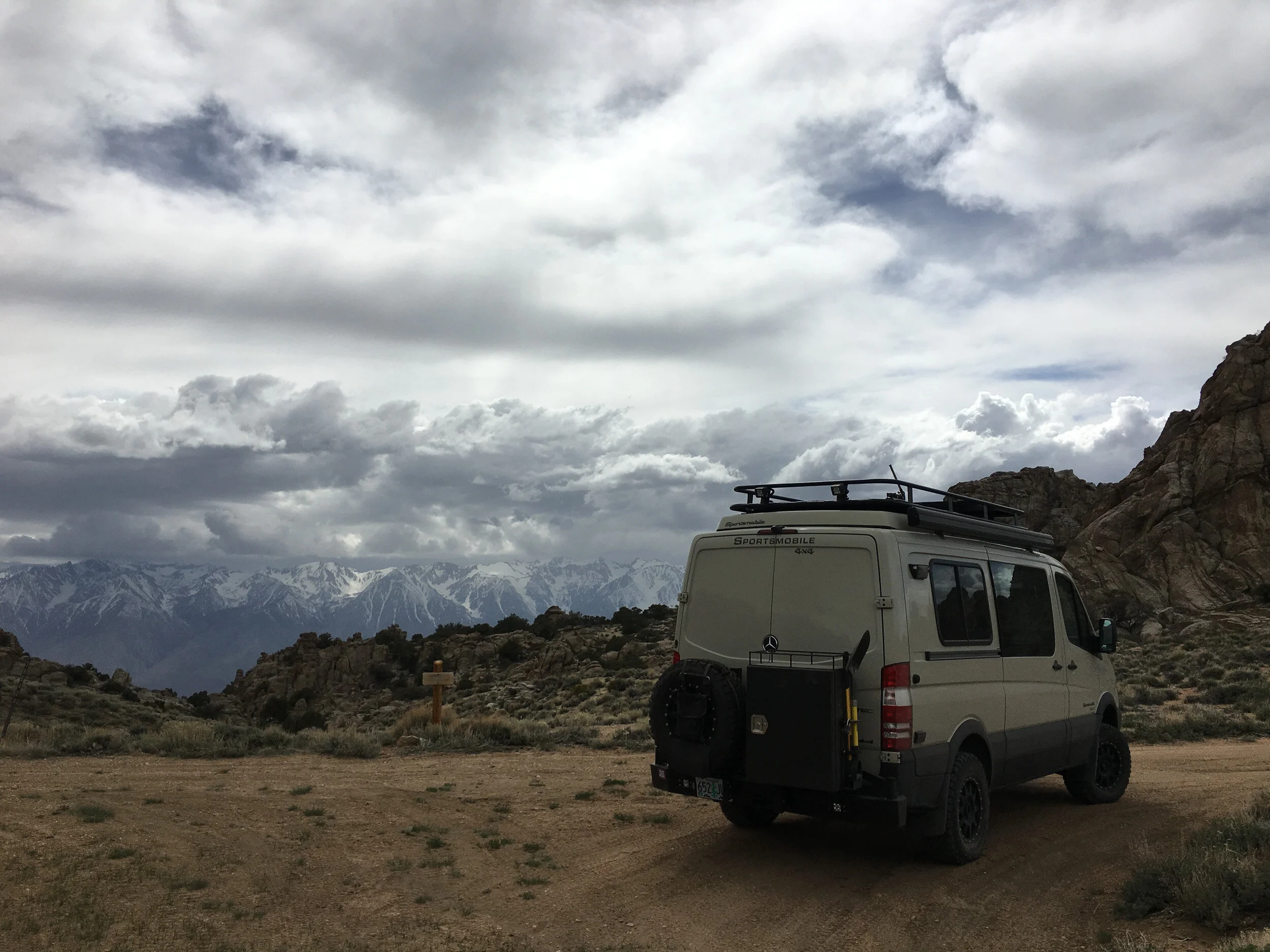
At about 3/4 of the way up I was blown away, “This thing is amazing! It’s a beast!” Ann said, “Yes it is. Maybe that’s what we should name it - Beast!” So yes Hilda, our rig has a name - Beast!
To say we were flabbergasted at how well Beast performed in climbing that hill was an understatement. It made me feel like it could handle pretty much anything we would come across. Which, as you could guess, falls into that category of famous last words because little did I realize, the track was going to show us just how much Beast could take.
It’s pretty simple really, every school kid knows it - what goes up must come down. And we’d been steadily climbing for awhile now (not to mention the big climb we’d just completed). We knew that we had to end up at the very bottom of the valley, which was way down there, even if we couldn’t see it. And off in the distance was about a quarter mile of relatively flat surface and . . . sky. Which meant that at the end of the flat portion it had to go down.
And down it did. We came up to the crest of the flat and parked the rig. This one I’d have to walk to figure out the right line. As is the case with many descents (or ascents), the worst part was the very beginning near the top, and the very bottom where it flattens out. But all along the way there were body damaging boulders to avoid, sharp tire-shredding rocks to avoid, and drops that I would have to carefully take so as to not bottom out the rig.
After determining the right line I’d have to take, and where the critical parts of the descent were, I started off, slow and steady down this hill. Again, blown away at how well Beast handled it, this time I had sense enough to photograph what we’d just navigated.
But hard won victories are short lived, at least that day they were. Things seemed to be going just fine on the rest of the descent back until we approached another one of those open-skies-on-a-nearby-horizon-line views that portends a steep descent.
As we crossed the crest, I started to ask myself just what I did to deserve this. An extremely narrow and steep set of switchbacks made its way down the hillside. Worse off, it wasn’t even close to level (and no, the slope wasn’t back towards the hillside) and appeared to be greatly eroded from California’s heavy spring rains.
Looking carefully at the first leg of the switchback, it generally looked that, while all the surface dirt and gravel had been washed away, it didn’t look like the stability of the outer portion of the track had been undermined. Well, not too much.
“There were no good thoughts running through my mind at this point. It was only about a thousand foot drop, should Dan make a miscalculation or if the edge gave way...”
— Ann
To be honest, it looked a lot like some of those roads you see in National Geographic from the Himalayas or the Andes and you ask yourself, “People drive on these things?” But I looked again - yes there were some areas that dipped outward, but not too much [it was going to feel a lot worse than it actually was - or at least that’s what I told myself], and areas that looked a bit suspect stability wise, which meant I’d have to make sure I was pressing the hill-side edge of the trail. I concluded it was do-able, and set off. I’ll let Ann comment on what she was thinking because . . . well, I can’t blame her. It was definitely my fault.
“Yep. Got that right in one try!”
— Ann
Long story short, I picked the right line. Two of the switch backs were so extreme, we had to stop, backup, and move forwards a couple of times to navigate them. I didn’t even think of asking Ann to marshall me through those. They were terrifying. There’s nothing like not being able to see beyond the nose of your vehicle - well, nothing but the ground a thousand feet below - to make you triple check you are in “R” instead of “D” and to make sure your foot is firmly on the brake pedal.
After the switchbacks things were fairly easy on the rest of the route back. At one point Ann said, “Dan, I want a drink, a hotel and a good restaurant tonight, and not necessarily in that order!” I replied, “You know, I’ve been thinking the same thing myself.”
“And I’m not much of a drinker, but this was for medicinal purposes!”
— Ann
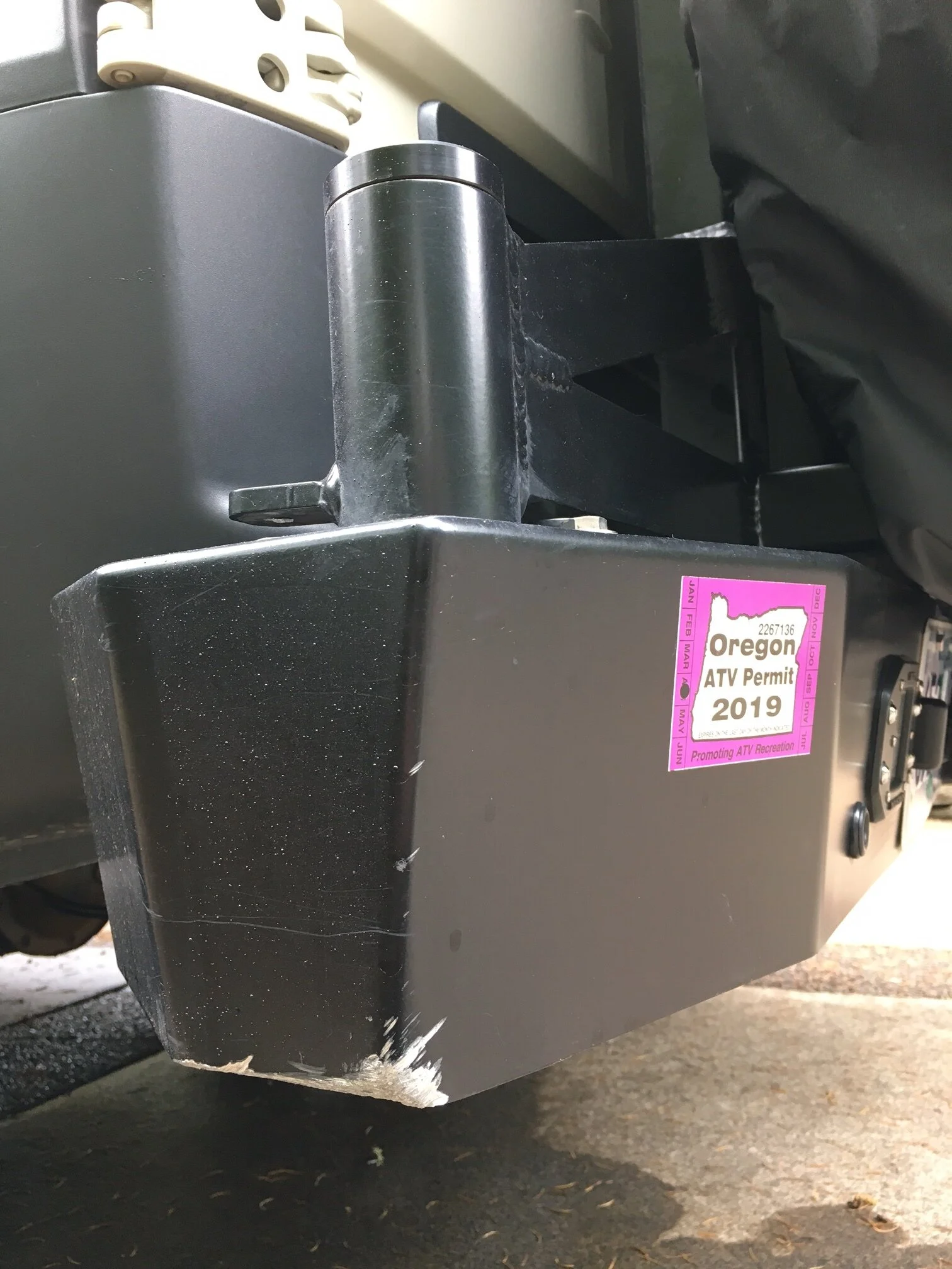
As we approached pavement, I pulled over, disengaged the 4WD and decided to assess the damage. There were plenty of scratches on plastic from bottom to top, streaks on the paint (that Ann thought would wash out - which fortunately they did), and streaks of pine sap on everything (which took a bit of work to remove). We could see that tree parts were stuck in the roof rack as well as the awning, so I climbed up to assess for damage and to remove what I could. Up there I found out that the antenna for our wi-fi extender had been damaged and pulled away at the base of the antenna. I pulled out the tool kit, removed the antenna and sealed up the co-axial cable connection with electrical tape (we need to find an electrician who can install a moveable connector so we can tilt the antenna down against the floor of the roof rack when not in use - Oregon has lots of trees!). Finally, I remounted the MaxTrax and our trash bag onto the spare tire and we set off towards Bishop, a slightly larger town than Big Pine, and one more likely to have a vacant hotel (which it did).
We thought that the headaches were over for the day, but who were we kidding. Just as we turned onto Hwy. 395 heading north towards Bishop, the DEF light came on. DEF is the additive for diesel engines that removes particulate matter and has helped make diesel engines become more environmental friendly. The indicator explained that there were problems with the DEF. So we pulled over and pulled out the manual. It said to see a dealer to get it checked out. For anyone who cares to know, there aren’t a lot of Mercedes dealerships in that part of California, so we were starting to wonder if our whole trip was about to go bust.
In Bishop we loaded up with diesel and bought a box of DEF at a gas station on the edge of town. We also noted that they had a 24-hour truck wash, which we intended to use once we got our lives sorted. We also found a hotel and checked in, got on the internet and checked out what the error message could mean. The prospect looked hopeful. Previously, Mercedes had separate messages that you needed to add DEF or that there were problems with the DEF systemWe found out that they’ve combined those messages. So the first step to making the error message go away is to add DEF (and keep your fingers crossed). Thank goodness for the internet, because the Mercedes manual gives no clue that the solution to the error message could be as simple as the need to add DEF.
Comforted with that knowledge we returned to the gas station to give Beast a good bath. We were filthy and exhausted anyway, so it didn’t matter if I got soaked cleaning up our rig. He deserved it. That done, we returned to the hotel room, got showered up, and walked to a near-by Japanese restaurant. And yes, we had our drinks. We needed it!
Wow! What a day! Ann and I like a bit of adventure in our lives, but that was more than we bargained for. Yes, we learned that we could problem solve and work hard as a team and not kill each other. Yes, we learned that the financial investment in tools and the time invested in watching videos on “what to do when” was worth while - which means we were at least minimally (in)competent. And we learned that Beast is indeed a beast. We just wish there had been an easier way to learn those lessons.
Overall, Beast has cleaned up nicely, although he no longer has that brand-spanking new look. I guess that's now pretty obvious from the markings the trees let on our side mirrors.
I don’t think Beast appreciated such a pristine appearance anyway. And I still owe Ann her Mother’s Day present (hey, we’ve only been back a week and are already planning a weekend trip so who knows when that is going to happen). And as for Len’s comment, I think this from the encounter with the boulder qualifies as our first dent.
Now we can get on with photography!
Oh yeah, and the next morning, we filled up the DEF tank and . . . no indicator light. Maybe the vacation wasn’t going to go bust after all.