Expedition Prep
I’m calling it “expedition” preparation instead of “trip” preparation because a 25-day trip on the road living out of the Sportsmobile is likely to be more of an expedition and adventure than a simple vacation trip.
Although I’d done a lot of trip planning over the winter, I’ve had a long break from it given the need to prepare for a photography talk and then getting ready to pick up the rig [not to mention the fact I’ve been working all the hours I can to cover for the unpaid time I’ll take during the expedition]. There’s still a lot to do, even more so since Ann and I realized that we’ll have to pay much more attention to learning about the vehicle itself than we’d realized. So to use an understatement, Ann and I have been busy!
I think things are working out with the Rig. My nightly reading of the user’s manual and the huge binder of materials Sportsmobile gave us is is paying off. I hop inside and things aren’t quite so foreign as they were last weekend. We’ve figured out what needs to go, and how to otherwise reorganize some things to make living out of it easier. By far, we’re not done figuring things out; but we’re getting there.
Yesterday I went through Google maps and logged GPS points for the entire trip - all 25 days and well over 120 points. Some areas where we’ll be searching for a wild campsite (pretty much anywhere on BLM land), I had to zoom in to search for campsites, but for the most part it was going through the trip in my mind and identifying where we need to go next (or to stop for water, possible photography locations, etc.). I also numbered/named them in a way that would be easily trackable on a GPS. This morning Ann entered those points into the vehicle’s GPS. It seemed to work.
The rest of this morning has been spent with me compiling the hard copy maps (duplicate systems are a necessity when out on our own), with me realizing that we were missing a key map (to Toroweap, Grand Canyon of all places [a quick visit to Amazon Smile {in support of providing water in the developing world} and the map will be here on Tuesday!]). Ann’s been working on other electronic systems we’ll be using (PDF maps, etc.).
As it stands, here’s a Google Maps image of our trip:
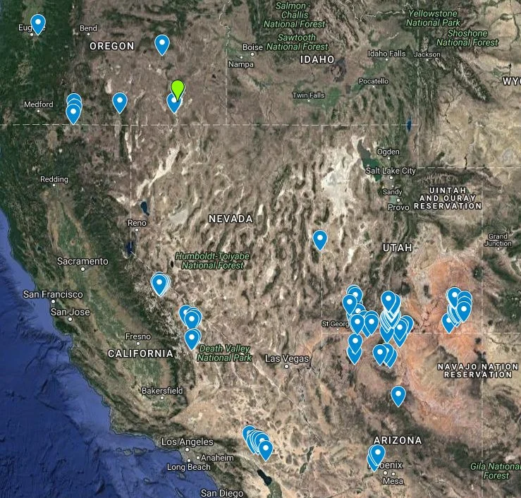
We’re basically going to do a big loop counter clockwise with an uncertain ending on which way to come home on the last day. Day of departure - May 3. Day of return - May 28.
Now back to other prep work!